1950s Maps of Buellton, California
Explore 6 historic maps of Buellton from the 1950s. These maps offer a rare glimpse into what life looked like during the 1950s — showing old roads, neighborhoods, homes, and landmarks that have changed or disappeared over time.
Whether you're researching your family's past, planning a metal detecting trip, or studying how Buellton's landscape evolved across the 1950s, these high-resolution maps are a powerful tool for exploring the history of this region.
- Focus on a specific era: All maps on this page are from the 1950s, giving you a focused view of this time period.
- See what’s changed: Compare century-old streets, trails, and buildings to today's modern landscape using overlays and satellite layers.
- Research with precision: Use these maps for genealogy, historical research, land use analysis, or educational projects.
- View, download, or print: Maps are fully viewable online in high resolution, and can be downloaded or printed for your own records.
Start exploring Buellton's history through authentic maps from the 1950s. This is your window into the past.
Buellton, CA maps
(6)- 1956 Map of Santa Maria, 1973 Print
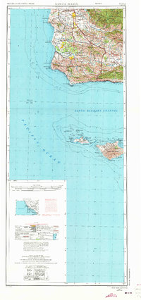 1956 Santa Maria1973 Print · USGSThe Central Coast landscape at the height of the Cold War reveals a mix of aerospace expansion and historic ranching towns. Trace the early footprint of Vandenberg AFB or locate coastal rail stops like Surf and the mission site at La Purisima Mission State Park.2 unique versions available
 - 1957 Map of Santa Maria
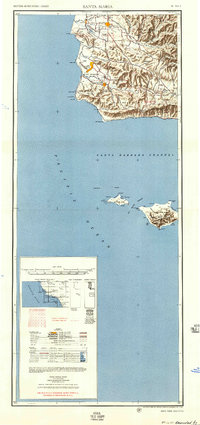 1957 Santa Maria1957 Print · USGSCoastal Santa Barbara County is captured here during the mid-fifties, showing a landscape defined by military installations and petroleum production. Researchers can trace the Southern Pacific rail line and locate rural landmarks like Honda School, Betteravia, and the John Manville Plant.
 - 1958 Map of Santa Maria
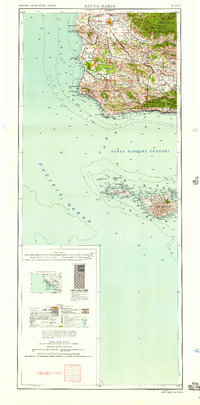 1958 Santa Maria1958 Print · USGSThe Central Coast in the mid-fifties reveals a landscape shaped by military expansion and historic ranching towns. Researchers can trace the Southern Pacific railroad through Betteravia and Guadalupe, or explore the early layout of Camp Cooke Military Reservation.
 - 1959 Map of Zaca Creek, 1960 Print
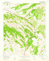 1959 Zaca Creek1960 Print · USGSSanta Barbara County ranch lands and petroleum interests are captured in the late fifties as the regional landscape modernized. Genealogists and researchers can trace historic land grants and family holdings such as Barham Ranch, Rancho Santa Ynez, and the active Zaca Oil Field.3 unique versions available
 - 1959 Map of Solvang, 1960 Print
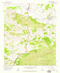 1959 Solvang1960 Print · USGSThe Santa Ynez Valley is captured here in the late fifties, showcasing the early growth of Solvang alongside historic ranching estates. Researchers can trace the original footprint of Mission Santa Ines and the winding course of U.S. Route 101 as it climbs toward Nojoqui Summit.4 unique versions available
 - 1959 Map of Los Olivos, 1962 Print
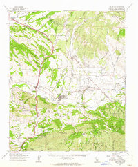 1959 Los Olivos1962 Print · USGSSanta Barbara County’s ranching heartland is captured here in the late fifties, showing the historic missions and land grants of the Santa Ynez Valley. Researchers can trace the layout of early Solvang and Los Olivos or locate family landmarks like Las Cruces Ranch and the Mission Santa Ines Ruins.
End of results
Showing maps 1-6 of 6
Top cities near Buellton
Frequently asked questions
- What are the different types of historical maps available for Buellton?
- What is the oldest map of Buellton?
- Where can I purchase historical maps of Buellton for my home or office?
- Where can I download high-res historical maps of Buellton?
- Are there historical topographic maps available for Buellton?
- Is there historical aerial imagery available for Buellton?
- Where are historical maps of Buellton sourced from?