1940s Maps of Foothill Estates, Lompoc
Explore 6 historic maps of Foothill Estates from the 1940s. These maps offer a rare glimpse into what life looked like during the 1940s — showing old roads, neighborhoods, homes, and landmarks that have changed or disappeared over time.
Whether you're researching your family's past, planning a metal detecting trip, or studying how Foothill Estates's landscape evolved across the 1940s, these high-resolution maps are a powerful tool for exploring the history of this region.
- Focus on a specific era: All maps on this page are from the 1940s, giving you a focused view of this time period.
- See what’s changed: Compare century-old streets, trails, and buildings to today's modern landscape using overlays and satellite layers.
- Research with precision: Use these maps for genealogy, historical research, land use analysis, or educational projects.
- View, download, or print: Maps are fully viewable online in high resolution, and can be downloaded or printed for your own records.
Start exploring Foothill Estates's history through authentic maps from the 1940s. This is your window into the past.
Foothill Estates, Lompoc maps
(6)- 1942 Map of Lompoc
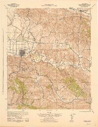
 1942 Lompoc1942 Print · USGSSanta Barbara County at the start of World War II reveals a landscape of missions, ranching, and coastal rail. Researchers can trace the Pacific Coast Railroad, locate historic schools like Sisquoc Sch, and find the remote Asphaltum Mine.
 - 1942 Map of Lompoc
 1942 Lompoc1942 Print · USGSSanta Barbara County’s coastal valleys were a mix of industrial mining and historic ranching during the early 1940s. Genealogists and researchers can locate several rural schoolhouses like Maple Sch and San Julian Sch, or trace the Southern Pacific rail line.2 unique versions available
 - 1943 Map of Lompoc
 1943 Lompoc1943 Print · USGSCoastal Santa Barbara County appears in the early 1940s as a land of historic missions, early oil and asphalt mining, and rugged mountain ranges. Researchers can trace the PACIFIC COAST RAILROAD, locate schools like Tepusquet Sch, and explore the grounds of Mission La Purisima.
 - 1947 Map of Lompoc
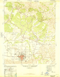 1947 Lompoc1947 Print · USGSLompoc emerges into the post-war era as a focal point of military activity and civic growth in Santa Barbara County. Genealogists and researchers can trace the mid-century layout of Lompoc, the restored Mission La Purisima, and the Lompoc Cemetery.
 - 1947 Map of Lompoc, 1956 Print
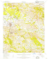 1947 Lompoc1956 Print · USGSCoastal Santa Barbara County appears here shortly after the war, showing the expansion of military lands and the preservation of Spanish mission sites. Researchers can locate the Camp Cooke Military Reservation, the Mission La Purisima, and local schools like San Julian Sch.2 unique versions available
 - 1948 Map of Santa Maria
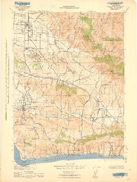
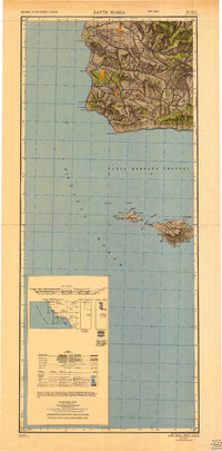 1948 Santa Maria1948 Print · USGSSanta Barbara County in the late 1940s reveals a landscape of coastal defense and valley agriculture. Genealogists and historians can trace the footprint of Camp Cooke Military Reservation or locate rural landmarks like Honda School and Betteravia.2 unique versions available
End of results
Showing maps 1-6 of 6
Frequently asked questions
- What are the different types of historical maps available for Foothill Estates?
- What is the oldest map of Foothill Estates?
- Where can I purchase historical maps of Foothill Estates for my home or office?
- Where can I download high-res historical maps of Foothill Estates?
- Are there historical topographic maps available for Foothill Estates?
- Is there historical aerial imagery available for Foothill Estates?
- Where are historical maps of Foothill Estates sourced from?