1900s (20th Century) Maps of Orchams, California
Explore 10 historic maps of Orchams from the 1900s (20th Century). These maps offer a rare glimpse into what life looked like during the 1900s — showing old roads, neighborhoods, homes, and landmarks that have changed or disappeared over time.
Whether you're researching your family's past, planning a metal detecting trip, or studying how Orchams's landscape evolved across the 1900s, these high-resolution maps are a powerful tool for exploring the history of this region.
- Focus on a specific era: All maps on this page are from the 1900s, giving you a focused view of this time period.
- See what’s changed: Compare century-old streets, trails, and buildings to today's modern landscape using overlays and satellite layers.
- Research with precision: Use these maps for genealogy, historical research, land use analysis, or educational projects.
- View, download, or print: Maps are fully viewable online in high resolution, and can be downloaded or printed for your own records.
Start exploring Orchams's history through authentic maps from the 1900s. This is your window into the past.
Orchams, CA maps
(10)- 1942 Map of Goleta, 1943 Print
 1942 Goleta1943 Print · USGSThe Santa Barbara coastline in the early 1940s reveals a world of historic ranchos and coastal canyons before the post-war boom. Trace the footprints of the Corona Del Mar Rancho, Dos Pueblos Ranch, and the rail stops at Naples.
 - 1949 Map of Los Angeles
 1949 Los Angeles1949 Print · USGSSouthern California and the South Coast appear at the onset of the post-war boom, from the Channel Islands to the Mojave Desert. Trace early aviation sites like Lockheed Air Terminal and mining history at the Redrock Quicksilver Mine and Redrover Mine.2 unique versions available
 - 1951 Map of Dos Pueblos Canyon
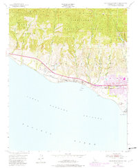 1951 Dos Pueblos Canyon1951 Print · USGSThe Santa Barbara coast transitioned from ranching to mid-century development as the early 1950s gave way to the 1980s. Trace the legacy of Los Dos Pueblos along the Southern Pacific rail line and locate landmarks like Naples and the Ellwood Union Sch.9 unique versions available
 - 1955 Map of Los Angeles
 1955 Los Angeles1955 Print · USGSThe mid-century transformation of Southern California comes into focus as the urban sprawl of Los Angeles meets the wilderness of the Santa Monica Mountains. Researchers can trace the development of post-war suburbs alongside historic landmarks like the Santa Barbara Lighthouse and early industrial sites such as the Good Luck Mine.
 - 1959 Map of Los Angeles
 1959 Los Angeles1959 Print · USGSCoastal California and the high desert met in a period of booming growth after the war. Researchers can trace early aviation and military history at the Point Mugu Air Missile Test Ctr or locate desert mining sites like the Double Eagle Mine.3 unique versions available
 - 1966 Map of Los Angeles
 1966 Los Angeles1966 Print · USGSSouthern California underwent a mid-century transformation as suburban grids reached the base of the San Gabriel Mountains. Researchers can trace the path of the Los Angeles Aqueduct or locate defense landmarks like Edwards Air Force Base.
 - 1975 Map of Los Angeles, 1977 Print
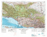 1975 Los Angeles1977 Print · USGSSouthern California is captured in a period of significant growth during the mid-seventies, showing the urban sprawl from the coast to the high desert. Researchers can trace the development of the Pacific Coast Hwy and find aerospace landmarks like Edwards Air Force Base and the Flight Test Center (NASA).2 unique versions available
 - 1980 Map of Dos Pueblos Canyon
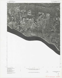 1980 Dos Pueblos Canyon1980 Print · USGSCovers Orchams, including Goleta, Isla Vista, and other nearby areas
 - 1982 Map of Santa Barbara, 1983 Print
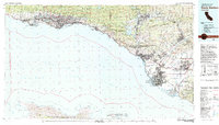 1982 Santa Barbara1983 Print · USGSCoastal California in the early eighties exhibits a landscape of growing cities and massive military and academic footprints. Genealogists and historians can trace the Southern Pacific rail line through Santa Barbara or explore the boundaries of historic ranchos like Las Positas y Calera.3 unique versions available
 - 1995 Map of Dos Pueblos Canyon, 2000 Print
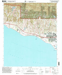 1995 Dos Pueblos Canyon2000 Print · USGSThe Santa Barbara coastline in the mid-nineties shows a landscape of historic ranch grants and petroleum industry infrastructure. Researchers can trace the Southern Pacific line through Naples or locate the Ellwood Union School and Devereux Ranch School.
End of results
Showing maps 1-10 of 10
Top cities near Orchams
- Santa Barbara historical maps
- Goleta historical maps
- Isla Vista historical maps
- Montecito historical maps
- Santa Ynez historical maps
- Mission Canyon historical maps
Frequently asked questions
- What are the different types of historical maps available for Orchams?
- What is the oldest map of Orchams?
- Where can I purchase historical maps of Orchams for my home or office?
- Where can I download high-res historical maps of Orchams?
- Are there historical topographic maps available for Orchams?
- Is there historical aerial imagery available for Orchams?
- Where are historical maps of Orchams sourced from?