2020s Maps of Sierra County, California
Explore 30 historic maps of Sierra County from the 2020s. These maps offer a rare glimpse into what life looked like during the 2020s — showing old roads, neighborhoods, homes, and landmarks that have changed or disappeared over time.
Whether you're researching your family's past, planning a metal detecting trip, or studying how Sierra County's landscape evolved across the 2020s, these high-resolution maps are a powerful tool for exploring the history of this region.
- Focus on a specific era: All maps on this page are from the 2020s, giving you a focused view of this time period.
- See what’s changed: Compare century-old streets, trails, and buildings to today's modern landscape using overlays and satellite layers.
- Research with precision: Use these maps for genealogy, historical research, land use analysis, or educational projects.
- View, download, or print: Maps are fully viewable online in high resolution, and can be downloaded or printed for your own records.
Start exploring Sierra County's history through authentic maps from the 2020s. This is your window into the past.
Sierra County, CA maps
(30)- 2021 Map of Hobart Mills, 2021 Print
 2021 Hobart Mills2021 Print · USGSThe high timber country of the Sierra Nevada comes alive in this 2021 survey of the lands between Sierra and Nevada counties. Researchers can trace the historic Commemorative Overland Emigrant Trail and locate sites like Hobart Mills and Woodchoppers Spring.
 - 2021 Map of Haypress Valley, 2021 Print
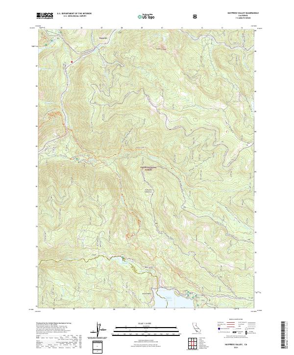 2021 Haypress Valley2021 Print · USGSThe High Sierra backcountry near the Sierra and Nevada County line is shown here in the 2020s, dominated by the Tahoe National Forest. Researchers can trace the historic Henness Pass Road and locate remote landmarks like Deadman Peak and Milton Reservoir.
 - 2021 Map of American House, 2021 Print
 2021 American House2021 Print · USGSHigh in the Sierra Nevada, this modern survey shows the rugged watersheds of the Plumas National Forest. Researchers can trace historic mining activity at the Sanborn Mine or follow the route of the old Quincy-La Porte Road near Little Grass Valley Reservoir.
 - 2021 Map of Onion Valley, 2021 Print
 2021 Onion Valley2021 Print · USGSThe Plumas National Forest highlands are captured here in the 2020s, showing the deep canyons of the Feather River and the high Sierra ridges. Researchers can trace historic river sites like Rich Bar and McCarthy Bar or follow the path of the Pacific Crest National Scenic Trl.
 - 2021 Map of Independence Lake, 2021 Print
 2021 Independence Lake2021 Print · USGSThe High Sierra backcountry near the Sierra and Nevada County line is presented here in great detail during the early 2020s. Hikers and historians can trace the Pacific Crest National Scenic Trl, the historic Old Henness Pass Trl, and family-named landmarks like Meathouse Meadow or Mt Lola.
 - 2021 Map of Blue Nose Mountain, 2021 Print
 2021 Blue Nose Mountain2021 Print · USGSThe high Sierra Nevada ridges of Plumas and Sierra Counties are captured here in the early twenty-first century. Researchers can trace the Pacific Crest National Scenic Trl as it winds past Pilot Peak, Blue Nose Mtn, and the historic flats along the Middle Fork Feather River.
 - 2021 Map of Gold Lake, 2021 Print
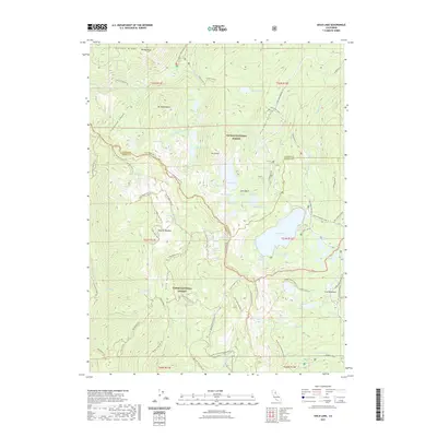 2021 Gold Lake2021 Print · USGSCovers Sierra County, including Plumas County, United States, and other nearby areas
 - 2021 Map of Sierraville, 2021 Print
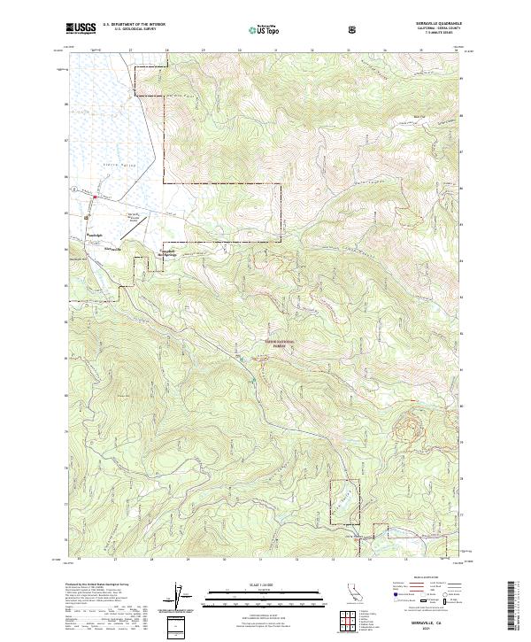 2021 Sierraville2021 Print · USGSSierraville and the high meadows of the Sierra Valley are captured here in the early twenty-first century. Researchers can trace the layout of Sierraville and Randolph, find local landmarks like Campbell Hot Springs, and explore the backcountry trails of Tahoe National Forest.
 - 2021 Map of Sierra City, 2021 Print
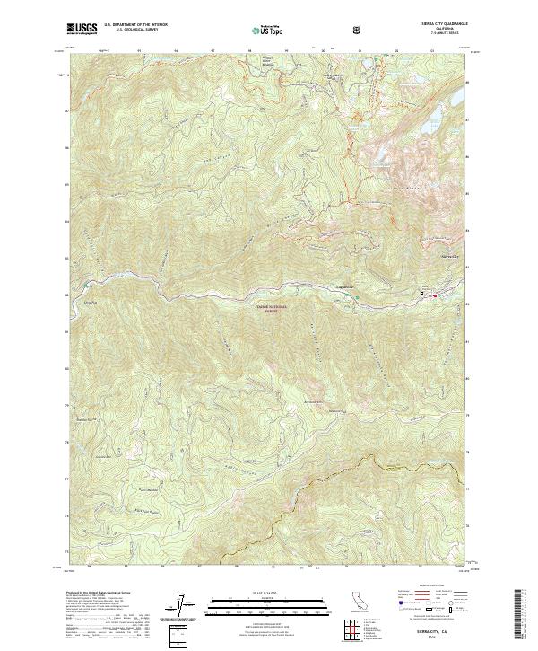 2021 Sierra City2021 Print · USGSThe steep Sierra Nevada peaks of the Tahoe National Forest define this region near the century's end. Researchers can trace historic routes like Henness Pass Rd or locate family sites at Sierra City Cem and Harris Meadow.
 - 2021 Map of Sardine Peak, 2021 Print
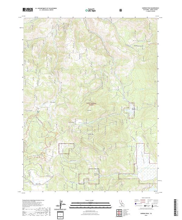 2021 Sardine Peak2021 Print · USGSSierra County's high ridges and historical transit routes are preserved here in this recent survey of the northern Sierras. Researchers can trace the path of the Henness Pass Rd and locate local landmarks like Sardine Peak, Pats Meadow, and Groundhog Rock.
 - 2021 Map of Sattley, 2021 Print
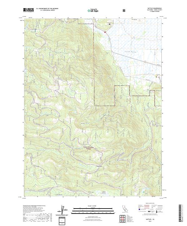 2021 Sattley2021 Print · USGSThe northern Sierra Nevada highlands meet the open expanse of the Sierra Valley in this detailed recent survey. Local historians can trace the paths of Henness Pass Rd and Yuba Pass Rd or locate the historic Sattley Cem and Sierraville Cem.
 - 2021 Map of Pike, 2021 Print
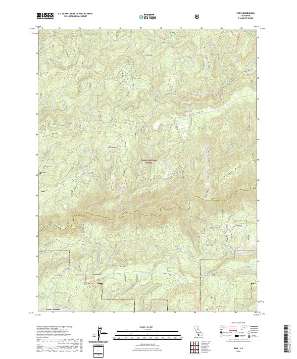 2021 Pike2021 Print · USGSThe Sierra Nevada foothills come into sharp focus in this recent survey of the rugged divide between the Yuba and its tributaries. Researchers can trace the layout of Pike and North Columbia, or locate historic sites like the Pike City Cem and the Black Sands Mine.
 - 2021 Map of Graniteville, 2021 Print
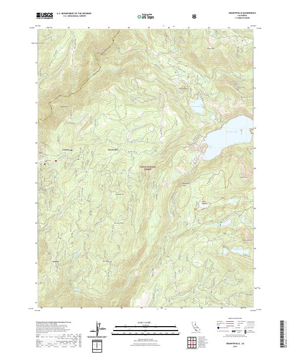 2021 Graniteville2021 Print · USGSThe high Sierra terrain of Nevada and Sierra counties is documented here in the early twenty-first century. Genealogists and historians can locate Graniteville Cem and trace the paths to historic sites like Marsh Mill and the settlement of Gaston.
 - 2021 Map of Downieville, 2021 Print
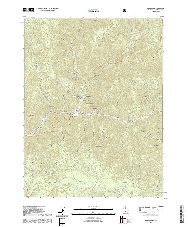 2021 Downieville2021 Print · USGSSierra County's gold-rush legacy is on full display in the early twenty-first century as Downieville sits at the meeting of the Downie River and North Yuba River. Genealogists and historians can trace the Sierra County Courthouse, Downieville Cem, and historical river flats like Jersey Flat.
 - 2021 Map of Webber Peak, 2021 Print
 2021 Webber Peak2021 Print · USGSThe high Sierra crest at the Nevada and Sierra County border comes alive in this contemporary survey of the Tahoe National Forest. Genealogists and hikers can trace the historic Henness Pass Road and locate remote alpine landmarks like Webber Lake or the shores of Fordyce Lake.
 - 2021 Map of Strawberry Valley, 2021 Print
 2021 Strawberry Valley2021 Print · USGSThe Sierra Nevada foothills at the meeting of Yuba and Sierra counties come alive in this recent survey. Researchers can locate isolated mountain settlements like Brandy City and Strawberry Valley, as well as historic cemetery sites and the riverside Fosters Bar.
 - 2021 Map of Clio, 2021 Print
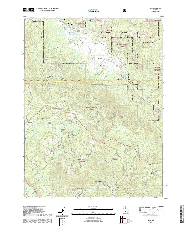 2021 Clio2021 Print · USGSThe high Sierra country of Plumas and Sierra counties comes into focus in the early 2020s, showcasing the intersection of national forest lands and mountain communities. Researchers can trace the drainages of the Feather Wild and Scenic River or locate landmarks like Miners Psge and Haskell Creek Homesites.
 - 2022 Map of Antelope Valley, 2022 Print
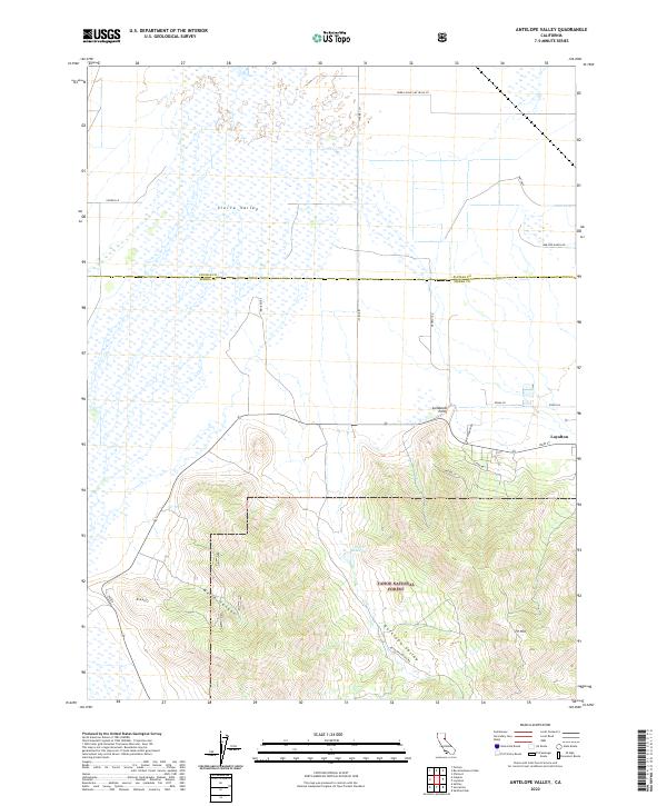 2022 Antelope Valley2022 Print · USGSSierra County ranching and timber lands are documented here in the early twenty-first century, centered on the settlement of Loyalton. Researchers can trace local landholdings via named corridors like Bar One Ranch Rd and identify natural landmarks from Sierra Valley to Lombardi Point.
 - 2022 Map of La Porte, 2022 Print
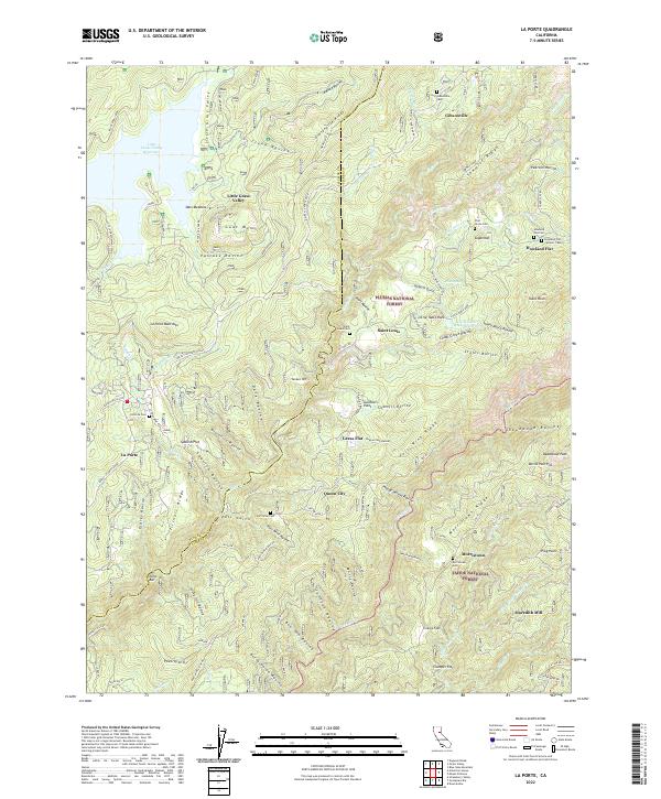 2022 La Porte2022 Print · USGSThe high Sierra mining camps of Plumas and Sierra counties are captured in this modern survey of the historic Gold Country. Researchers can locate numerous 19th-century burial sites like the Howland Flat Catholic Cem and trace old timber and mining works at Meredith Mill and the Moto Mine.
 - 2022 Map of Loyalton, 2022 Print
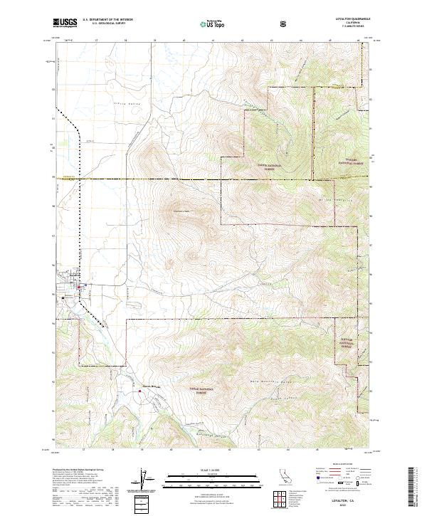 2022 Loyalton2022 Print · USGSThe high Sierra valley floor meets the mountains of Sierra County in this recent survey. Local researchers can trace the streets of Loyalton, explore the Mountain View Cem, and find the canyon-side settlement of Sierra Brooks.
 - 2022 Map of Evans Canyon, 2022 Print
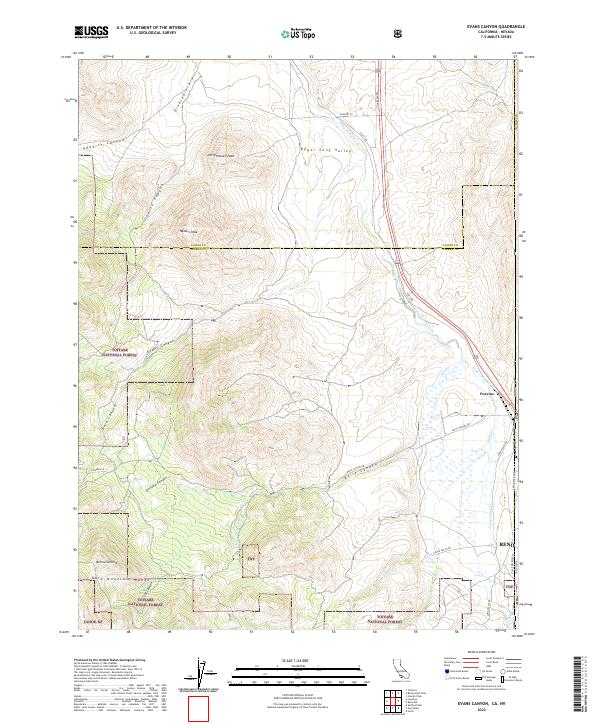 2022 Evans Canyon2022 Print · USGSThe high sierra borderlands come into focus in this recent survey of the ridges and canyons northwest of the Nevada state line. Genealogists and hikers can trace the geography around Staverville or follow the descent of Long Valley Creek through the Bold Mountain Range.
 - 2022 Map of Dog Valley, 2022 Print
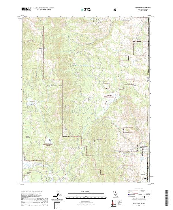 2022 Dog Valley2022 Print · USGSThe California-Nevada borderlands near the Sierra Nevada crest are captured here in the early twenty-first century. Researchers can trace historic mountain passages like Henness Pass Rd and locate landmarks from Babbitt Peak to the settlement of Verdi.
 - 2022 Map of Calpine, 2022 Print
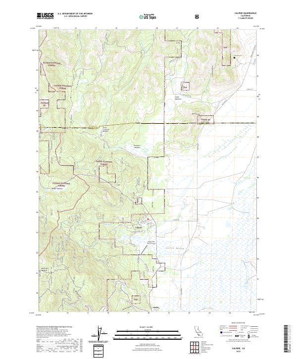 2022 Calpine2022 Print · USGSThe high meadows and mountain valleys of the Sierra-Plumas border come into focus in this contemporary survey. Historians and residents can trace the development of Calpine and Sattley, locate the Westside Cem, and explore the drainage of Fletcher Creek.
 - 2022 Map of English Mountain, 2022 Print
 2022 English Mountain2022 Print · USGSHigh in the Sierra Nevada during the early twenty-first century, this area reveals a landscape of alpine lakes and old mountain outposts. Researchers can locate the site of Baltimore Town, the Meadow Lake Cem, and traces of the Fordyce Jeep Trl.
 - 2022 Map of Goodyears Bar, 2022 Print
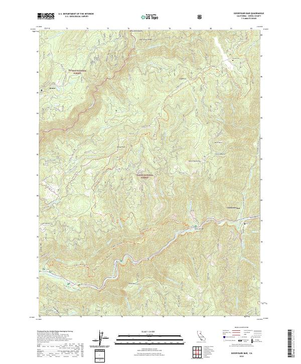 2022 Goodyears Bar2022 Print · USGSSierra County's gold-mining heritage is visible across these canyons and ridges in the early 2020s. Genealogists and historians can trace the foundations of pioneer settlements at Goodyears Bar and Scales, or locate family sites near Eureka Cemetery and Saint Joe Bar.
Showing maps 1-25 of 30
Top cities of Sierra County
Frequently asked questions
- What are the different types of historical maps available for Sierra County?
- What is the oldest map of Sierra County?
- Where can I purchase historical maps of Sierra County for my home or office?
- Where can I download high-res historical maps of Sierra County?
- Are there historical topographic maps available for Sierra County?
- Is there historical aerial imagery available for Sierra County?
- Where are historical maps of Sierra County sourced from?