2000-2009 Maps of Sierra County, California
Explore 24 historic maps of Sierra County from 2000-2009. These maps offer a rare glimpse into what life looked like during the 2000s — showing old roads, neighborhoods, homes, and landmarks that have changed or disappeared over time.
Whether you're researching your family's past, planning a metal detecting trip, or studying how Sierra County's landscape evolved across the 2000s, these high-resolution maps are a powerful tool for exploring the history of this region.
- Focus on a specific era: All maps on this page are from the 2000s, giving you a focused view of this time period.
- See what’s changed: Compare century-old streets, trails, and buildings to today's modern landscape using overlays and satellite layers.
- Research with precision: Use these maps for genealogy, historical research, land use analysis, or educational projects.
- View, download, or print: Maps are fully viewable online in high resolution, and can be downloaded or printed for your own records.
Start exploring Sierra County's history through authentic maps from the 2000s. This is your window into the past.
Sierra County, CA maps
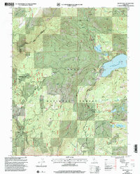
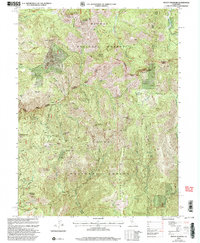
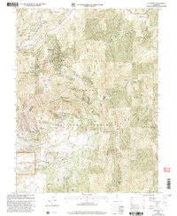
(24)- 2000 Map of Independence Lake, 2003 Print
 2000 Independence Lake2003 Print · USGSHigh in the Sierra Nevada during the late twentieth century, this area serves as a vital watershed and recreation hub. Hikers and historians can trace the Pacific Crest National Scenic Trail or locate historic routes like Henness Pass Road near Independence Lake.
 - 2000 Map of Loyalton, 2003 Print
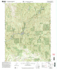
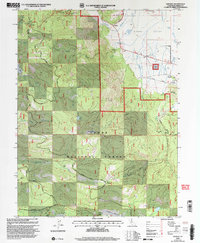
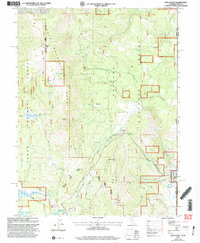
 2000 Loyalton2003 Print · USGSLoyalton and the surrounding Sierra Valley are shown at the turn of the millennium as timber and ranching landscapes met forest service conservation. Researchers can trace family sites near Loyalton, the Cem, and historical routes like Staverville Road.
 - 2000 Map of Calpine, 2003 Print
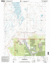
 2000 Calpine2003 Print · USGSThe town of Calpine sits at the intersection of forest and valley floor during the turn of the millennium. Researchers can locate the Westside Cemetery, trace the path of CHANNELS across the valley, and find landmarks like McElroy Hill or the Landing Strip.
 - 2000 Map of Boca, 2003 Print
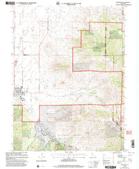
 2000 Boca2003 Print · USGSThe California-Nevada borderlands appear here as a vital water and transit corridor at the close of the twentieth century. Genealogists and researchers can trace the riverside settlements of Floriston, Hinton, and the Boca Townsite along the Truckee River.
 - 2000 Map of Clio, 2003 Print
 2000 Clio2003 Print · USGSThe northern Sierra Nevada highlands meet the Mohawk Valley at the turn of the century, showing a landscape defined by forest service lands and old mining claims. Researchers can trace the heritage of Clio or locate sites like Hayden Mine and Fournier Cabins.
 - 2000 Map of Graniteville, 2003 Print
 2000 Graniteville2003 Print · USGSThe high Sierra mining country near the Nevada and Sierra County line is captured here as it appeared at the turn of the century. Genealogists and researchers can trace historic operations at the Birchville Mine, locate the Gaston site, or find the cemetery at Graniteville.
 - 2000 Map of Mount Fillmore, 2003 Print
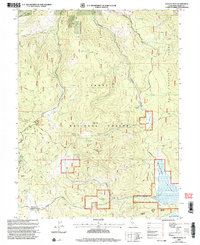
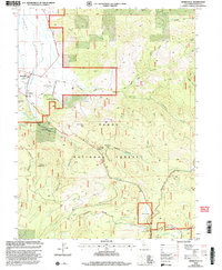
 2000 Mount Fillmore2003 Print · USGSThe high Sierra Ridges at the turn of the millennium remain defined by their gold-mining heritage and national forest boundaries. Genealogists and historians can trace old mining camps and extraction sites like Poker Flat, Deadwood Diggings, and the California Mine.2 unique versions available
 - 2000 Map of Sardine Peak, 2003 Print
 2000 Sardine Peak2003 Print · USGSSierra County high country comes into focus at the dawn of the twenty-first century, showing the forest roads and historical stations of the eastern Sierra. Genealogists and historians can trace routes to Wheelers Sheep Camp, Lewis Mill Station, and the historic Henness Pass Road.
 - 2000 Map of Gold Lake, 2003 Print
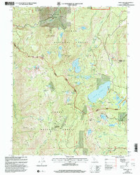 2000 Gold Lake2003 Print · USGSThe Sierra Nevada high country at the turn of the millennium reveals a storied landscape of alpine resorts and historic mining claims. Researchers can trace the heritage of the Beckworth Downieville Trail or locate old sites like the Jamison Mine and Four Hills Mine.
 - 2000 Map of Haypress Valley, 2003 Print
 2000 Haypress Valley2003 Print · USGSThe High Sierra at the dawn of the millennium shows a landscape of mining history and high-altitude water storage. You can trace old mining sites like Kentucky Mine and the seasonal Ahart Sheep Camp along the historic Henness Pass Road.
 - 2000 Map of Downieville, 2003 Print
 2000 Downieville2003 Print · USGSDownieville and the surrounding Sierra County gold country are captured here at the end of the millennium, showing a landscape shaped by mining and timber. Researchers can trace historical routes like the Henness Pass Road and locate old operations including the Monte Cristo Mine and Cornish House (Site).
 - 2000 Map of Antelope Valley, 2003 Print
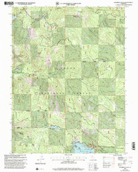
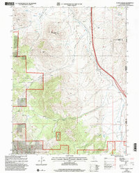
 2000 Antelope Valley2003 Print · USGSAntelope Valley and the high Sierra country are captured here at the turn of the millennium, showing a landscape defined by water management and timber lands. Trace the network of Sierra Valley Channels and find local landmarks like Lombardi Point and Rice Hill.
 - 2000 Map of Pike, 2003 Print
 2000 Pike2003 Print · USGSThe Sierra Nevada mining district is documented here at the turn of the millennium, showing a landscape defined by the Middle Yuba River. Genealogists and historians can trace old homesteads and mining claims like Miller Ranch, Alaska Mine, and the historic Malakoff Diggings.
 - 2000 Map of Camptonville, 2003 Print
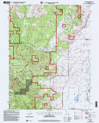
 2000 Camptonville2003 Print · USGSCamptonville and the Tahoe National Forest are shown at the turn of the millennium as the local landscape balances reservoir development with historic trails. Genealogists and historians can trace family sites like Youngs Grave and Lohman Ranch or locate the Covered Bridge and Camptonville Cemetery.
 - 2000 Map of Hobart Mills, 2003 Print
 2000 Hobart Mills2003 Print · USGSTahoe National Forest and the Sierra Nevada boundary are shown here at the turn of the century, highlighting a landscape defined by timber and pioneer history. Trace the remnants of industry at Old Smith Mill and follow the historic Emigrant Trail past Hobart Mills.
 - 2000 Map of Sierraville, 2003 Print
 2000 Sierraville2003 Print · USGSThe Sierra Valley and Tahoe National Forest meet here at the turn of the millennium, documenting a landscape of high-altitude ranching and timber. Map collectors can trace the Henness Pass Road and locate landmarks like Campbell Hot Springs and the Sierra Dearwater Airport.
 - 2000 Map of Evans Canyon, 2003 Print
 2000 Evans Canyon2003 Print · USGSThe high Sierra country along the Nevada border comes into focus in this late-twentieth-century study of the Toiyabe National Forest. Researchers can trace old family ranching sites like Balls Ranch or locate geographic landmarks such as Haskell Peak and Burma Summit.
 - 2000 Map of Webber Peak, 2003 Print
 2000 Webber Peak2003 Print · USGSThe high Sierra Nevada mountains on the border of Sierra and Nevada counties are shown here as they appeared at the turn of the millennium. Outdoor historians and researchers can trace the historic Henness Pass Road, locate the Anderson Mine, and follow the Pacific Crest National Scenic Trail.
 - 2000 Map of Sattley, 2003 Print
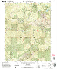
 2000 Sattley2003 Print · USGSSierra County ranching and logging history are captured here at the turn of the millennium. Genealogists and researchers can trace the Nichols Mill (Site), the Sierraville Cemetery, and the historic Henness Pass route.
 - 2000 Map of Sierra City, 2003 Print
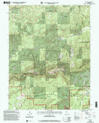
 2000 Sierra City2003 Print · USGSSierra County mining districts and high-altitude lake basins are documented in this late-twentieth-century forest revision. Researchers can trace deep-rooted mining claims like Sierra Buttes Mine and remote outposts such as Robinson Cow Camp.
 - 2000 Map of English Mountain, 2003 Print
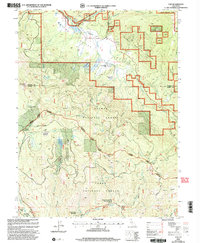
 2000 English Mountain2003 Print · USGSAt the turn of the millennium, this portion of the Sierra Nevada mountains reveals a landscape of high-altitude reservoirs and early settlement sites. You can trace the historic footprint of Summit City and the Baltimore Town Site or locate the remote Cemetery near the shores of Meadow Lake.
 - 2000 Map of Alleghany, 2003 Print
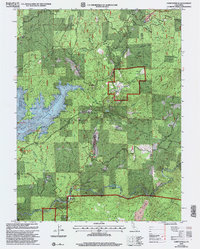
 2000 Alleghany2003 Print · USGSThe Sierra Nevada's gold country is revealed at the turn of the millennium, centered on the historic mining town of Alleghany. Researchers can trace old hydraulic sites and former settlements like Moores Flat or locate family-named landmarks such as Quinn Ranch and Babb Ranch.
 - 2000 Map of Dog Valley, 2003 Print
 2000 Dog Valley2003 Print · USGSThe high Sierra ridges along the California-Nevada border are captured here at the turn of the millennium. Researchers can trace historic travel routes like Henness Pass Road and Emigrant Road past landmarks like Camp 21 (Site) and Babbitt Peak.
 - 2000 Map of Goodyears Bar, 2003 Print
 2000 Goodyears Bar2003 Print · USGSIn the high country of the Sierra Nevada during the late twentieth century, this area reveals a landscape shaped by generations of gold extraction. Researchers can trace the legacy of the Gold Rush through the Eureka Diggings, the Eureka Cemetery, and historic sites like Scales and the Magnolia Mine.
End of results
Showing maps 1-24 of 24
Top cities of Sierra County
Frequently asked questions
- What are the different types of historical maps available for Sierra County?
- What is the oldest map of Sierra County?
- Where can I purchase historical maps of Sierra County for my home or office?
- Where can I download high-res historical maps of Sierra County?
- Are there historical topographic maps available for Sierra County?
- Is there historical aerial imagery available for Sierra County?
- Where are historical maps of Sierra County sourced from?