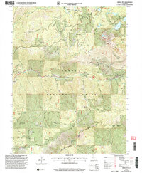
2000 Map of Sierra City
USGS Topo · Published 2003About this map
Gold mining history permeates this mountainous region of Tahoe National Forest, where the North Fork Yuba River cuts through the landscape near Sierra City. The terrain is marked by numerous lode mines and prospects, reflecting the industrial character of the Sierra Nevada. High-altitude operations like the Sierra Buttes Mine and Monarch Mine dominate the slopes above Loganville. Local ranching and seasonal camps are evidenced by Fournier Ranch and Robinson Cow Camp.
Find a feature on this map
64 named features on this map. Tap any name to fly to it.
Don’t see what you’re looking for? This feature index may not catch every label — zoom into the map to look around manually.
Map Details
Editions of this 2000 Sierra City Map
This is the sole edition of this map. No revisions or reprints were ever made.
Other maps of this area

1891 · Downieville
USGS Topo · 1:125,000

1891 · Colfax
USGS Topo · 1:125,000

1892 · Colfax
USGS Topo · 1:125,000

1893 · Downieville
USGS Topo · 1:125,000

1894 · Colfax
USGS Topo · 1:125,000

1895 · Downieville
USGS Topo · 1:125,000

1896 · Downieville
USGS Topo · 1:125,000

1897 · Downieville
USGS Topo · 1:125,000

1898 · Colfax
USGS Topo · 1:125,000

1900 · Colfax
USGS Topo · 1:125,000