Old Maps of Downieville, California for Hiking & Exploration
Hike through history with 15 historic maps of Downieville. Explore old trails, ghost towns, and forgotten backroads — perfect for outdoor adventurers and local explorers.
- Rediscover forgotten places: Map out old mining camps, roads, and footpaths that no longer exist on modern maps.
- Layer with modern tools: Combine with LiDAR or satellite views to plan hikes through historical terrain.
- Made for exploration: Popular among hikers, overlanders, and local history lovers.
Use these maps to find adventure and explore the hidden past of Downieville.
Downieville, CA maps
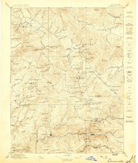
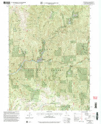
(15)- 1891 Map of Downieville
 1891 Downieville1891 Print · USGSThe gold-bearing ridges of the Northern Sierra come alive in the 1890s, when mining camps and high-country ranches defined the local economy. Researchers can trace the Sierra Turnpike and locate historic claims like the Empire Mine or the settlement of Whiskey Diggings.
 - 1893 Map of Downieville
 1893 Downieville1893 Print · USGSThe northern Sierra Nevada's gold country is revealed here during its late nineteenth-century mining peak. Researchers can trace historic claims and family outposts from Whiskey Diggings and Poker Flat to the Plumas Eureka mine.
 - 1895 Map of Downieville
 1895 Downieville1895 Print · USGSThe high Sierra mining districts of the 1890s are captured here during a peak era of resource extraction. Researchers can trace historic gold camps and industrial sites like Whiskey Diggings, the Plumas Eureka mine, and Poker Flat.
 - 1896 Map of Downieville
 1896 Downieville1896 Print · USGSThe northern Sierra Nevada comes alive in this 1890s survey of the Feather and Yuba River watersheds. Genealogists and historians can trace gold-rush era settlements from Quincy to Downieville, locating historic sites like Whiskey Diggings and the Empire Mine.
 - 1897 Map of Downieville
 1897 Downieville1897 Print · USGSThe northern Sierra Nevada's rugged gold country comes to life in the late nineteenth century, showing the dense network of camps and mines around Downieville. Researchers can trace the exact locations of historic operations like the Young America Mine and long-standing settlements like Howland Flat and Quincy.7 unique versions available
 - 1951 Map of Downieville, 1953 Print
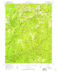
 1951 Downieville1953 Print · USGSThe mining district around Downieville is captured here in the early fifties, showing the deep legacy of the Gold Rush. Researchers can trace historic claims like the Gold Bluff Mine and Monte Cristo Mine or locate the Cornish House and Lavezzola Ranch.6 unique versions available
 - 1951 Map of Downieville, 1958 Print
 1951 Downieville1958 Print · USGSGold country life in the early fifties centered on the deep canyons of the Yuba and Feather Rivers. Trace the legacies of mining camps and family holdings from Downieville to the remote Howland Flat and the Standard Mine.3 unique versions available
 - 1958 Map of Chico, 1962 Print
 1958 Chico1962 Print · USGSMid-century Northern California comes to life across the Central Valley and high Sierras as the postwar economy transformed the landscape. Trace the rail lines of the Southern Pacific RR, locate family roots near Chico Cem, or explore the early layout of Paradise and Beale Air Force Base.4 unique versions available
 - 1960 Map of Chico
 1960 Chico1960 Print · USGSThe Northern California high country and Sacramento Valley meet in this 1960s-era landscape of mining towns and river settlements. Trace the rail-and-water economy of the gold country through the Empire Mine, Beale Air Force Base, and the Western Pacific Railroad.
 - 1979 Map of Portola, 1993 Print
 1979 Portola1993 Print · USGSThe northern Sierra Nevada and its timber-and-rail economy are captured here during the late seventies, spanning from the Feather River canyons to the high basins. Researchers can trace the path of the Western Pacific RR and locate historic hubs like Quincy, Portola, and Loyalton.2 unique versions available
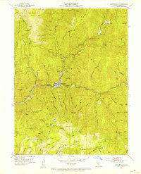
 - 2000 Map of Downieville, 2003 Print
 2000 Downieville2003 Print · USGSDownieville and the surrounding Sierra County gold country are captured here at the end of the millennium, showing a landscape shaped by mining and timber. Researchers can trace historical routes like the Henness Pass Road and locate old operations including the Monte Cristo Mine and Cornish House (Site).
 - 2012 Map of Downieville, 2012 Print
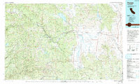
 2012 Downieville2012 Print · USGSCovers Downieville, including Sierra County, United States, and other nearby areas
 - 2015 Map of Downieville, 2015 Print
 2015 Downieville2015 Print · USGSCovers Downieville, including Sierra County, United States, and other nearby areas
 - 2018 Map of Downieville, 2018 Print
 2018 Downieville2018 Print · USGSCovers Downieville, including Sierra County, United States, and other nearby areas
 - 2021 Map of Downieville, 2021 Print
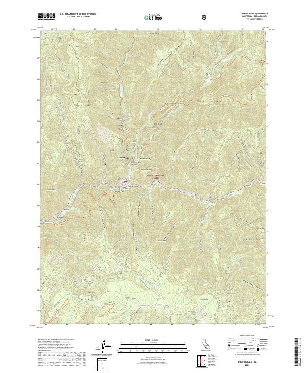 2021 Downieville2021 Print · USGSSierra County's gold-rush legacy is on full display in the early twenty-first century as Downieville sits at the meeting of the Downie River and North Yuba River. Genealogists and historians can trace the Sierra County Courthouse, Downieville Cem, and historical river flats like Jersey Flat.
End of results
Showing maps 1-15 of 15
Top cities near Downieville
Frequently asked questions
- What are the different types of historical maps available for Downieville?
- What is the oldest map of Downieville?
- Where can I purchase historical maps of Downieville for my home or office?
- Where can I download high-res historical maps of Downieville?
- Are there historical topographic maps available for Downieville?
- Is there historical aerial imagery available for Downieville?
- Where are historical maps of Downieville sourced from?