2020s Maps of Solano County, California
Explore 30 historic maps of Solano County from the 2020s. These maps offer a rare glimpse into what life looked like during the 2020s — showing old roads, neighborhoods, homes, and landmarks that have changed or disappeared over time.
Whether you're researching your family's past, planning a metal detecting trip, or studying how Solano County's landscape evolved across the 2020s, these high-resolution maps are a powerful tool for exploring the history of this region.
- Focus on a specific era: All maps on this page are from the 2020s, giving you a focused view of this time period.
- See what’s changed: Compare century-old streets, trails, and buildings to today's modern landscape using overlays and satellite layers.
- Research with precision: Use these maps for genealogy, historical research, land use analysis, or educational projects.
- View, download, or print: Maps are fully viewable online in high resolution, and can be downloaded or printed for your own records.
Start exploring Solano County's history through authentic maps from the 2020s. This is your window into the past.
Solano County, CA maps
(30)- 2021 Map of Monticello Dam, 2021 Print
 2021 Monticello Dam2021 Print · USGSThe interface of the coastal ranges and the valley floor comes into focus in this contemporary survey of the area around Winters. Local historians and genealogists can trace the rural landscape from the shores of Lake Berryessa to the heights of Edgar Peak and along the historic routes of Putah Creek.
 - 2021 Map of Mount George, 2021 Print
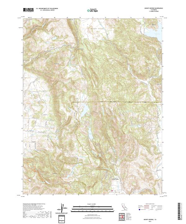 2021 Mount George2021 Print · USGSNapa and Solano Counties are mapped here in the modern era as a region of protected watersheds and rugged ridgelines. Researchers can trace intricate trail networks like the Bay Area Ridge Trail or locate landmarks such as Jenkins Rock and Green Valley Falls.
 - 2021 Map of Mount Vaca, 2021 Print
 2021 Mount Vaca2021 Print · USGSThe Vaca Mountains meet the Sacramento Valley floor in this recent survey of the Solano County foothills. Genealogists and hikers can trace the rural landscape around Bucktown, the heights of Mt Vaca, and the flight paths near Blake Sky Park.
 - 2021 Map of Sears Point, 2021 Print
 2021 Sears Point2021 Print · USGSThe Sonoma marshlands and San Pablo Bay shoreline come to life in this detailed recent survey. Genealogists and local historians can trace the foundations of Schellville, the remote outpost of Wingo, and the sprawling reaches of Skaggs Island.
 - 2021 Map of Capell Valley, 2021 Print
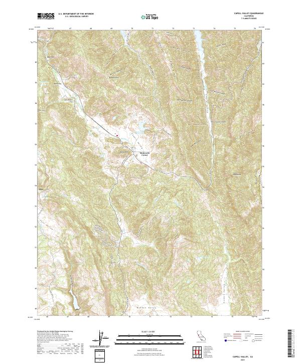 2021 Capell Valley2021 Print · USGSNapa County's eastern ridges and valleys are meticulously detailed in this early twenty-first-century survey. Local historians and land researchers can trace the roads and drainages around Moskowite Corner, Wooden Valley, and the Vaca Mountains.
 - 2021 Map of Winters, 2021 Print
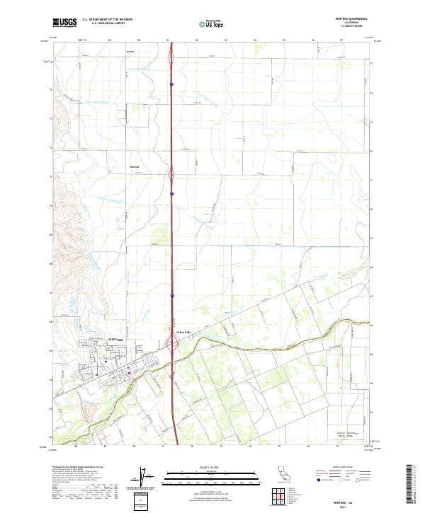 2021 Winters2021 Print · USGSWinters and the surrounding valley floor appear in this recent survey, showcasing a landscape of intensive water management and rural hubs. Genealogists and local historians can trace family locations near Arroz, Norton, and the Winters Cemetery, or follow the winding course of Putah Creek and Union School Slough.
 - 2021 Map of Antioch North, 2021 Print
 2021 Antioch North2021 Print · USGSThe Sacramento-San Joaquin Delta comes into focus in this recent survey, showcasing the meeting of industrial cities and marshland islands. Trace local history through Collinsville Cem, the hilltop roads of Montezuma Hills, and the waterfronts of Antioch and Pittsburg.
 - 2021 Map of Davis, 2021 Print
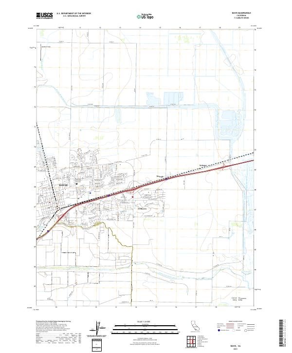 2021 Davis2021 Print · USGSDavis and the surrounding Sacramento Valley are shown in detail during a period of modern expansion. Local researchers can trace the growth of Davis neighborhoods and locate established landmarks like Swingle, El Macero, and the Davis Cem District and Arboretum.
 - 2021 Map of Fairfield North, 2021 Print
 2021 Fairfield North2021 Print · USGSNorthern Solano County comes into focus in this 2021 study of the growing corridor between Fairfield and Vacaville. Genealogists can locate Fairmont Memorial Park and the Old Solano County Courthouse while tracing old crossroads like Mankas Corner.
 - 2021 Map of Isleton, 2021 Print
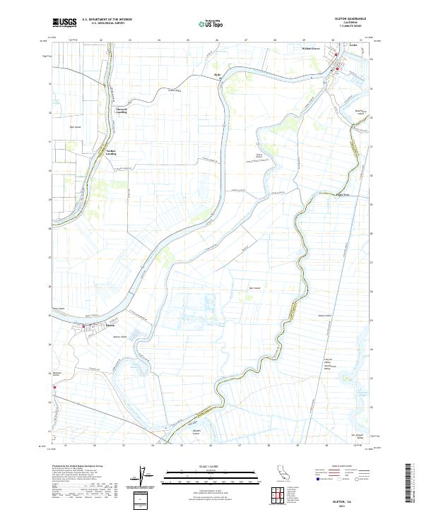 2021 Isleton2021 Print · USGSThe California Delta region appears in high detail during the early 2020s, revealing the intricate levee and slough system of the Sacramento Valley. Researchers can trace historic river communities like Locke, Isleton, and Walnut Grove along the winding Sacramento River.
 - 2021 Map of Dixon, 2021 Print
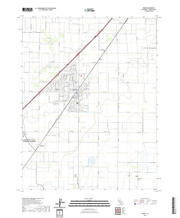 2021 Dixon2021 Print · USGSThe Solano County agricultural landscape of the early twenty-first century is captured here, centered on the growing community of Dixon. Researchers can trace local lineage at Silveyville Cem or locate the rural crossroads of Batavia and Sucro.
 - 2021 Map of Benicia, 2021 Print
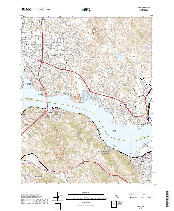 2021 Benicia2021 Print · USGSThe Carquinez Strait corridor comes alive in this modern survey of the historic maritime and industrial heart of Solano County. Researchers can trace institutional landmarks like the California Maritime Academy and numerous local burial sites such as the Benicia City Cem or Alhambra Cem.
 - 2021 Map of Jersey Island, 2021 Print
 2021 Jersey Island2021 Print · USGSThe California Delta's intricate network of islands and channels is captured here in the early 2020s. Researchers can trace the levee-lined borders of Jersey Island, the residential waterways of Bethel Island, and historic transit points like the Twitchell Island Ferry Rd.
 - 2021 Map of Mare Island, 2021 Print
 2021 Mare Island2021 Print · USGSThe northern reaches of San Francisco Bay appear in high detail during the early 2020s, showing the dense urban and industrial development of the East Bay. Trace local history through the streets of Vallejo, the naval heritage of Mare Island, and family markers at Hillside Cem.
 - 2021 Map of Denverton, 2021 Print
 2021 Denverton2021 Print · USGSSolano County’s marshlands and low hills are captured here in the early twenty-first century as urban growth nears the Suisun Marsh. Researchers can trace rural landmarks like Shiloh Cem and the quiet settlement of Denverton alongside Travis Air Force Base.
 - 2021 Map of Cuttings Wharf, 2021 Print
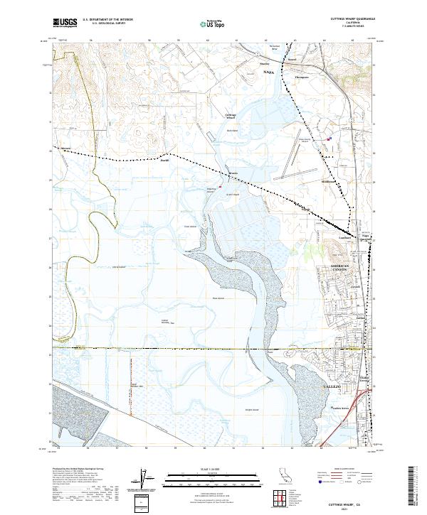 2021 Cuttings Wharf2021 Print · USGSThe marshes and tidal channels of the southern Napa Valley meet the growing industrial corridor of American Canyon. Trace the waterways of Napa River past Bull Island or find the early settlements at Cuttings Wharf and Buchli.
 - 2021 Map of Vine Hill, 2021 Print
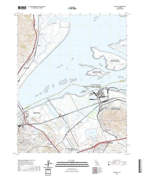 2021 Vine Hill2021 Print · USGSSuisun Bay's industrial and military shoreline is captured in this recent survey of the Suisun Bay area. Trace the legacy of the Port Chicago Naval Magazine National Memorial and follow the routes of the Mokelumne Aqueduct and Contra Costa Canal through Clyde and Vine Hill.
 - 2022 Map of Allendale, 2022 Print
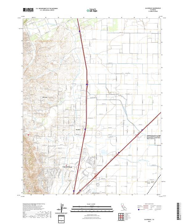 2022 Allendale2022 Print · USGSThe western edge of the Sacramento Valley meets the rising English Hills in the early 2020s. Researchers can trace irrigation networks like the Putah South Canal and locate family landmarks near Allendale, Hartley, or the Nut Tree Airport.
 - 2022 Map of Elmira, 2022 Print
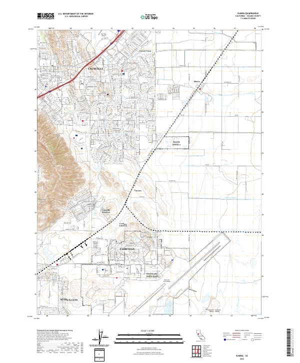 2022 Elmira2022 Print · USGSThe Solano County corridor at the start of the 2020s shows a landscape of suburban expansion and military strategic importance. Genealogists and local historians can trace the growth of Vacaville and Fairfield alongside the Vacaville-Elmira Cem and the vast grounds of Travis Air Force Base.
 - 2022 Map of Merritt, 2022 Print
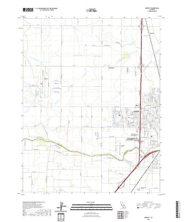 2022 Merritt2022 Print · USGSThe northern reaches of the Sacramento Valley come into focus in the early 2020s, showing the expansive University of California-Davis campus. Genealogists and local historians can trace the irrigation networks of Willow Slough or locate regional landmarks like the Yolo County Airport.
 - 2022 Map of Honker Bay, 2022 Print
 2022 Honker Bay2022 Print · USGSThe industrial waterfront and sprawling marshes of the East Bay meet in this 2020s study. Researchers can trace the residential growth of Pittsburg and Bay Point or find maritime remnants at McAvoy and Chipps.
 - 2022 Map of Cordelia, 2022 Print
 2022 Cordelia2022 Print · USGSThe foothills of the Howell Mountains meet the expanding north bay communities in the early 2020s. Genealogists and historians can trace the development of Vallejo neighborhoods and find old landmarks like Elkhorn Peak, Cordelia, and the Terminal Reservoir.
 - 2022 Map of Petaluma Point, 2022 Print
 2022 Petaluma Point2022 Print · USGSSan Pablo Bay and the Marin coastline are captured here in the early 2020s, showing the meeting of four major North Bay counties. Researchers can trace the unique shoreline topography of China Camp Point, the marshes of Tubbs Island, and hills like Turtle Back.
 - 2022 Map of Fairfield South, 2022 Print
 2022 Fairfield South2022 Print · USGSThe Suisun Marsh and the North Bay hinterlands are revealed in this detailed look at Solano County. Local historians can trace the intricate waterways of Montezuma Slough and locate landmarks like the Rockville Cem and Grizzly Island.
 - 2022 Map of Birds Landing, 2022 Print
 2022 Birds Landing2022 Print · USGSThe rural Montezuma Hills and the Sacramento Valley are seen here in the early 2020s, showing a landscape defined by rolling agricultural terrain and small crossroad settlements. Researchers can trace land patterns around Birds Landing or locate landmarks like Hopkins Ravine and The Big Ditch.
Showing maps 1-25 of 30
Top cities of Solano County
- Vallejo historical maps
- Fairfield historical maps
- Vacaville historical maps
- Suisun City historical maps
- Benicia historical maps
- Dixon historical maps
See more
Frequently asked questions
- What are the different types of historical maps available for Solano County?
- What is the oldest map of Solano County?
- Where can I purchase historical maps of Solano County for my home or office?
- Where can I download high-res historical maps of Solano County?
- Are there historical topographic maps available for Solano County?
- Is there historical aerial imagery available for Solano County?
- Where are historical maps of Solano County sourced from?