Old Maps of Coffey Park, Santa Rosa for Academic Research
Study the evolution of Coffey Park with 15 high-resolution historic maps. Whether you're teaching, researching, or modeling changes in land use, these maps provide essential visual documentation of urban, environmental, and geographic change.
- Analyze long-term change: Track patterns in development, transportation, and natural features.
- Ideal for environmental or urban studies: Support academic projects with primary historical map data.
- Use in the classroom or lab: Educators and researchers rely on these maps to bring historical context to life.
These maps are a powerful tool for teaching, research, and visualizing how Coffey Park has changed over the decades.
Coffey Park, Santa Rosa maps
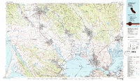
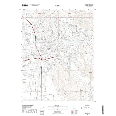
(15)- 1916 Map of Santa Rosa
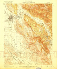 1916 Santa Rosa1916 Print · USGSSonoma County in the mid-1910s is a landscape of established rail towns and historic land grants. Researchers can trace early infrastructure through sites like the Sonoma State Home, Adobe Fort, and rural landmarks such as Grangers Hall or the Winery.3 unique versions available
 - 1944 Map of Santa Rosa
 1944 Santa Rosa1944 Print · USGSSonoma County transitions from its early land-grant heritage to a mid-century agricultural hub in the years following the 1942 revision. Genealogists and researchers can locate numerous country schools and family-linked landmarks like Sonoma State Home, Adobe Fort, and Grange Hall.2 unique versions available
 - 1947 Map of Santa Rosa
 1947 Santa Rosa1947 Print · USGSNorthern California in the late 1940s was a landscape of agricultural valleys and vital rail hubs. Trace the historic routes of the Northwestern Pacific through Healdsburg or explore the mid-century waterfronts of Vallejo and Benicia near Mare Island.
 - 1949 Map of Santa Rosa
 1949 Santa Rosa1949 Print · USGSThe North Bay and Wine Country appear here in the late 1940s, when the Northwestern Pacific RR still dominated regional transit. Genealogists and historians can trace old coastal outposts like Anchor Bay Settlement and the early layout of Santa Rosa.2 unique versions available
 - 1954 Map of Santa Rosa, 1955 Print
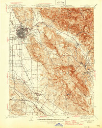
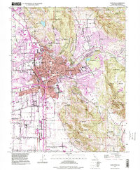
 1954 Santa Rosa1955 Print · USGSSanta Rosa in the mid-fifties is a thriving hub of civic life and new suburban development set against the backdrop of Sonoma County’s mountains. Researchers can trace the legacy of local landmarks like the Luther Burbank Gardens, the Rural Cemetery, and the Bennett Valley Grange Hall.6 unique versions available
 - 1954 Map of Santa Rosa, 1959 Print
 1954 Santa Rosa1959 Print · USGSSonoma County at the mid-century shows a landscape of expanding valley towns and military infrastructure. Researchers can locate the Cotati Naval Auxiliary Air Station or trace the Jack London Ranch and Penngrove rail stops.2 unique versions available
 - 1958 Map of Santa Rosa, 1968 Print
 1958 Santa Rosa1968 Print · USGSThe North Bay and Wine Country are captured in the mid-twentieth century as the region balanced its agricultural roots with a growing military and recreational footprint. Researchers can trace the Northwestern Pacific RR through the Russian River valley or locate landmarks like the Petaluma Adobe Historical Monument and The Geysers Resort.3 unique versions available
 - 1962 Map of Santa Rosa
 1962 Santa Rosa1962 Print · USGSThe North Bay and Wine Country were entering a period of significant growth in the early sixties, anchored by established rail corridors and coastal maritime commerce. Genealogists and historians can trace the development of Santa Rosa, locate the Mare Island Naval Shipyard, and follow the Northwestern Pacific RR through the Cotati Valley.
 - 1964 Map of Santa Rosa
 1964 Santa Rosa1964 Print · USGSThe North Bay and Wine Country appear in the mid-fifties during a period of significant military and educational growth. Trace old rail lines like the Northwestern Pacific RR and explore historic sites from Petaluma to the Benicia Arsenal.
 - 1983 Map of Napa
 1983 Napa1983 Print · USGSThe North Bay and wine country are captured in the early eighties as suburban growth began to surround traditional agricultural centers. Researchers can trace the rail corridors of the Northwestern Pacific Railroad, the grounds of Mare Island Naval Shipyard, and the reach of the San Andreas Rift Zone.
 - 1994 Map of Santa Rosa, 1999 Print
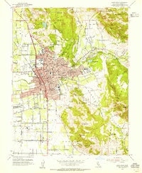
 1994 Santa Rosa1999 Print · USGSSanta Rosa and its surrounding valleys are captured in the late nineties during a period of steady growth. Researchers can trace the legacy of regional landmarks like the Rural Cemetery, the Sonoma County Fairgrounds, and the Luther Burbank Gardens.
 - 2012 Map of Santa Rosa, 2012 Print
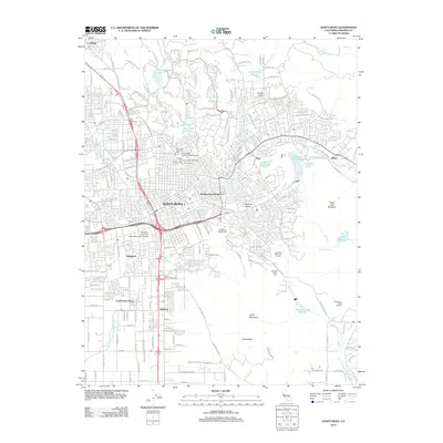 2012 Santa Rosa2012 Print · USGSCovers Coffey Park, including Santa Rosa, Bellevue, and other nearby areas
 - 2015 Map of Santa Rosa, 2015 Print
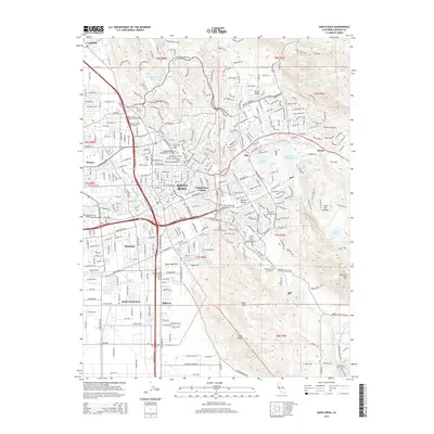 2015 Santa Rosa2015 Print · USGSCovers Coffey Park, including Santa Rosa, Bellevue, and other nearby areas
 - 2018 Map of Santa Rosa, 2018 Print
 2018 Santa Rosa2018 Print · USGSCovers Coffey Park, including Santa Rosa, Bellevue, and other nearby areas
 - 2021 Map of Santa Rosa, 2021 Print
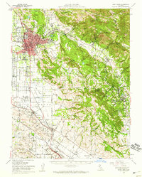
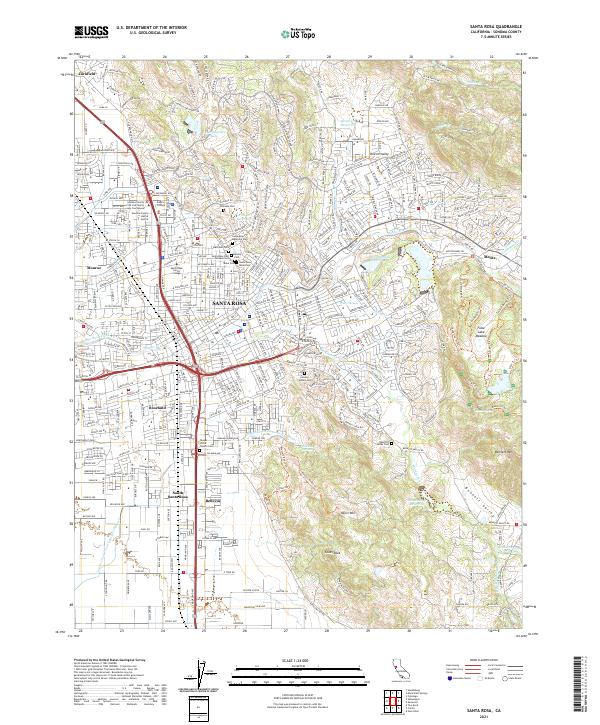 2021 Santa Rosa2021 Print · USGSSanta Rosa and its surrounding valleys are shown here in the early 2020s, highlighting the city's growth alongside its rugged eastern foothills. Genealogists can trace family sites at the Santa Rosa Rural Cem or Calvary Catholic Cem, while hikers can map the complex trail network around Taylor Mtn.
End of results
Showing maps 1-15 of 15
Frequently asked questions
- What are the different types of historical maps available for Coffey Park?
- What is the oldest map of Coffey Park?
- Where can I purchase historical maps of Coffey Park for my home or office?
- Where can I download high-res historical maps of Coffey Park?
- Are there historical topographic maps available for Coffey Park?
- Is there historical aerial imagery available for Coffey Park?
- Where are historical maps of Coffey Park sourced from?