1950s Maps of Oakmont, Santa Rosa
Explore 3 historic maps of Oakmont from the 1950s. These maps offer a rare glimpse into what life looked like during the 1950s — showing old roads, neighborhoods, homes, and landmarks that have changed or disappeared over time.
Whether you're researching your family's past, planning a metal detecting trip, or studying how Oakmont's landscape evolved across the 1950s, these high-resolution maps are a powerful tool for exploring the history of this region.
- Focus on a specific era: All maps on this page are from the 1950s, giving you a focused view of this time period.
- See what’s changed: Compare century-old streets, trails, and buildings to today's modern landscape using overlays and satellite layers.
- Research with precision: Use these maps for genealogy, historical research, land use analysis, or educational projects.
- View, download, or print: Maps are fully viewable online in high resolution, and can be downloaded or printed for your own records.
Start exploring Oakmont's history through authentic maps from the 1950s. This is your window into the past.
Oakmont, Santa Rosa maps
(3)- 1954 Map of Kenwood, 1955 Print
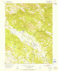 1954 Kenwood1955 Print · USGSSonoma Valley's rural character is preserved here in the mid-fifties, showing the intersection of valley ranching and early mountain industry. Researchers can trace the Northwestern Pacific Railroad Grade and locate historic landmarks like the Los Guilicos School For Girls and McCormack Ranch.7 unique versions available
 - 1954 Map of Santa Rosa, 1959 Print
 1954 Santa Rosa1959 Print · USGSSonoma County at the mid-century shows a landscape of expanding valley towns and military infrastructure. Researchers can locate the Cotati Naval Auxiliary Air Station or trace the Jack London Ranch and Penngrove rail stops.2 unique versions available
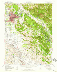
 - 1958 Map of Santa Rosa, 1968 Print
 1958 Santa Rosa1968 Print · USGSThe North Bay and Wine Country are captured in the mid-twentieth century as the region balanced its agricultural roots with a growing military and recreational footprint. Researchers can trace the Northwestern Pacific RR through the Russian River valley or locate landmarks like the Petaluma Adobe Historical Monument and The Geysers Resort.3 unique versions available
End of results
Showing maps 1-3 of 3
Top cities near Oakmont
- Santa Rosa historical maps
- Petaluma historical maps
- Rohnert Park historical maps
- Windsor historical maps
- Sonoma historical maps
- Sebastopol historical maps
See more
Frequently asked questions
- What are the different types of historical maps available for Oakmont?
- What is the oldest map of Oakmont?
- Where can I purchase historical maps of Oakmont for my home or office?
- Where can I download high-res historical maps of Oakmont?
- Are there historical topographic maps available for Oakmont?
- Is there historical aerial imagery available for Oakmont?
- Where are historical maps of Oakmont sourced from?