1960s Maps of Sutter County, California
Explore 5 historic maps of Sutter County from the 1960s. These maps offer a rare glimpse into what life looked like during the 1960s — showing old roads, neighborhoods, homes, and landmarks that have changed or disappeared over time.
Whether you're researching your family's past, planning a metal detecting trip, or studying how Sutter County's landscape evolved across the 1960s, these high-resolution maps are a powerful tool for exploring the history of this region.
- Focus on a specific era: All maps on this page are from the 1960s, giving you a focused view of this time period.
- See what’s changed: Compare century-old streets, trails, and buildings to today's modern landscape using overlays and satellite layers.
- Research with precision: Use these maps for genealogy, historical research, land use analysis, or educational projects.
- View, download, or print: Maps are fully viewable online in high resolution, and can be downloaded or printed for your own records.
Start exploring Sutter County's history through authentic maps from the 1960s. This is your window into the past.
Sutter County, CA maps
(5)- 1960 Map of Chico
 1960 Chico1960 Print · USGSThe Northern California high country and Sacramento Valley meet in this 1960s-era landscape of mining towns and river settlements. Trace the rail-and-water economy of the gold country through the Empire Mine, Beale Air Force Base, and the Western Pacific Railroad.
 - 1967 Map of Pleasant Grove, 1968 Print
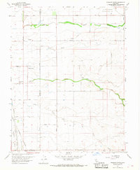 1967 Pleasant Grove1968 Print · USGSThe agricultural heart of the Central Valley at the Sutter and Placer county line comes into focus in this late-sixties survey. Genealogists and historians can trace rail-side settlements like Riego and Sankey or locate landmarks such as the Radio Towers (KFBK).2 unique versions available
 - 1967 Map of Verona, 1968 Print
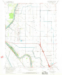
 1967 Verona1968 Print · USGSIn the late 1960s, the Sacramento and Feather rivers met amidst a complex landscape of irrigation and agriculture. Researchers can trace rural community life at Verona, locate family history at Pleasant Grove Cem, and follow the Old Railroad Grade through the basin.2 unique versions available
 - 1967 Map of Taylor Monument, 1968 Print
 1967 Taylor Monument1968 Print · USGSThe Sacramento valley was undergoing rapid change in the late 1960s as suburban infrastructure met traditional agriculture. You can trace the path of the Sacramento Northern railway and locate family landmarks like the Natomas Sch and Fishermans Lake.4 unique versions available
 - 1967 Map of Rio Linda, 1968 Print
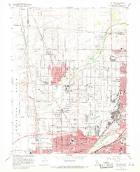 1967 Rio Linda1968 Print · USGSNorthern Sacramento County enters a period of post-war growth as the aerospace sector and suburban expansion reshape the landscape. Researchers can trace the development of Rio Linda and North Highlands alongside McClellan Air Force Base and the Sacramento Northern rail line.5 unique versions available
End of results
Showing maps 1-5 of 5
Top cities of Sutter County
Frequently asked questions
- What are the different types of historical maps available for Sutter County?
- What is the oldest map of Sutter County?
- Where can I purchase historical maps of Sutter County for my home or office?
- Where can I download high-res historical maps of Sutter County?
- Are there historical topographic maps available for Sutter County?
- Is there historical aerial imagery available for Sutter County?
- Where are historical maps of Sutter County sourced from?