1950s Maps of Bucktail, California
Explore 3 historic maps of Bucktail from the 1950s. These maps offer a rare glimpse into what life looked like during the 1950s — showing old roads, neighborhoods, homes, and landmarks that have changed or disappeared over time.
Whether you're researching your family's past, planning a metal detecting trip, or studying how Bucktail's landscape evolved across the 1950s, these high-resolution maps are a powerful tool for exploring the history of this region.
- Focus on a specific era: All maps on this page are from the 1950s, giving you a focused view of this time period.
- See what’s changed: Compare century-old streets, trails, and buildings to today's modern landscape using overlays and satellite layers.
- Research with precision: Use these maps for genealogy, historical research, land use analysis, or educational projects.
- View, download, or print: Maps are fully viewable online in high resolution, and can be downloaded or printed for your own records.
Start exploring Bucktail's history through authentic maps from the 1950s. This is your window into the past.
Bucktail, CA maps
(3)- 1950 Map of Weaverville, 1957 Print
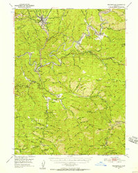 1950 Weaverville1957 Print · USGSTrinity County's gold mining heritage remains prominent in the 1950s, centered on the historic town of Weaverville. Genealogists and historians can trace the cultural landscape through the Chinese Cem, La Grange Mine, and the remote Blanchard Flat School.2 unique versions available
 - 1952 Map of Weaverville
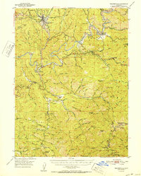 1952 Weaverville1952 Print · USGSTrinity County in the early fifties remains a landscape defined by its mining roots and river-canyon settlements. Genealogists and historians can trace family locations from the Blanchard Flat School and Lowden Ranch to early industry at the La Grange Mine.2 unique versions available
 - 1958 Map of Redding
 1958 Redding1958 Print · USGSNorthern California's valley and mountain landscapes are captured in the late fifties, showing the region as new reservoirs reshaped the river systems. Genealogists and historians can trace rail-side towns like Cottonwood, the military presence at Red Bluff Air Force Station, and mountain outposts like Weaverville.5 unique versions available
End of results
Showing maps 1-3 of 3
Top cities near Bucktail
Frequently asked questions
- What are the different types of historical maps available for Bucktail?
- What is the oldest map of Bucktail?
- Where can I purchase historical maps of Bucktail for my home or office?
- Where can I download high-res historical maps of Bucktail?
- Are there historical topographic maps available for Bucktail?
- Is there historical aerial imagery available for Bucktail?
- Where are historical maps of Bucktail sourced from?