
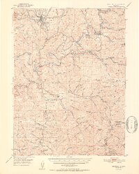
1952 Map of Weaverville
USGS Topo · Published 1952About this map
The gold mining legacy of the Trinity National Forest is etched across this mid-century landscape, centered on the historic town of Weaverville. The area's diverse cultural history is reflected in the presence of both a Chinese Cem and an Indian Cem near the town site. Industrial infrastructure from the hydraulic and lode mining era remains prominent, from the massive La Grange Mine and Union Hill Mine to the winding course of the Union Ditch, which redirected water across the ridges to support these operations.
Find a feature on this map
96 named features on this map. Tap any name to fly to it.
Don’t see what you’re looking for? This feature index may not catch every label — zoom into the map to look around manually.
Map Details
Editions of this 1952 Weaverville Map
2 editions found
Other maps of this area

1890 · Red Bluff
USGS Topo · 1:250,000

1894 · Red Bluff
USGS Topo · 1:250,000

1909 · Big Bar
USGS Topo · 1:96,000

1913 · Weaverville
USGS Topo · 1:125,000

1915 · Big Bar and Vicinity
USGS Topo · 1:250,000

1931 · Hoaglin
USGS Topo · 1:96,000

1935 · Hoaglin
USGS Topo · 1:125,000

1944 · French Gulch
USGS Topo · 1:62,500

1948 · French Gulch
USGS Topo · 1:62,500

1950 · Minersville
USGS Topo · 1:62,500