Old Maps of Hoboken, California
Explore 12 old maps of Hoboken, spanning from 1909 to today. These high-resolution historic maps reveal how streets, neighborhoods, landmarks, and natural features evolved over time — perfect for genealogy, metal detecting, research, and local history exploration.
What you can do with these maps:
- See how Hoboken changed over time: Compare historical maps to modern-day views to trace roads, homesites, rail lines & more.
- View detailed metadata: Each map includes creators, publishers, year, scale, and archive source.
- Overlay maps with satellite & LiDAR: Visualize the past alongside modern tools to explore terrain & human change.
- Trusted historical sources: Maps sourced from the USGS, Library of Congress, and other archives.
- Access maps your way: View online, download high-res files, or order prints for personal or research use.
Start exploring old maps of Hoboken to uncover forgotten places, hidden landmarks, and the deep history beneath your feet.
Hoboken, CA maps
(12)- 1909 Map of Big Bar
 1909 Big Bar1909 Print · USGSTrinity County at the turn of the century shows a land defined by deep river canyons and remote mountain settlements. Genealogists and local historians can trace early footprints at Hyampom and Hayfork, or locate the high ridges of Barker Mtn and Thompson Peak.2 unique versions available
 - 1915 Map of Big Bar and Vicinity
 1915 Big Bar and Vicinity1915 Print · USGSThe Trinity River wilderness in the early twentieth century was a landscape of isolated mining outposts and river settlements. Genealogists and historians can trace the early footprints of Junction City, Helena, and Hyampom alongside remote landmarks like Keystone Cabin.5 unique versions available
 - 1951 Map of Ironside Mountain, 1953 Print
 1951 Ironside Mountain1953 Print · USGSTrinity County's deep river canyons and forest ridges are captured here in the early fifties, showing a remote landscape defined by mining and mountain ranching. Researchers can locate family landmarks like Gray Ranch, old mining sites such as Index Mine, and riverside camps including Del Loma and Sandy Bar.4 unique versions available
 - 1958 Map of Redding
 1958 Redding1958 Print · USGSNorthern California's valley and mountain landscapes are captured in the late fifties, showing the region as new reservoirs reshaped the river systems. Genealogists and historians can trace rail-side towns like Cottonwood, the military presence at Red Bluff Air Force Station, and mountain outposts like Weaverville.5 unique versions available
 - 1982 Map of Denny
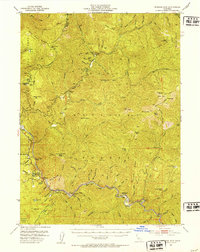
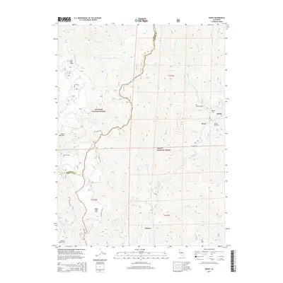
 1982 Denny1982 Print · USGSTrinity County's remote mountain backcountry is captured here in the early 1980s at the intersection of two national forests. Genealogists and historians can locate mining roots at the Index Mine or trace former outposts like Elk Camp (Site) and the settlement of Hoboken.
 - 1982 Map of Hayfork, 1983 Print
 1982 Hayfork1983 Print · USGSTrinity and Humboldt counties appear here in the early eighties as a landscape of timber and mining. Researchers can trace remote river settlements like Hyampom and Burnt Ranch or locate old operations such as the Yellowstone Mine and Index Mine.
 - 1998 Map of Denny, 2003 Print
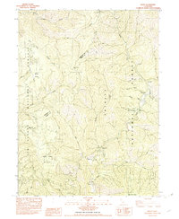
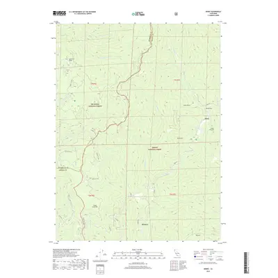
 1998 Denny2003 Print · USGSThe Trinity Alps wilderness in the late 1990s reveals a landscape of isolated forest outposts and historic mining claims. Researchers can trace family history at the Cem near Dailey or locate early workings at Index Mine and Hazel D Mine.
 - 2012 Map of Denny, 2012 Print
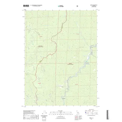
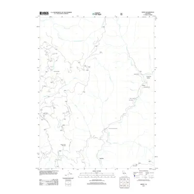 2012 Denny2012 Print · USGSCovers Hoboken, including Denny, Humboldt County, and other nearby areas
 - 2015 Map of Denny, 2015 Print
 2015 Denny2015 Print · USGSCovers Hoboken, including Denny, Humboldt County, and other nearby areas
 - 2018 Map of Denny, 2018 Print
 2018 Denny2018 Print · USGSCovers Hoboken, including Denny, Humboldt County, and other nearby areas
 - 2021 Map of Denny, 2021 Print
 2021 Denny2021 Print · USGSCovers Hoboken, including Denny, Humboldt County, and other nearby areas
 - 2023 Map of Denny, 2023 Print
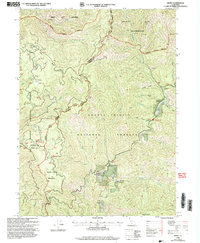
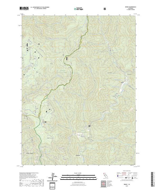 2023 Denny2023 Print · USGSThe Trinity County backcountry near the New River comes into focus in this recent survey. Researchers can trace the isolated roads and riverside sites of Denny, Hoboken, and the family-named landmarks of McAtee Bar and Scotts Gulch.
End of results
Showing maps 1-12 of 12
Top cities near Hoboken
Frequently asked questions
- What are the different types of historical maps available for Hoboken?
- What is the oldest map of Hoboken?
- Where can I purchase historical maps of Hoboken for my home or office?
- Where can I download high-res historical maps of Hoboken?
- Are there historical topographic maps available for Hoboken?
- Is there historical aerial imagery available for Hoboken?
- Where are historical maps of Hoboken sourced from?