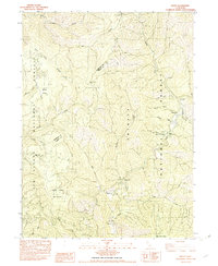
1982 Map of Denny
USGS Topo · Published 1982About this map
The New River corridor dominates this 1982 survey of the mountainous terrain where the Six Rivers National Forest meets the Trinity National Forest. The remote settlement of Denny serves as a central landmark, supported by the nearby Denny F.S. Station and the Denny Campground. This area has long been defined by its resource extraction and rugged access, as evidenced by the presence of the Index Mine and Hazel D Mine. Historical occupation is noted at Elk Camp (Site) and Onion Camp (Site), indicating locations that were already historical by the early 1980s. Further south, the map identifies small clusters and individual sites such as Hoboken and Dailey. The geography is deeply etched by watercourses like Horse Linto Creek and Bell Creek, creating a landscape that necessitated the early trail networks of TR 43 and TR 44.
Find a feature on this map
38 named features on this map. Tap any name to fly to it.
Don’t see what you’re looking for? This feature index may not catch every label — zoom into the map to look around manually.
Map Details
Editions of this 1982 Denny Map
This is the sole edition of this map. No revisions or reprints were ever made.
Other maps of this area

1909 · Big Bar
USGS Topo · 1:96,000

1915 · Big Bar and Vicinity
USGS Topo · 1:250,000

1922 · China Flat
USGS Topo · 1:62,500

1925 · Hoopa
USGS Topo · 1:125,000

1948 · Weed
USGS Topo · 1:250,000

1950 · Weed
USGS Topo · 1:250,000

1951 · Ironside Mountain
USGS Topo · 1:62,500

1952 · Willow Creek
USGS Topo · 1:62,500

1952 · Hoopa
USGS Topo · 1:62,500

1955 · Salmon Mtn
USGS Topo · 1:62,500