Old Maps of Simi Valley, California for Metal Detecting
Plan your next treasure hunt with 48 historic maps of Simi Valley. Find old homesites, ghost towns, trails, and gathering spots that may be lost to time — perfect for identifying promising metal detecting locations.
- Locate forgotten sites: Uncover places like long-lost settlements, abandoned rail lines, or gathering spots.
- Plan better hunts: Use map overlays combined with LiDAR or satellite views to narrow in on historically rich areas.
- Made for detectorists: Thousands of hobbyists use these maps to discover relics, coins, and hidden history.
Use these historic maps to boost your research and find new opportunities beneath the surface of Simi Valley.
Simi Valley, CA maps
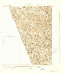
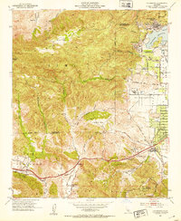
(48)- 1900 Map of Triunfo Pass
 1900 Triunfo Pass1900 Print · USGSIn the final year of the nineteenth century, the coast between Ventura and Los Angeles remained a series of massive ranchos and canyons. Genealogists and historians can trace early settlements like Newbury Park and Vejor, or follow the ancient Boundary Line across the Santa Monica Mountains.2 unique versions available
 - 1900 Map of Piru
 1900 Piru1900 Print · USGSVentura County thrived along the rail-and-river corridor at the turn of the century as agriculture and ranching expanded. Trace the early layouts of Fillmore, Moorpark, and Piru or locate family landmarks in Bardsdale and Camulos.
 - 1903 Map of Calabasas
 1903 Calabasas1903 Print · USGSThe northern reaches of the Santa Monica Mountains and the western San Fernando Valley are shown here at the turn of the century. Genealogists and historians can trace early ranch boundaries like Encino and Las Virgenes, or locate the original sites of Grape Arbor and the Chatsworth Park Branch railroad.8 unique versions available
 - 1903 Map of Camulos
 1903 Camulos1903 Print · USGSSouthern California at the dawn of the twentieth century shows a landscape of ranchos and early rail towns. Trace the old routes through Simi and Camulos, or locate vanished stops like Ternez Siding and the coastal piers at Port Los Angeles.5 unique versions available
 - 1903 Map of Santa Susana
 1903 Santa Susana1903 Print · USGSNorthern Los Angeles and Ventura counties are captured here at the start of the twentieth century, as the railroad transformed the frontier. Trace early rail hubs at Newhall and Saugus, and find the engineering feats of the Santa Susana Tunnel and Fernando Tunnel.8 unique versions available
 - 1921 Map of Piru
 1921 Piru1921 Print · USGSThe Santa Clara River valley and southern Ventura County are shown here in the early twentieth century as the rail network expanded. Genealogists and historians can trace old property lines and rail stops at Sespe Sta, Camulos, and Bardsdale.4 unique versions available
 - 1921 Map of Triunfo Pass
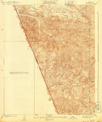
 1921 Triunfo Pass1921 Print · USGSThe coastal canyons and mountain passes of Ventura and Los Angeles counties are captured here at the turn of the century. Genealogists and historians can trace early settlements at Newbury Park and Triunfo, or follow the rugged drainage of Dume Canyon to the sea.3 unique versions available
 - 1925 Map of Chatsworth
 1925 Chatsworth1925 Print · USGSThe western San Fernando Valley appears here in the mid-1920s as a landscape of new reservoirs and expanding rail lines. Genealogists and local historians can trace the early streets of Chatsworth, the grounds of Oakwood Cemetery, and the historic El Escorpion tract.
 - 1927 Map of Chatsworth
 1927 Chatsworth1927 Print · USGSIn the mid-1920s, the western San Fernando Valley was a landscape of emerging townsets and critical water infrastructure. Trace early street grids and rail lines near Chatsworth, Owensmouth, and the Chatsworth Reservoir.
 - 1929 Map of Chatsworth
 1929 Chatsworth1929 Print · USGSThe foothills of the Santa Susana Mountains come into focus in the late 1920s as Los Angeles began its westward expansion. Genealogists and historians can trace the early boundaries of Oakwood Cemetery, the Southern Pacific rail line, and the fledgling Twin Lakes Addition.
 - 1929 Map of Pico
 1929 Pico1929 Print · USGSThe northern Santa Susana Mountains were a hub of early petroleum activity in the late 1920s. Trace the historic footprint of the Pico Oil Field and follow early mountain routes through Pico Canyon and Towsley Canyon.
 - 1933 Map of Chatsworth
 1933 Chatsworth1933 Print · USGSThe Chatsworth area in the early thirties shows a unique blend of old ranching estates and new valley subdivisions. You can trace early property lines at Rancho Sombra del Roble or locate historic landmarks like the Garden of The Gods and Oakwood Cemetery.
 - 1940 Map of Pico
 1940 Pico1940 Print · USGSThe northern reaches of the Santa Susana Mountains appear here in the late 1930s, showing the complex canyons of the Los Angeles and Ventura county line. Researchers can trace early settlements and remote outposts like Pico and La Quinta or locate high-country landmarks such as Oat Mtn Lookout.
 - 1940 Map of Chatsworth
 1940 Chatsworth1940 Print · USGSThe northwest San Fernando Valley appears in the 1940s as a land of iconic movie ranches and burgeoning citrus communities. Researchers can trace the early footprints of Chatsworth and Canoga Park or locate family-named sites like Iverson Ranch and Brandies Ranch.
 - 1941 Map of Piru, 1963 Print
 1941 Piru1963 Print · USGSVentura County ranching and rail life are captured here during the early 1940s as citrus and oil industries shaped the valley. Researchers can trace historic family holdings like the Frey Ranch and locate vanished local landmarks such as San Cayetano Sch or the Temescal Guard Station.
 - 1941 Map of Santa Susana, 1964 Print
 1941 Santa Susana1964 Print · USGSVentura and Los Angeles counties meet in this 1940s landscape of steep canyons and early oil development. Researchers can trace the ranching history of Brandeis Ranch and Iverson Ranch or locate industrial sites like the Newhall-Potrero Oil Field.2 unique versions available
 - 1943 Map of Santa Susana
 1943 Santa Susana1943 Print · USGSSouthern California ranching and oil industries intersect in the early 1940s along the Santa Susana Mountains. Trace historic boundaries and sites like Tapo Ranch, the Newhall-Potrero Oil Field, and the Southern Pacific rail line.
 - 1943 Map of Triunfo Pass
 1943 Triunfo Pass1943 Print · USGSThe Conejo Valley and Santa Monica Mountains are shown here during the early war years, when ranching and small coastal outposts defined the region. Local researchers can locate family landholdings like Fillmore Ranch or trace the early development of the Thousand Oaks Community and Newbury Park.
 - 1944 Map of Calabasas
 1944 Calabasas1944 Print · USGSMid-century Los Angeles County unfolds here, showing the grid of the San Fernando Valley meeting the Santa Monica Mountains. Trace old ranch boundaries at Platt Ranch or locate early landmarks like the Will Rogers Memorial and Topanga Lookout.
 - 1949 Map of Los Angeles
 1949 Los Angeles1949 Print · USGSSouthern California and the South Coast appear at the onset of the post-war boom, from the Channel Islands to the Mojave Desert. Trace early aviation sites like Lockheed Air Terminal and mining history at the Redrock Quicksilver Mine and Redrover Mine.2 unique versions available
 - 1950 Map of Thousand Oaks, 1955 Print
 1950 Thousand Oaks1955 Print · USGSThousand Oaks and the surrounding ranch lands are shown here in the early fifties, just as the regional highway network began to modernize. Researchers can locate early community hubs like Triunfo Corner, Greenwich Village, and the Conejo Sch.5 unique versions available
 - 1951 Map of Simi, 1952 Print
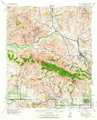
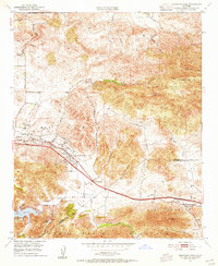
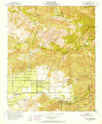
 1951 Simi1952 Print · USGSSimi Valley and Moorpark are captured in the early fifties during an era of agricultural prosperity and early suburban planning. Genealogists and local historians can locate the Virginia Colony settlement, the Simi Sta railroad stop, and the Cem south of the tracks.6 unique versions available
 - 1951 Map of Santa Susana, 1952 Print
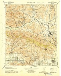
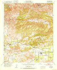
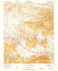
 1951 Santa Susana1952 Print · USGSSimi Valley and the surrounding mountains are captured here in the early fifties, showing the region before modern suburban expansion. Researchers can trace ranching history at Tapo Ranch, locate the Santa Susana Airport, or follow the Southern Pacific line through the Santa Susana Tunnel.6 unique versions available
 - 1952 Map of Thousand Oaks
 1952 Thousand Oaks1952 Print · USGSThousand Oaks and the Conejo Valley are captured in the early fifties, just as this ranching region began to modernize. Researchers can locate the original Conejo School, the Conejo Valley Airport, and old landmarks like Triunfo Corner and the Olson Cemetery.
 - 1952 Map of Calabasas, 1953 Print
 1952 Calabasas1953 Print · USGSThe western San Fernando Valley meets the Simi Hills in the early fifties, showing a landscape of foothill ranching and early canyon communities. Genealogists can locate family landmarks like Chatsworth Lake Manor, the L A Pet Cemetery, and Las Virgenes School.9 unique versions available
Showing maps 1-25 of 48
Top cities near Simi Valley
- Los Angeles historical maps
- Santa Clarita historical maps
- Thousand Oaks historical maps
- Santa Monica historical maps
- Moorpark historical maps
- Calabasas historical maps
See more
Top neighborhoods of Simi Valley
- Highlands at Big Sky historical maps
- The Bluffs historical maps
- Jasmine Glen Estates historical maps
- Windstone at Big Sky historical maps
- Alamo Villas historical maps
- Tradewinds Club historical maps
See more
Frequently asked questions
- What are the different types of historical maps available for Simi Valley?
- What is the oldest map of Simi Valley?
- Where can I purchase historical maps of Simi Valley for my home or office?
- Where can I download high-res historical maps of Simi Valley?
- Are there historical topographic maps available for Simi Valley?
- Is there historical aerial imagery available for Simi Valley?
- Where are historical maps of Simi Valley sourced from?