Old Maps of Berthoud Falls, Colorado for Metal Detecting
Plan your next treasure hunt with 14 historic maps of Berthoud Falls. Find old homesites, ghost towns, trails, and gathering spots that may be lost to time — perfect for identifying promising metal detecting locations.
- Locate forgotten sites: Uncover places like long-lost settlements, abandoned rail lines, or gathering spots.
- Plan better hunts: Use map overlays combined with LiDAR or satellite views to narrow in on historically rich areas.
- Made for detectorists: Thousands of hobbyists use these maps to discover relics, coins, and hidden history.
Use these historic maps to boost your research and find new opportunities beneath the surface of Berthoud Falls.
Berthoud Falls, CO maps
(14)- 1924 Map of Fraser, 1957 Print
 1924 Fraser1957 Print · USGSGrand County's high-country rail and ranching corridors come alive in this mid-twenties survey of the Fraser Valley. Researchers can trace the original Denver and Salt Lake RR route, locate the Pole Creek School, and study the early layout of West Portal near the Moffat Tunnel.2 unique versions available
 - 1926 Map of Fraser
 1926 Fraser1926 Print · USGSThe high Rockies come alive in the mid-twenties as the Moffat Tunnel and Denver and Salt Lake Railroad reshape the landscape. Researchers can trace early infrastructure like the Lumber Flume and the isolated Pole Creek School.4 unique versions available
 - 1953 Map of Denver, 1964 Print
 1953 Denver1964 Print · USGSDenver and the Colorado Front Range are captured here during a decade of post-war growth and military expansion. Researchers can trace the sprawling rail lines of the Union Pacific, locate the State Capitol, and explore historic mountain mining hubs like Central City.6 unique versions available
 - 1957 Map of Denver
 1957 Denver1957 Print · USGSDenver and the Colorado Front Range are seen here during a mid-century period of intense military and urban expansion. Trace the footprints of the Rocky Mountain Arsenal, the early United States Air Force Academy, and the Lowry AF Base.
 - 1957 Map of Berthoud Pass, 1959 Print
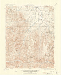
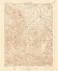
 1957 Berthoud Pass1959 Print · USGSThe high Divide during the late fifties captures a landscape of early ski culture and mountain engineering. Researchers can trace the Jones Pass Tunnel, locate the First Creek Ski Cabin, and explore the terrain around Berthoud Pass and the Urad Mine.7 unique versions available
 - 1957 Map of Fraser, 1960 Print
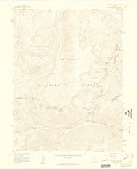
 1957 Fraser1960 Print · USGSGrand County high country comes alive in this late 1950s survey of the mountain corridor. Local historians can trace the Denver and Rio Grande Western rail line and locate landmarks like the Hideaway Park Cem and the early Ski Area at Berthoud Pass.4 unique versions available
 - 1958 Map of Denver
 1958 Denver1958 Print · USGSDenver and the Colorado Front Range are captured here during the mid-century suburban boom. Trace the footprints of military installations like Buckley Air Force Base alongside the established rail networks of the Colorado & Southern Ry.
 - 1960 Map of Denver
 1960 Denver1960 Print · USGSDenver and the Colorado Front Range are seen here at a pivotal moment of postwar expansion into the plains and foothills. Researchers can trace the mid-century rail network of the Denver & Rio Grande Western RR and locate historic institutional landmarks like Buckley Field and the Colorado School of Mines.
 - 1983 Map of Denver West
 1983 Denver West1983 Print · USGSThe Front Range and Denver's western suburbs meet in the early 1980s, documenting the era's growth from the mountain peaks to the valley floor. Genealogists and historians can trace the foundations of Lakewood and Golden, or locate high-altitude landmarks like the Moffat Tunnel and Mount Olivet Cem.2 unique versions available
 - 2011 Map of Berthoud Pass, 2011 Print
 2011 Berthoud Pass2011 Print · USGSCovers Berthoud Falls, including Winter Park, Grand County, and other nearby areas
 - 2013 Map of Berthoud Pass, 2013 Print
 2013 Berthoud Pass2013 Print · USGSCovers Berthoud Falls, including Winter Park, Grand County, and other nearby areas
 - 2016 Map of Berthoud Pass, 2016 Print
 2016 Berthoud Pass2016 Print · USGSCovers Berthoud Falls, including Winter Park, Grand County, and other nearby areas
 - 2019 Map of Berthoud Pass, 2019 Print
 2019 Berthoud Pass2019 Print · USGSCovers Berthoud Falls, including Winter Park, Grand County, and other nearby areas
 - 2022 Map of Berthoud Pass, 2022 Print
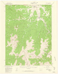
 2022 Berthoud Pass2022 Print · USGSHigh in the Colorado Rockies during the early 2020s, this area showcases a landscape defined by winter sports and vital water infrastructure. Trace the Continental Divide National Scenic Trl past landmarks like Berthoud Pass and the August P Gumlick Tunnel.
End of results
Showing maps 1-14 of 14
Top cities near Berthoud Falls
- Georgetown historical maps
- Dillon historical maps
- Fraser historical maps
- Tabernash historical maps
- Empire historical maps
- Silver Plume historical maps
See more
Frequently asked questions
- What are the different types of historical maps available for Berthoud Falls?
- What is the oldest map of Berthoud Falls?
- Where can I purchase historical maps of Berthoud Falls for my home or office?
- Where can I download high-res historical maps of Berthoud Falls?
- Are there historical topographic maps available for Berthoud Falls?
- Is there historical aerial imagery available for Berthoud Falls?
- Where are historical maps of Berthoud Falls sourced from?