1960s Maps of Conejos County, Colorado
Explore 41 historic maps of Conejos County from the 1960s. These maps offer a rare glimpse into what life looked like during the 1960s — showing old roads, neighborhoods, homes, and landmarks that have changed or disappeared over time.
Whether you're researching your family's past, planning a metal detecting trip, or studying how Conejos County's landscape evolved across the 1960s, these high-resolution maps are a powerful tool for exploring the history of this region.
- Focus on a specific era: All maps on this page are from the 1960s, giving you a focused view of this time period.
- See what’s changed: Compare century-old streets, trails, and buildings to today's modern landscape using overlays and satellite layers.
- Research with precision: Use these maps for genealogy, historical research, land use analysis, or educational projects.
- View, download, or print: Maps are fully viewable online in high resolution, and can be downloaded or printed for your own records.
Start exploring Conejos County's history through authentic maps from the 1960s. This is your window into the past.
Conejos County, CO maps
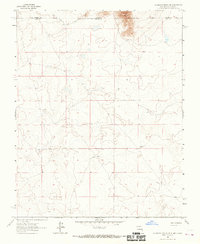
(41)- 1961 Map of Durango
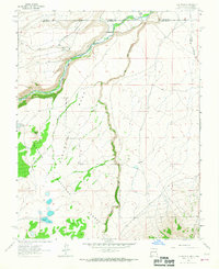
 1961 Durango1961 Print · USGSThe high San Juan country in the early sixties is shown here as a network of historic mining towns and early reservoir projects. Genealogists and researchers can trace the Denver & Rio Grande Western RR as it connects Durango, Silverton, and Arboles.
 - 1962 Map of Aztec
 1962 Aztec1962 Print · USGSNorthwestern New Mexico in the early sixties showcases a landscape defined by the arrival of the Navajo Reservoir and the high-altitude timber of the Carson National Forest. Trace the path of the Denver & Rio Grande Western RR or locate historic settlements like Tierra Amarilla and Gobernador.
 - 1963 Map of Durango
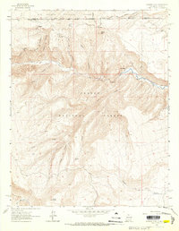
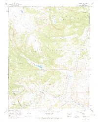
 1963 Durango1963 Print · USGSThe San Juan Mountains and San Luis Valley are captured here in the early 1950s as mining, rail, and tribal lands shaped the region. Researchers can trace the Denver & Rio Grande Western RR through high-country towns like Telluride and Silverton, or locate landmarks such as the Asiatic Mine.
 - 1963 Map of Los Pinos, 1967 Print
 1963 Los Pinos1967 Print · USGSThe high borderlands of New Mexico and Colorado are captured here in the early sixties as the railroad still wound through the mountain passes. Researchers can trace the narrow-gauge path of the Denver and Rio Grande Western near Lava and Los Pinos.2 unique versions available
 - 1963 Map of Bighorn Peak, 1967 Print
 1963 Bighorn Peak1967 Print · USGSThe high country of the New Mexico-Colorado borderlands comes alive in the early sixties, showing a landscape of remote mountain settlements and national forest boundaries. Researchers can trace the path of the Rio Grande and Western railroad through Sublette or locate the small Cem near San Miguel.2 unique versions available
 - 1963 Map of Pinabetoso Peaks, 1967 Print
 1963 Pinabetoso Peaks1967 Print · USGSThe high borderlands between New Mexico and Colorado are captured here in the early 1960s, showing a landscape defined by industrial history and rugged terrain. Local historians can trace the clear path of the Old Railroad Grade as it bypasses the Pinabetoso Peaks.2 unique versions available
 - 1963 Map of Ute Mountain, 1967 Print
 1963 Ute Mountain1967 Print · USGSThe volcanic heights of the Sangre De Cristo range meet the New Mexico-Colorado border in the early 1960s. Researchers can trace the dramatic Cañon Del Rio Grande, a remote Landing Strip, and the historic Grant Boundary.3 unique versions available
 - 1963 Map of La Segita Peaks NE, 1967 Print
 1963 La Segita Peaks NE1967 Print · USGSThe Colorado and New Mexico borderlands come into focus in this mid-century survey of the high desert. Researchers can trace early water management along the Valley Ditch and locate an isolated Well in the northern terrain.
 - 1965 Map of Aztec
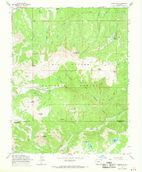
 1965 Aztec1965 Print · USGSNorthern New Mexico and southern Colorado come alive in the mid-sixties, from the San Juan Basin to the high Jemez Mountains. Trace the narrow-gauge Denver & Rio Grande Western RR through Monero or locate old outposts like Blanco Trading Post.
 - 1965 Map of Lasauses, 1968 Print
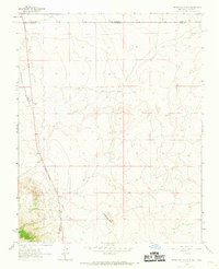
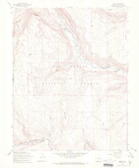
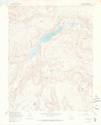
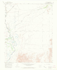 1965 Lasauses1968 Print · USGSThe San Luis Valley in the mid-1960s shows a landscape of high-altitude hydrology where the Rio Grande meets the Conejos River. Genealogists and historians can locate the Lasauses settlement, the Becker Cem, and several flowing wells along the Trinchera Creek.3 unique versions available
 - 1966 Map of Durango
 1966 Durango1966 Print · USGSSouthwestern Colorado and the New Mexico borderlands are shown here in the mid-1960s, a time when the narrow-gauge rail network still tied the high peaks to the valley floor. Researchers can trace the Denver & Rio Grande Western Railroad between settlements like Silverton, Antonito, and Pagosa Springs.2 unique versions available
 - 1966 Map of Elwood Pass, 1968 Print
 1966 Elwood Pass1968 Print · USGSHigh in the San Juan Mountains during the mid-sixties, this survey captures the intersection of four counties along the Continental Divide. Researchers can trace remote alpine routes like the Stock Driveway and locate the historic Black Diamond Mine or McCormick Cabin.4 unique versions available
 - 1966 Map of Summit Peak, 1968 Print
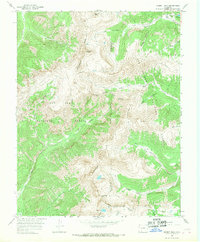 1966 Summit Peak1968 Print · USGSThe high alpine crest of the San Juan Mountains is captured in the mid-1960s, showing the intersection of major national forests along the Continental Divide. Outdoorsmen and researchers can trace historic backcountry routes like the Quartz Creek Trail or find remote landmarks such as Gunsight Pass and Horsethief Park.3 unique versions available
 - 1967 Map of Osier, 1969 Print
 1967 Osier1969 Print · USGSSouthern Colorado's high country is captured here during the mid-1960s, centered on the vital railway stop at Osier. Modern researchers can trace the narrow-gauge path of the Denver and Rio Grande Western past McIntyre Peak and the Menkhaven Ranch.3 unique versions available
 - 1967 Map of Spectacle Lake, 1969 Print
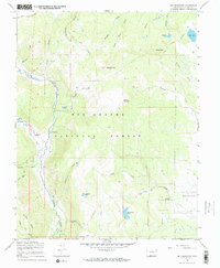
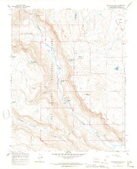 1967 Spectacle Lake1969 Print · USGSThe high backcountry of the Rio Grande National Forest is captured here in the late sixties, centered on the Conejos River corridor. Genealogists and historians can trace legacy sites like the Thomas Ranch or explore old pack routes such as the Conejos Stock Driveway.5 unique versions available
 - 1967 Map of La Jara Canyon, 1969 Print
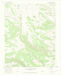 1967 La Jara Canyon1969 Print · USGSConejos County's high canyon country is documented here in the late sixties, showing a landscape of seasonal ranching and high-altitude water management. Researchers can trace historic livestock routes like the Stock Driveway (Pack) and locate remote outposts such as Braiden Cow Camp and Darley.4 unique versions available
 - 1967 Map of Jasper, 1969 Print
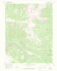 1967 Jasper1969 Print · USGSJasper and the surrounding high country are captured in the late sixties, showcasing a landscape defined by forestry and high-altitude water systems. Researchers can trace the remote Fitton Guard Station, the winding Alamosa River, and high-country landmarks like Blowout Pass and Cliff Lake.3 unique versions available
 - 1967 Map of Cumbres, 1969 Print
 1967 Cumbres1969 Print · USGSHigh in the San Juan Mountains during the late sixties, this survey captures the narrow-gauge operations of the Denver and Rio Grande Western Railroad. Trace the steep rail grade through Cumbres Pass and locate remote outposts like Los Pinos and the seasonal La Manga Cow Camp.4 unique versions available
 - 1967 Map of Summitville, 1969 Print
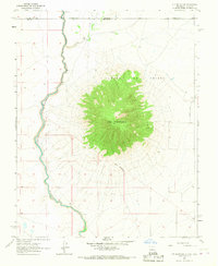
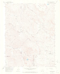
 1967 Summitville1969 Print · USGSThe high-altitude mining district of Rio Grande County comes into sharp focus in the late sixties. Researchers can trace the extensive network of the Chandler Tunnel, find the Stunner Cabin, and locate the historic Summitville townsite.4 unique versions available
 - 1967 Map of Platoro, 1969 Print
 1967 Platoro1969 Print · USGSThe high-country settlement of Platoro is captured here during the 1960s, surrounded by the rugged peaks and alpine lakes of the Rio Grande National Forest. Trace the legacy of mountain mining at the Mammoth Revenue Mine or locate historic backcountry routes like the Continental Divide Trail and Stunner Pass.3 unique versions available
 - 1967 Map of Red Mountain, 1969 Print
 1967 Red Mountain1969 Print · USGSThe high country of Conejos County was a landscape of remote ranching and seasonal grazing in the 1960s. Genealogists and historians can trace the network of the Stock Driveway and Jeep Trail leading to landmarks like Lake Fork Ranch and Valdez.3 unique versions available
 - 1967 Map of Centro, 1970 Print
 1967 Centro1970 Print · USGSConejos County at the end of the sixties shows a landscape defined by ranching and high-altitude water management. Genealogists and local historians can trace the De la Luz Cem, the settlement at Centro, and a network of irrigation works like the Viejo Ditch.2 unique versions available
 - 1967 Map of Terrace Reservoir, 1970 Print
 1967 Terrace Reservoir1970 Print · USGSConejos County rangelands and high-country water systems are documented here during the late sixties. Researchers can locate seasonal livestock hubs like Shawcroft Cow Camp, the Stock Driveway, and the shores of La Jara Reservoir.4 unique versions available
 - 1967 Map of Greenie Mountain, 1970 Print
 1967 Greenie Mountain1970 Print · USGSThe high country of Rio Grande County in the late sixties reveals a landscape of university retreats, remote ranches, and forest trails. Researchers can locate the Phillips University Camp, the secluded Lost Cabin Ranch, and the old Stock Driveway through the national forest.4 unique versions available
 - 1967 Map of Goshawk Dam, 1970 Print
 1967 Goshawk Dam1970 Print · USGSConejos County ranching and water management are front and center in the late sixties as irrigation ditches and small reservoirs define the high-country landscape. Researchers can trace the paths of the Romero Ditch and Mogote Ditch or locate family-named landmarks like The Poso and Goshawk Dam.
Showing maps 1-25 of 41
Top cities of Conejos County
- Manassa historical maps
- Sanford historical maps
- La Jara historical maps
- Antonito historical maps
- Romeo historical maps
Frequently asked questions
- What are the different types of historical maps available for Conejos County?
- What is the oldest map of Conejos County?
- Where can I purchase historical maps of Conejos County for my home or office?
- Where can I download high-res historical maps of Conejos County?
- Are there historical topographic maps available for Conejos County?
- Is there historical aerial imagery available for Conejos County?
- Where are historical maps of Conejos County sourced from?