Old Maps of Conejos County, Colorado for Genealogy
Trace your family roots with 281 historic maps of Conejos County. These high-res maps reveal old neighborhoods, homesites, landmarks, and streets — helping you uncover where your ancestors lived and how the area evolved over time.
- Explore historic neighborhoods: Identify where your relatives may have lived in the 1800s or 1900s.
- Compare maps over time: Trace the changes in streets, buildings, and landmarks for multi-generational research.
- Perfect for genealogy & ancestry research: Used by family historians and researchers to map out lineage and migration.
These maps are an incredible resource for exploring your personal connection to Conejos County's past.
Conejos County, CO maps
(281)- 1913 Map of Summitville, 1962 Print
 1913 Summitville1962 Print · USGSThe high San Juan Mountains at the turn of the century are captured here, from the gold-mining district at Summitville to the ranchlands of the Navajo River valley. Genealogists and historians can trace early school sites like Blanco School and working mines including the Asiatic Mine and Forest King Mine.
 - 1915 Map of Summitville
 1915 Summitville1915 Print · USGSSouthern Colorado mining and timber operations are captured here during the early twentieth century. Researchers can trace remote mining claims like the Asiatic Mine, mountain schools such as Blanco School, and the path of the Logging RR.4 unique versions available
 - 1918 Map of Tusas
 1918 Tusas1918 Print · USGSThe high country of Northern New Mexico and the Colorado border is captured here during the First World War. Researchers can trace the Denver and Rio Grande RR through remote stations like Toltec or locate early settlements in the Tierra Amarilla Grant.
 - 1922 Map of Conejos
 1922 Conejos1922 Print · USGSThe high San Juan peaks meet the irrigated Luis Valley in the early 1920s, showing a landscape defined by mountain ranching and rail. Trace the Denver and Rio Grande Railroad through the mountains or locate old local landmarks like Bowen Church, Antonito, and the Hot Creek School.4 unique versions available
 - 1945 Map of Durango
 1945 Durango1945 Print · USGSSouthwest Colorado and Northern New Mexico at mid-century are defined by the high peaks of the San Juan Range and the tribal lands of the Southern Ute. Genealogists and historians can trace the paths of the D & R G W RR and locate local landmarks like Animas City and the Blanco Basin School.3 unique versions available
 - 1953 Map of Durango, 1963 Print
 1953 Durango1963 Print · USGSThe high peaks of the San Juan Mountains and the Colorado mining country are shown here as they appeared in the early fifties. Genealogists and local historians can trace the rail lines of the D & R G W RR and locate historic mining camps like Silverton, Ouray, and Old Ophir.
 - 1954 Map of Durango
 1954 Durango1954 Print · USGSSouthern Colorado in the mid-1950s was defined by high-altitude mining towns and the expansion of water storage in the San Luis Valley. Trace the narrow-gauge Denver & Rio Grande Western RR as it connects Durango to mountain outposts like Silverton and Creede.2 unique versions available
 - 1954 Map of Raton, 1963 Print
 1954 Raton1963 Print · USGSNorthern New Mexico's high-country and plains are documented here in the early sixties, showing the region's ranching and mining infrastructure. Trace the legacy of the Maxwell Land Grant, locate remote rural sites like Tafoya School, and follow the Atchison Topeka and Santa Fe Railway through the heart of Raton.3 unique versions available
 - 1954 Map of Trinidad, 1963 Print
 1954 Trinidad1963 Print · USGSSouthern Colorado is captured here during the mid-fifties, showing the vital rail-and-river connections between the San Luis Valley and the eastern foothills. Researchers can trace the Denver and Rio Grande Western line and locate rural landmarks like Malachite School and San Luis.2 unique versions available
 - 1954 Map of Aztec, 1975 Print
 1954 Aztec1975 Print · USGSNorthern New Mexico and southern Colorado come alive in the mid-1950s, showing the high-country settlements and tribal lands of the San Juan Basin. Genealogists and historians can trace the path of the Denver & Rio Grande Western RR and locate communities like Abiquiu, Park View, and Lumberton.4 unique versions available
 - 1955 Map of Brazos Peak, 1957 Print
 1955 Brazos Peak1957 Print · USGSThe high New Mexico and Colorado borderlands are captured here during the mid-fifties, showing a remote landscape of rail and ranching. Genealogists and historians can trace the narrow-gauge Denver and Rio Grande Western railroad past Toltec Gorge and locate family-named sites like Nelagoney Ranch and Rivera Cow Camp.4 unique versions available
 - 1955 Map of Trinidad, 1976 Print
 1955 Trinidad1976 Print · USGSSouthern Colorado during the mid-fifties is defined by the high-altitude agriculture of the San Luis Valley and the peaks of the Culebra Range. Genealogists can trace early settlements and rural schoolhouses like Medina Plaza, San Luis, and the Trujillo Creek School.
 - 1957 Map of Chama Peak, 1959 Print
 1957 Chama Peak1959 Print · USGSArchuleta and Conejos counties are shown here in the late fifties, where the Continental Divide splits the high wilderness. Genealogists and researchers can trace the historic Tierra Amarilla Grant Boundary and remote sites like Gramps Oil Field and Banded Peak Ranch.4 unique versions available
 - 1958 Map of Raton
 1958 Raton1958 Print · USGSNorthern New Mexico and the Colorado borderlands are mapped here in the late fifties, showcasing a landscape of high peaks and historic land grants. Genealogists and historians can trace families across Picuris Pueblo, find old schoolhouses like Piedra Lumbre School, or follow the Atchison Topeka and Santa Fe rail line.3 unique versions available
 - 1958 Map of Trinidad
 1958 Trinidad1958 Print · USGSSouthern Colorado in the late fifties was a landscape of high-altitude agriculture and coal production, centered on the San Luis Valley. Local historians can trace old community centers like the Malachite School or follow the mining and rail activity near Walsenburg and the Allen Mine.
 - 1958 Map of Aztec
 1958 Aztec1958 Print · USGSNorthern New Mexico and the southern Colorado border are captured here during the mid-fifties, showing the rugged intersection of national forests and tribal lands. Researchers can trace the Denver and Rio Grande Western rail line and locate remote outposts like Blanco Trading Post or Sargent Ranch.
 - 1959 Map of Trinidad
 1959 Trinidad1959 Print · USGSThe San Luis Valley and the high Sangre de Cristo peaks are documented here in the late fifties, during a period of steady ranching and rail activity. Genealogy researchers can locate family-named landmarks and rural institutions like Trujillo Creek School and the historic San Luis settlement.
 - 1961 Map of Durango
 1961 Durango1961 Print · USGSThe high San Juan country in the early sixties is shown here as a network of historic mining towns and early reservoir projects. Genealogists and researchers can trace the Denver & Rio Grande Western RR as it connects Durango, Silverton, and Arboles.
 - 1962 Map of Aztec
 1962 Aztec1962 Print · USGSNorthwestern New Mexico in the early sixties showcases a landscape defined by the arrival of the Navajo Reservoir and the high-altitude timber of the Carson National Forest. Trace the path of the Denver & Rio Grande Western RR or locate historic settlements like Tierra Amarilla and Gobernador.
 - 1963 Map of Durango
 1963 Durango1963 Print · USGSThe San Juan Mountains and San Luis Valley are captured here in the early 1950s as mining, rail, and tribal lands shaped the region. Researchers can trace the Denver & Rio Grande Western RR through high-country towns like Telluride and Silverton, or locate landmarks such as the Asiatic Mine.
 - 1963 Map of Los Pinos, 1967 Print
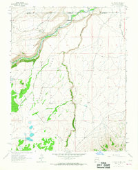 1963 Los Pinos1967 Print · USGSThe high borderlands of New Mexico and Colorado are captured here in the early sixties as the railroad still wound through the mountain passes. Researchers can trace the narrow-gauge path of the Denver and Rio Grande Western near Lava and Los Pinos.2 unique versions available
 - 1963 Map of Bighorn Peak, 1967 Print
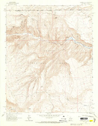 1963 Bighorn Peak1967 Print · USGSThe high country of the New Mexico-Colorado borderlands comes alive in the early sixties, showing a landscape of remote mountain settlements and national forest boundaries. Researchers can trace the path of the Rio Grande and Western railroad through Sublette or locate the small Cem near San Miguel.2 unique versions available
 - 1963 Map of Pinabetoso Peaks, 1967 Print
 1963 Pinabetoso Peaks1967 Print · USGSThe high borderlands between New Mexico and Colorado are captured here in the early 1960s, showing a landscape defined by industrial history and rugged terrain. Local historians can trace the clear path of the Old Railroad Grade as it bypasses the Pinabetoso Peaks.2 unique versions available
 - 1963 Map of Ute Mountain, 1967 Print
 1963 Ute Mountain1967 Print · USGSThe volcanic heights of the Sangre De Cristo range meet the New Mexico-Colorado border in the early 1960s. Researchers can trace the dramatic Cañon Del Rio Grande, a remote Landing Strip, and the historic Grant Boundary.3 unique versions available
 - 1963 Map of La Segita Peaks NE, 1967 Print
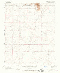 1963 La Segita Peaks NE1967 Print · USGSThe Colorado and New Mexico borderlands come into focus in this mid-century survey of the high desert. Researchers can trace early water management along the Valley Ditch and locate an isolated Well in the northern terrain.
Showing maps 1-25 of 281
Top cities of Conejos County
- Manassa historical maps
- Sanford historical maps
- La Jara historical maps
- Antonito historical maps
- Romeo historical maps
Frequently asked questions
- What are the different types of historical maps available for Conejos County?
- What is the oldest map of Conejos County?
- Where can I purchase historical maps of Conejos County for my home or office?
- Where can I download high-res historical maps of Conejos County?
- Are there historical topographic maps available for Conejos County?
- Is there historical aerial imagery available for Conejos County?
- Where are historical maps of Conejos County sourced from?