1990s Maps of Conejos County, Colorado
Explore 4 historic maps of Conejos County from the 1990s. These maps offer a rare glimpse into what life looked like during the 1990s — showing old roads, neighborhoods, homes, and landmarks that have changed or disappeared over time.
Whether you're researching your family's past, planning a metal detecting trip, or studying how Conejos County's landscape evolved across the 1990s, these high-resolution maps are a powerful tool for exploring the history of this region.
- Focus on a specific era: All maps on this page are from the 1990s, giving you a focused view of this time period.
- See what’s changed: Compare century-old streets, trails, and buildings to today's modern landscape using overlays and satellite layers.
- Research with precision: Use these maps for genealogy, historical research, land use analysis, or educational projects.
- View, download, or print: Maps are fully viewable online in high resolution, and can be downloaded or printed for your own records.
Start exploring Conejos County's history through authentic maps from the 1990s. This is your window into the past.
Conejos County, CO maps
(4)- 1995 Map of West Fork Rio Brazos, 1998 Print
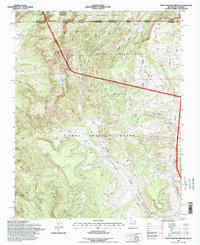 1995 West Fork Rio Brazos1998 Print · USGSThe high-altitude border of New Mexico and Colorado is shown here in the 1990s, where the historic railroad still winds through the mountains. Researchers can trace the path of the Cumbres and Toltec Scenic RR past Burn Cow Camp and through the Tierra Amarilla Grant.
 - 1995 Map of Bighorn Peak, 1998 Print
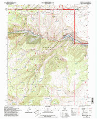 1995 Bighorn Peak1998 Print · USGSThe Colorado-New Mexico borderlands come alive in the mid-nineties, centering on the remote settlement of Sublette and the winding Rio de los Pinos. Local historians can trace high-country ranching and timber heritage through landmarks like Atencio Springs, the local Cem, and Bighorn Peak.
 - 1995 Map of Los Pinos, 1998 Print
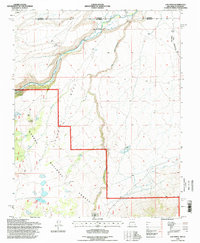 1995 Los Pinos1998 Print · USGSThe high desert borderlands between New Mexico and Colorado come alive in the 1990s, centered on the Rio San Antonio. Genealogists and rail fans can trace the Cumbres and Toltec Scenic Railroad through Lava and locate the Cisnero Mine No 1.
 - 1995 Map of Toltec Mesa, 1998 Print
 1995 Toltec Mesa1998 Print · USGSThe high backcountry of the New Mexico-Colorado border remains largely untouched in the 1990s, centered on the dramatic Toltec Gorge. Trace the historic path of the Cumbres & Toltec Scenic RR and find mountain landmarks like Upper Lagunitas and Brazos Ridge.
End of results
Showing maps 1-4 of 4
Top cities of Conejos County
- Manassa historical maps
- Sanford historical maps
- La Jara historical maps
- Antonito historical maps
- Romeo historical maps
Frequently asked questions
- What are the different types of historical maps available for Conejos County?
- What is the oldest map of Conejos County?
- Where can I purchase historical maps of Conejos County for my home or office?
- Where can I download high-res historical maps of Conejos County?
- Are there historical topographic maps available for Conejos County?
- Is there historical aerial imagery available for Conejos County?
- Where are historical maps of Conejos County sourced from?