1900s (20th Century) Maps of Colorado Springs, Colorado
Explore 59 historic maps of Colorado Springs from the 1900s (20th Century). These maps offer a rare glimpse into what life looked like during the 1900s — showing old roads, neighborhoods, homes, and landmarks that have changed or disappeared over time.
Whether you're researching your family's past, planning a metal detecting trip, or studying how Colorado Springs's landscape evolved across the 1900s, these high-resolution maps are a powerful tool for exploring the history of this region.
- Focus on a specific era: All maps on this page are from the 1900s, giving you a focused view of this time period.
- See what’s changed: Compare century-old streets, trails, and buildings to today's modern landscape using overlays and satellite layers.
- Research with precision: Use these maps for genealogy, historical research, land use analysis, or educational projects.
- View, download, or print: Maps are fully viewable online in high resolution, and can be downloaded or printed for your own records.
Start exploring Colorado Springs's history through authentic maps from the 1900s. This is your window into the past.
Colorado Springs, CO maps
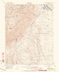
(59)- 1909 Map of Colorado Springs
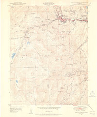
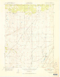
 1909 Colorado Springs1909 Print · USGSColorado Springs and the Front Range foothills are shown here at a pivotal era of rail expansion and early tourism. Genealogists and historians can trace defunct rail lines, rural schoolhouse locations like Grandview School, and landmarks such as the Cliff Dwellings and Burial Rocks.5 unique versions available
 - 1913 Map of Castle Rock
 1913 Castle Rock1913 Print · USGSThe Colorado front range at the start of the twentieth century was a landscape of high-plains ranching and vital rail junctions. Genealogists can locate family homesteads near dozens of early schools like Rock Ridge School and churches such as Bethel Church.5 unique versions available
 - 1942 Map of Colorado Springs
 1942 Colorado Springs1942 Print · USGSColorado Springs and the Front Range appear here in the early years of the Second World War. Genealogists and historians can trace the rail corridors of the Chicago Rock Island and Pacific RR and locate sites like the Printers Home and Glen Eyrie.
 - 1948 Map of Falcon, 1952 Print
 1948 Falcon1952 Print · USGSEl Paso County ranching culture is at its peak in the late 1940s, showing a landscape defined by cattle operations and the railway. Genealogists and historians can locate specific family homesteads like Old Orr Ranch and Blaney Ranch or trace the Chicago Rock Island and Pacific and Southern Colorado Railroad through Falcon.2 unique versions available
 - 1948 Map of Manitou Springs, 1956 Print
 1948 Manitou Springs1956 Print · USGSManitou Springs and the surrounding mountain canyons are captured here just after the war, revealing a landscape defined by tourism and rail engineering. Trace the route of the Manitou and Pikes Peak Cog RR, locate the Halen Hunt Jackson Cemetery, or find old outposts like Minnehaha and Artists Glen.2 unique versions available
 - 1948 Map of Colorado Springs, 1957 Print
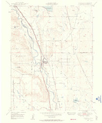
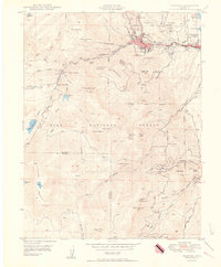
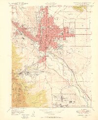
 1948 Colorado Springs1957 Print · USGSColorado Springs and the Front Range foothills are captured here in the late Forties, just as post-war growth began to accelerate. Genealogists and historians can trace institutional landmarks like the Modern Woodmen of America Sanatorium and the Myron Stratton Home alongside the early bounds of Camp Carson.
 - 1948 Map of Pikeview, 1957 Print
 1948 Pikeview1957 Print · USGSEl Paso County at the end of the 1940s shows a landscape of sanitariums, ranches, and dual rail lines. Genealogists can trace family footprints at Reverse J Diamond Ranch, the Woodmen School, and the settlement of Papeton.
 - 1948 Map of Cascade, 1958 Print
 1948 Cascade1958 Print · USGSEl Paso County mountain communities and the eastern foothills of the Rampart Range are captured here in the late 1940s. Genealogists and historians can trace the foundations of Cascade, Chipita Park, and Woodmen, or locate the historic Toll Gate along Ute Pass.2 unique versions available
 - 1948 Map of Fountain, 1958 Print
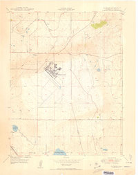
 1948 Fountain1958 Print · USGSThe high plains of El Paso County are captured here just after the war, showing the expansion of military lands and rail lines. You can trace the railroad corridors through Fountain and locate local landmarks like Fairview Cemetery and Widefield School.
 - 1948 Map of Colorado Springs, 1958 Print
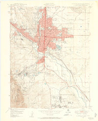 1948 Colorado Springs1958 Print · USGSColorado Springs is shown here in the late 1940s, as its urban footprint expanded toward the foothills. Researchers can trace historic landmarks like the Union Printers Home, the Will Rogers Shrine of the Sun, and the grounds of Colorado College.2 unique versions available
 - 1948 Map of Cheyenne Mountain, 1959 Print
 1948 Cheyenne Mountain1959 Print · USGSEl Paso County at the end of the 1940s shows the post-war growth of Camp Carson alongside traditional ranching and academic retreats. You can trace the Military Reservation Boundary and locate the Iowa State College Camp or Hitch Rack Ranch.
 - 1948 Map of Falcon, 1960 Print
 1948 Falcon1960 Print · USGSEl Paso County ranching and early aviation come to life in the late 1940s as the high plains expand east of the mountains. Genealogists and researchers can locate family-named landmarks like Banning Lewis Ranch, trace the rail corridor of the Chicago Rock Island and Pacific, and see the early layout of Peterson Field.
 - 1948 Map of Falcon NW, 1960 Print
 1948 Falcon NW1960 Print · USGSEl Paso County ranching and rail infrastructure are captured here in the late 1940s as the high plains meet the timberline. Genealogists and historians can trace family holdings like Wolf Ranch or follow the Chicago Rock Island and Pacific rail line.
 - 1948 Map of Mount Big Chief, 1964 Print
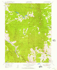
 1948 Mount Big Chief1964 Print · USGSThe foothills and high peaks of the Front Range come alive in this post-war study of the area south of Colorado Springs. Genealogists and historians can trace the foundations of Camp Carson, search for family-named holdings like Avery Ranch, or locate vanished mountain schools such as Lytle School.2 unique versions available
 - 1949 Map of Pikeview
 1949 Pikeview1949 Print · USGSEl Paso County at the close of the 1940s reveals a unique landscape of specialized sanitariums and early aviation fields along the rail corridors. Genealogists and researchers can trace the historic Modern Woodmen of America Sanatorium or locate rail stops at Woodmen Station and Pikeview Station.2 unique versions available
 - 1949 Map of Corral Bluffs
 1949 Corral Bluffs1949 Print · USGSEl Paso County's high plains are documented in the late 1940s, showing an expansive ranching landscape defined by the prominent Corral Bluffs. Genealogists can trace family-named homesteads such as Bledsoe Ranch, Slocum Ranch, and Dentan Ranch along the early alignments of Drennan Road.
 - 1949 Map of Cheyenne Mountain
 1949 Cheyenne Mountain1949 Print · USGSEl Paso County at the close of the 1940s reveals the strategic footprint of the Camp Carson complex against the foothills. Researchers can trace the layout of the Military Reservation, find collegiate outposts like the Iowa State College Camp, and locate private landmarks such as J L Ranch.2 unique versions available
 - 1950 Map of Manitou
 1950 Manitou1950 Print · USGSThe foothills of the Rampart Range come alive in this mid-century survey of the mountain rail systems and canyon retreats west of Colorado Springs. Researchers can trace the steep Inclined Railway, locate the Helen Hunt Jackson Cemetery, and find vanished stops like Minnehaha along the cog railway.2 unique versions available
 - 1950 Map of Cascade
 1950 Cascade1950 Print · USGSThe Rampart Range foothills during the mid-twentieth century show a landscape of mountain health retreats and early tourism. Genealogists can trace families near Chipita Park, Glen Eyrie, and the Holy Rosary Chapel.2 unique versions available
 - 1950 Map of Elsmere
 1950 Elsmere1950 Print · USGSEl Paso County at the dawn of the 1950s shows an area transitioning through military aviation and ranching. Trace the early layout of Peterson Field or find local landmarks like Pikes Peak Speedway and the settlement of Elsmere.2 unique versions available
 - 1950 Map of Fountain
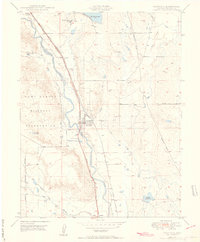 1950 Fountain1950 Print · USGSEl Paso County at the dawn of the fifties shows a landscape of strategic rail lines and expanding irrigation. Genealogy researchers can trace family landmarks like Fairview Cemetery and the original sites of Widefield School and Fountain Valley School.2 unique versions available
 - 1950 Map of Fountain NE
 1950 Fountain NE1950 Print · USGSEl Paso County ranch lands are captured here in the late 1940s, showing a landscape shaped by water and wide-open range. Researchers can trace early family holdings like Slate Ranch and Kane Ranch or locate historical water infrastructure like the Bailey Windmill.
 - 1950 Map of Falcon NW
 1950 Falcon NW1950 Print · USGSEl Paso County ranching culture is frozen in time here during the post-war era, showing a landscape defined by large family estates and high-plains drainages. Genealogists can locate named landmarks like Wolf Ranch and Banning Lewis Ranch or trace the early course of the Chicago Rock Island and Pacific railroad.2 unique versions available
 - 1950 Map of Colorado Springs
 1950 Colorado Springs1950 Print · USGSColorado Springs and its surrounding foothills are captured just after the war, showing a city defined by both its mountain tourism and military growth. Genealogists and historians can locate Broadmoor, the Union Printers Home, and the sprawling Camp Carson Military Reservation.2 unique versions available
 - 1951 Map of Falcon
 1951 Falcon1951 Print · USGSEastern El Paso County is shown as a thriving ranching and aviation hub in the early fifties. Genealogists and historians can trace numerous family-named landmarks like Banning Lewis Ranch and Wolf Ranch or locate early airfield layouts at Peterson Field.2 unique versions available
Showing maps 1-25 of 59
Top cities near Colorado Springs
- Fountain historical maps
- Manitou Springs historical maps
- Monument historical maps
- Palmer Lake historical maps
Top neighborhoods of Colorado Springs
- Stratton Meadows historical maps
- Broadmoor historical maps
- Kelker historical maps
- Knob Hill historical maps
- Pikeview historical maps
- Roswell historical maps
See more
Frequently asked questions
- What are the different types of historical maps available for Colorado Springs?
- What is the oldest map of Colorado Springs?
- Where can I purchase historical maps of Colorado Springs for my home or office?
- Where can I download high-res historical maps of Colorado Springs?
- Are there historical topographic maps available for Colorado Springs?
- Is there historical aerial imagery available for Colorado Springs?
- Where are historical maps of Colorado Springs sourced from?