1990s Maps of Huerfano County, Colorado
Explore 14 historic maps of Huerfano County from the 1990s. These maps offer a rare glimpse into what life looked like during the 1990s — showing old roads, neighborhoods, homes, and landmarks that have changed or disappeared over time.
Whether you're researching your family's past, planning a metal detecting trip, or studying how Huerfano County's landscape evolved across the 1990s, these high-resolution maps are a powerful tool for exploring the history of this region.
- Focus on a specific era: All maps on this page are from the 1990s, giving you a focused view of this time period.
- See what’s changed: Compare century-old streets, trails, and buildings to today's modern landscape using overlays and satellite layers.
- Research with precision: Use these maps for genealogy, historical research, land use analysis, or educational projects.
- View, download, or print: Maps are fully viewable online in high resolution, and can be downloaded or printed for your own records.
Start exploring Huerfano County's history through authentic maps from the 1990s. This is your window into the past.
Huerfano County, CO maps
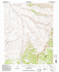
(14)- 1994 Map of Trinchera Peak, 1998 Print
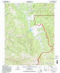
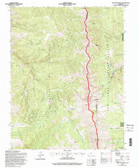 1994 Trinchera Peak1998 Print · USGSThe Sangre De Cristo Range stands as a massive barrier in the 1990s, where high-altitude peaks meet the edge of the Cuchara Valley. Genealogists and hikers can trace the Indian Creek Trail, locate remote Mine sites, and explore the geography of the Cuchara Valley Ski Area.
 - 1994 Map of Creager Reservoir, 1998 Print
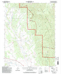
 1994 Creager Reservoir1998 Print · USGSHuerfano County ranching and forest lands come alive in this mid-nineties survey of the Colorado front range. Researchers can trace historic water rights and small settlements like Malachite or locate upland landmarks including Creager Reservoir and Black Mountain.
 - 1994 Map of Hayden Butte, 1998 Print
 1994 Hayden Butte1998 Print · USGSHuerfano County was a rugged crossroads of national forest and historic land grants in the 1990s. Genealogists and hikers can trace the Bartlett Trail past Apache Falls or locate resource sites like the Prospect and Gravel Pit.
 - 1994 Map of Deer Peak, 1998 Print
 1994 Deer Peak1998 Print · USGSCuster and Huerfano counties are shown here in the 1990s, dominated by the high-elevation peaks and canyons of the San Isabel National Forest. Researchers can trace old mining activities near Ophir Gulch or find the location of the Abbey Summer Camp and Lapin.
 - 1994 Map of San Isabel, 1998 Print
 1994 San Isabel1998 Print · USGSThe high Sangre de Cristo foothills and the San Isabel National Forest appear here in the mid-1990s. Researchers can trace the drainage of Greenhorn Creek, locate Rooster Spring, or find early recreational sites like Lazy Acres Camp and Lake Isabel.
 - 1994 Map of Rye, 1998 Print
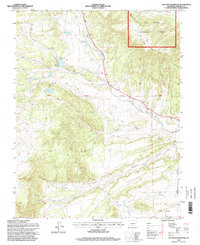
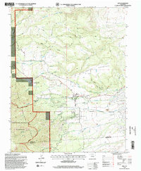 1994 Rye1998 Print · USGSRye and Colorado City are shown at the end of the twentieth century as the high plains transition into the Rockies. Genealogists and historians can trace local landmarks like Brookside Cem, the Fish Hatchery, and the Old San Isabel Road.2 unique versions available
 - 1994 Map of Badito Cone, 1998 Print
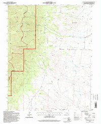
 1994 Badito Cone1998 Print · USGSSouthern Colorado's high-country drainages and early irrigation systems are preserved here as they appeared in the 1990s. Genealogists and hikers can trace family-named sites like Cisneros Cem and Maes Creek Cem or follow the Bartlett Trail toward Badito Cone.
 - 1994 Map of Mc Carty Park, 1998 Print
 1994 Mc Carty Park1998 Print · USGSThe high peaks of the Sangre de Cristo Range and the sprawling San Isabel National Forest define this mid-nineties topography. Researchers can trace remote ranching outposts like McCarty Cow Camp and the winding paths through Veta Pass and American Canyon.
 - 1994 Map of Devils Gulch, 1998 Print
 1994 Devils Gulch1998 Print · USGSCuster and Huerfano counties meet along the high ridges of the Wet Mountain Valley in the mid-1990s. Researchers can trace historic ranching infrastructure and local landmarks like the Akin Ranch, the Bradford (Site), and several named windmills including Cordrey Windmill.
 - 1994 Map of Bear Creek, 1998 Print
 1994 Bear Creek1998 Print · USGSThe high ridges of the Sangre de Cristo foothills come alive in this late twentieth-century survey of the Custer and Huerfano county line. Researchers can trace historic mineral exploration at various Prospects and follow the remote Horse Ranch Trail through Devils Hole.2 unique versions available
 - 1994 Map of Cucharas Pass, 2001 Print
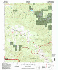
 1994 Cucharas Pass2001 Print · USGSHigh mountain passes and national forest boundaries define this portion of the Sangre de Cristo range in the mid-1990s. Researchers can trace alpine trails and drainage systems around Cuchara, including the Cuchara Valley Ski Area, Cordova Pass, and the Peaks Trail.
 - 1994 Map of Cuchara, 2001 Print
 1994 Cuchara2001 Print · USGSHuerfano County during the mid-nineties shows the transition from mountain ranching to high-country recreation. Map enthusiasts can locate the Linscott Mine, trace the Cucharas River past Three Bridges, and find landmarks like Devils Stairsteps and Goemmer Butte.
 - 1994 Map of Spanish Peaks, 2001 Print
 1994 Spanish Peaks2001 Print · USGSThe peaks and high canyons of the San Isabel National Forest define this landscape in the mid-1990s. Researchers can locate remote landmarks like the Wahatoya School, the Bullseye Mine, and the impressive Big Wall formation.
 - 1994 Map of Herlick Canyon, 2001 Print
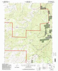
 1994 Herlick Canyon2001 Print · USGSSouthern Colorado in the mid-1990s reveals a landscape of high-altitude drainages and canyons within the national forest. Researchers can trace local lineage at Prince Cemetery and Hicks Cemetery or find the remote Aspen Grove Sch.
End of results
Showing maps 1-14 of 14
Top cities of Huerfano County
Frequently asked questions
- What are the different types of historical maps available for Huerfano County?
- What is the oldest map of Huerfano County?
- Where can I purchase historical maps of Huerfano County for my home or office?
- Where can I download high-res historical maps of Huerfano County?
- Are there historical topographic maps available for Huerfano County?
- Is there historical aerial imagery available for Huerfano County?
- Where are historical maps of Huerfano County sourced from?