1970s Maps of Huerfano County, Colorado
Explore 14 historic maps of Huerfano County from the 1970s. These maps offer a rare glimpse into what life looked like during the 1970s — showing old roads, neighborhoods, homes, and landmarks that have changed or disappeared over time.
Whether you're researching your family's past, planning a metal detecting trip, or studying how Huerfano County's landscape evolved across the 1970s, these high-resolution maps are a powerful tool for exploring the history of this region.
- Focus on a specific era: All maps on this page are from the 1970s, giving you a focused view of this time period.
- See what’s changed: Compare century-old streets, trails, and buildings to today's modern landscape using overlays and satellite layers.
- Research with precision: Use these maps for genealogy, historical research, land use analysis, or educational projects.
- View, download, or print: Maps are fully viewable online in high resolution, and can be downloaded or printed for your own records.
Start exploring Huerfano County's history through authentic maps from the 1970s. This is your window into the past.
Huerfano County, CO maps
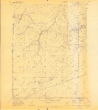
(14)- 1970 Map of Graneros Flats, 1973 Print
 1970 Graneros Flats1973 Print · USGSThe Colorado high plains near the Huerfano and Pueblo county line come into focus during the early 1970s. Trace rural life and rail history through the locations of the Graneros Sch, the Evergreen Cem, and the winding Denver and Rio Grande Western Railroad.2 unique versions available
 - 1970 Map of Capps Springs, 1973 Print
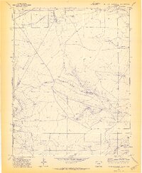
 1970 Capps Springs1973 Print · USGSSoutheastern Colorado ranching country is mapped here during the early seventies, where the Cucharas River winds between Pueblo and Huerfano counties. Genealogists and researchers can locate family-named landmarks like Kenner Ranch, Jake Vigil Spring, and Starbuck Lakes.2 unique versions available
 - 1970 Map of Cucharas Reservoir, 1974 Print
 1970 Cucharas Reservoir1974 Print · USGSSouthern Colorado ranching country is documented here in the early 1970s, focused on the critical water resource of the Cucharas Reservoir. Genealogists and historians can trace family-named land features like Bustos Flat, Maes Spring, and the high reaches of Cordova Mesa.3 unique versions available
 - 1970 Map of Pryor SE, 1974 Print
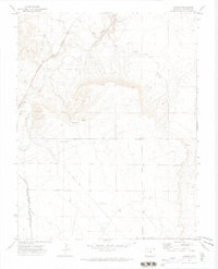
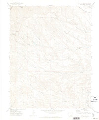
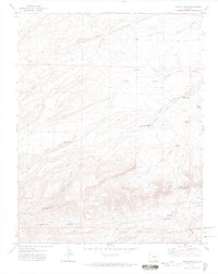
 1970 Pryor SE1974 Print · USGSThe Colorado high plains near the county line are documented here in 1970, showing a landscape defined by ranching and old transit routes. Researchers can trace the Old Railroad Grade and locate the Williams Ranch near the ridge of The Hogback.
 - 1970 Map of Cedarwood, 1974 Print
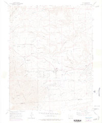
 1970 Cedarwood1974 Print · USGSThe Pueblo County rangelands come alive in the early 1970s as a hub for dual rail lines and vital water resources. Local researchers can trace the routes of the Colorado and Southern railroad or locate remote landmarks like Poleline Camp and Claypit.
 - 1970 Map of Lascar, 1974 Print
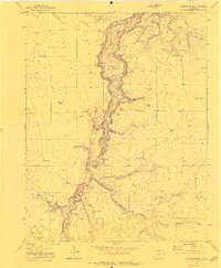
 1970 Lascar1974 Print · USGSHuerfano County's rail and ranching corridors are captured here in the 1970s, as the river valley served as a vital artery for the DENVER AND RIO GRANDE WESTERN RAILROAD. Trace the legacy of early transit via the OLD RAILROAD GRADE or locate the Turkey Ridge Sch and the settlement of Lascar.
 - 1970 Map of Myers Canyon, 1974 Print
 1970 Myers Canyon1974 Print · USGSSoutheast Colorado ranching country is captured here in the early seventies, detailing the intersection of Pueblo, Las Animas, and Huerfano counties. Genealogists and historians can locate family holdings like Spurlock Ranch and trace water sources like Big Flannery Res and Cactus Flat Windmill.
 - 1971 Map of South Rattlesnake Butte, 1973 Print
 1971 South Rattlesnake Butte1973 Print · USGSRanching life on the Colorado border is captured here in the early seventies, showing a land of windmills and deep canyons. Trace the remote rural infrastructure of the era, from the South Butte School to Big Dripping Spring and Baker Reservoir.3 unique versions available
 - 1971 Map of North Rattlesnake Butte, 1973 Print
 1971 North Rattlesnake Butte1973 Print · USGSHuerfano and Pueblo counties are documented here in the early 1970s as a landscape of remote ranching and essential water rights. Researchers can find old cattle country landmarks like North Butte Sch, Machatten Wells, and Hans Reservoir.2 unique versions available
 - 1971 Map of Herlick Canyon, 1974 Print
 1971 Herlick Canyon1974 Print · USGSSouthern Colorado high country in the early seventies shows a landscape of deep canyons and national forest land. Genealogists and local historians can locate remote landmarks like the Aspen Grove Sch, Scott Cem, and the high-elevation Apishapa Picnic Area.
 - 1971 Map of Spanish Peaks, 1974 Print
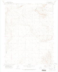
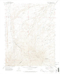 1971 Spanish Peaks1974 Print · USGSHigh-altitude Huerfano County was largely shaped by forest boundaries and early mountain camps in the 1970s. Researchers can locate the Wahatoya Sch, the Bulls Eye Mine, and distinct landmarks like Lovers Leap and Big Wall.4 unique versions available
 - 1971 Map of Aguilar, 1974 Print
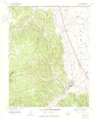 1971 Aguilar1974 Print · USGSSouthern Colorado coal country comes into focus in the early 1970s as industrial rail lines and mountain settlements define the landscape. Trace the history of the Black Hawk Mine and Rouse, or locate family sites near St Anthony Cem and Aguilar.4 unique versions available
 - 1972 Map of Santa Clara, 1974 Print
 1972 Santa Clara1974 Print · USGSSouthern Colorado ranching and remote settlement are captured in the 1970s along the boundary of Huerfano and Las Animas counties. Genealogists and historians can locate the Thomas Roger Cem, Ortiz Sch, and spring sites like Arnold Spring.4 unique versions available
 - 1975 Map of Rye, 1977 Print
 1975 Rye1977 Print · USGSThe foothills of the Sangre de Cristo Mountains come into focus in the mid-seventies, showing the growth of Rye and Colorado City. You can trace the Standard Ditch, find the Brookside Cem, and locate the Fish Hatchery near Greenhorn Creek.
End of results
Showing maps 1-14 of 14
Top cities of Huerfano County
Frequently asked questions
- What are the different types of historical maps available for Huerfano County?
- What is the oldest map of Huerfano County?
- Where can I purchase historical maps of Huerfano County for my home or office?
- Where can I download high-res historical maps of Huerfano County?
- Are there historical topographic maps available for Huerfano County?
- Is there historical aerial imagery available for Huerfano County?
- Where are historical maps of Huerfano County sourced from?