Old Maps of South Platte, Colorado for Metal Detecting
Plan your next treasure hunt with 15 historic maps of South Platte. Find old homesites, ghost towns, trails, and gathering spots that may be lost to time — perfect for identifying promising metal detecting locations.
- Locate forgotten sites: Uncover places like long-lost settlements, abandoned rail lines, or gathering spots.
- Plan better hunts: Use map overlays combined with LiDAR or satellite views to narrow in on historically rich areas.
- Made for detectorists: Thousands of hobbyists use these maps to discover relics, coins, and hidden history.
Use these historic maps to boost your research and find new opportunities beneath the surface of South Platte.
South Platte, CO maps
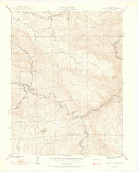
(15)- 1893 Map of Platte Canyon
 1893 Platte Canyon1893 Print · USGSThe Front Range highlands come to life in the 1890s as the narrow-gauge Denver South Park and Pacific RR snakes through the mountains. Trace early mountain settlements like Pine Grove and Estabrook along the steep turns of South Platte Canyon.8 unique versions available
 - 1945 Map of Platte Canyon, 1955 Print
 1945 Platte Canyon1955 Print · USGSJefferson and Douglas counties appear here during the mid-1940s, centered on the strategic water gaps of the Front Range. Researchers can trace rural school locations like Lamb Sch and explore small settlements such as Foxton and Longview.2 unique versions available
 - 1948 Map of Platte Canyon
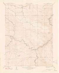 1948 Platte Canyon1948 Print · USGSThe South Platte canyon region in the late 1940s reveals a network of mountain settlements and water infrastructure. Genealogists can locate family sites near South Platte, Foxton, and the Lamb Sch, or trace the winding course of the South Platte River.2 unique versions available
 - 1953 Map of Denver, 1964 Print
 1953 Denver1964 Print · USGSDenver and the Colorado Front Range are captured here during a decade of post-war growth and military expansion. Researchers can trace the sprawling rail lines of the Union Pacific, locate the State Capitol, and explore historic mountain mining hubs like Central City.6 unique versions available
 - 1957 Map of Denver
 1957 Denver1957 Print · USGSDenver and the Colorado Front Range are seen here during a mid-century period of intense military and urban expansion. Trace the footprints of the Rocky Mountain Arsenal, the early United States Air Force Academy, and the Lowry AF Base.
 - 1958 Map of Denver
 1958 Denver1958 Print · USGSDenver and the Colorado Front Range are captured here during the mid-century suburban boom. Trace the footprints of military installations like Buckley Air Force Base alongside the established rail networks of the Colorado & Southern Ry.
 - 1960 Map of Denver
 1960 Denver1960 Print · USGSDenver and the Colorado Front Range are seen here at a pivotal moment of postwar expansion into the plains and foothills. Researchers can trace the mid-century rail network of the Denver & Rio Grande Western RR and locate historic institutional landmarks like Buckley Field and the Colorado School of Mines.
 - 1965 Map of Platte Canyon, 1967 Print
 1965 Platte Canyon1967 Print · USGSJefferson and Douglas Counties come together at the river confluence in the mid-1960s, showing a landscape of granite peaks and mountain hamlets. Trace the early layout of South Platte, Foxton, and Critchell, alongside landmarks like Dome Rock and the Little Patsy Quarry.3 unique versions available
 - 1983 Map of Bailey
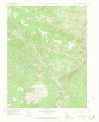
 1983 Bailey1983 Print · USGSPark County and the high Front Range are captured here during the early 1980s as traditional mountain settlements met new development patterns. Genealogists and researchers can trace the Denver and Rio Grande Western Railroad and old mountain hamlets like Bailey, Webster, and Garo.2 unique versions available
 - 1994 Map of Platte Canyon, 1998 Print
 1994 Platte Canyon1998 Print · USGSThe Jefferson County highlands and the confluence of the Platte rivers are captured here in the mid-1990s. Genealogists and hikers can locate the old community of Foxton, trace the Colorado Trail, and find landmarks like Reynolds Ranch.
 - 2011 Map of Platte Canyon, 2011 Print
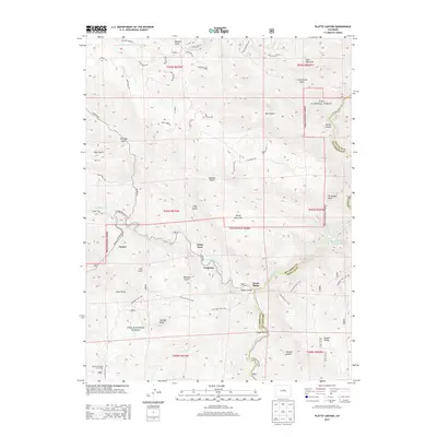
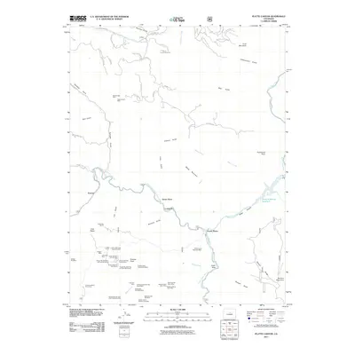 2011 Platte Canyon2011 Print · USGSCovers South Platte, including Longview, Dome Rock, and other nearby areas
 - 2013 Map of Platte Canyon, 2013 Print
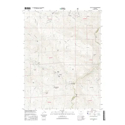
 2013 Platte Canyon2013 Print · USGSCovers South Platte, including Longview, Dome Rock, and other nearby areas
 - 2016 Map of Platte Canyon, 2016 Print
 2016 Platte Canyon2016 Print · USGSCovers South Platte, including Longview, Dome Rock, and other nearby areas
 - 2019 Map of Platte Canyon, 2019 Print
 2019 Platte Canyon2019 Print · USGSCovers South Platte, including Longview, Dome Rock, and other nearby areas
 - 2022 Map of Platte Canyon, 2022 Print
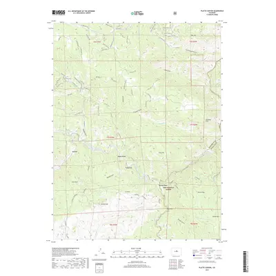
 2022 Platte Canyon2022 Print · USGSThe confluence of the North Fork and main stem of the South Platte River highlights this Jefferson County landscape in 2022. Trace mountain settlements and geologic landmarks from Foxton and South Platte to the massive formations of Dome Rock and Chair Rocks.
End of results
Showing maps 1-15 of 15
Top cities near South Platte
- Lakewood historical maps
- Highlands Ranch historical maps
- Centennial historical maps
- Littleton historical maps
- Englewood historical maps
- Greenwood Village historical maps
See more
Frequently asked questions
- What are the different types of historical maps available for South Platte?
- What is the oldest map of South Platte?
- Where can I purchase historical maps of South Platte for my home or office?
- Where can I download high-res historical maps of South Platte?
- Are there historical topographic maps available for South Platte?
- Is there historical aerial imagery available for South Platte?
- Where are historical maps of South Platte sourced from?