1970s Maps of Kit Carson County, Colorado
Explore 28 historic maps of Kit Carson County from the 1970s. These maps offer a rare glimpse into what life looked like during the 1970s — showing old roads, neighborhoods, homes, and landmarks that have changed or disappeared over time.
Whether you're researching your family's past, planning a metal detecting trip, or studying how Kit Carson County's landscape evolved across the 1970s, these high-resolution maps are a powerful tool for exploring the history of this region.
- Focus on a specific era: All maps on this page are from the 1970s, giving you a focused view of this time period.
- See what’s changed: Compare century-old streets, trails, and buildings to today's modern landscape using overlays and satellite layers.
- Research with precision: Use these maps for genealogy, historical research, land use analysis, or educational projects.
- View, download, or print: Maps are fully viewable online in high resolution, and can be downloaded or printed for your own records.
Start exploring Kit Carson County's history through authentic maps from the 1970s. This is your window into the past.
Kit Carson County, CO maps
(28)- 1970 Map of South of Burlington, 1995 Print
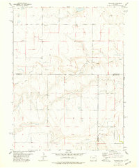
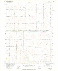
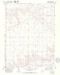
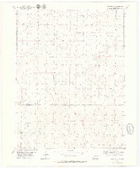
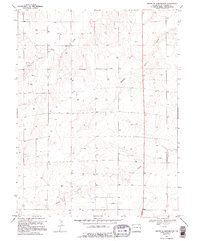 1970 South of Burlington1995 Print · USGSKit Carson County's high plains are captured here in the early seventies, showing a landscape defined by ranching and water management. Genealogists and historians can trace the specific placement of numerous Well sites and resource locations like the western Gravel Pits.
 - 1970 Map of South of Bethune, 1995 Print
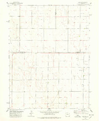
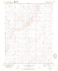
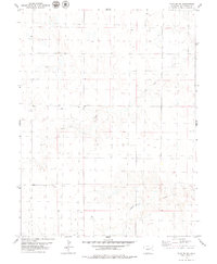
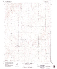 1970 South of Bethune1995 Print · USGSThe Colorado high plains near the Kansas border appear here in the late sixties, showing a landscape of remote ranching and essential water infrastructure. Genealogists and local historians can locate Beloit Cem, the small community of Raines, and numerous water Wells along Sand Creek.
 - 1971 Map of Bonny Reservoir South, 1973 Print
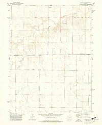
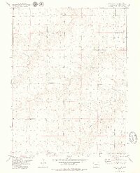
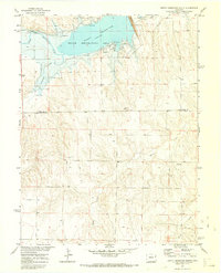 1971 Bonny Reservoir South1973 Print · USGSThe eastern Colorado plains meet the waters of the Republican River in the early seventies, just as the regional reservoir system was fully established. Researchers can trace the shoreline of Bonny Reservoir, locate the small settlement of Knapp, and identify early leisure sites like the Campground.3 unique versions available
 - 1971 Map of Bonny Reservoir SE, 1973 Print
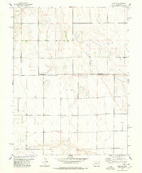
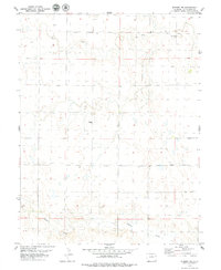
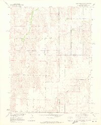 1971 Bonny Reservoir SE1973 Print · USGSThe Colorado-Kansas borderlands are captured here in the early seventies, showing a remote landscape of high plains ranching and intricate drainage systems. Genealogists and land historians can trace property boundaries and water rights along Beaver Creek, Battle Creek, and Jaqua Creek.2 unique versions available
 - 1977 Map of Thurman, 1978 Print
 1977 Thurman1978 Print · USGSEastern Colorado's High Plains in the 1970s reveal a landscape of remote farmsteads and river drainages. Genealogists can locate Thurman Cem and the settlement of Thurman near the winding North Fork Arikaree River.
 - 1977 Map of Cope SE, 1978 Print
 1977 Cope SE1978 Print · USGSThe eastern Colorado plains at the tri-county junction of Washington Co, Yuma Co, and Kit Carson Co show a landscape of high-plains agriculture. Researchers can locate the rural Smit Cem and trace the distribution of numerous water Well sites across the township grid.
 - 1977 Map of Anton SE, 1978 Print
 1977 Anton SE1978 Print · USGSThe High Plains of eastern Colorado come into focus in the late 1970s, showing a landscape defined by the Arikaree River and organized section lines. Genealogists and local historians can locate rural landmarks like Sunnydale Ch and the settlement of Clyde.
 - 1977 Map of Cope SW, 1978 Print
 1977 Cope SW1978 Print · USGSEastern Colorado plains life in the late seventies is captured here at the boundary of Washington and Kit Carson counties. Genealogists and local historians can locate a lonely Grave on the prairie or trace the path of the Arikaree River through the section lines.
 - 1978 Map of Joes SW
 1978 Joes SW1978 Print · USGSThe High Plains of Eastern Colorado are documented here in the late seventies, showing a landscape of carefully managed water and agriculture. Genealogists and local historians can trace the placement of early wells and landmarks like the Storage Bins along the Yuma and Kit Carson County line.
 - 1978 Map of Hugo 4 NW
 1978 Hugo 4 NW1978 Print · USGSThe eastern Colorado High Plains come into focus in the late seventies as ranching and water management define the landscape. Researchers can trace the winding South Fork Republican River and identify local landmarks like Storage Bins and Springs.
 - 1979 Map of Stratton 3 SE
 1979 Stratton 3 SE1979 Print · USGSThe eastern Colorado high plains are captured here in the late 1970s, showcasing the transition between Kit Carson and Cheyenne counties. Researchers can trace the intricate network of prairie waterways including Landsman Creek and Little Spring Creek, alongside rural points like Duncan and Mills.2 unique versions available
 - 1979 Map of Vona
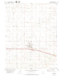
 1979 Vona1979 Print · USGSVona and its surrounding plains are documented here during the late seventies, showing the area as the interstate and rail lines converged. Researchers can trace the layout of Vona and its Chicago Rock Island and Pacific rail corridor.
 - 1979 Map of Seibert NE
 1979 Seibert NE1979 Print · USGSHigh plains ranching and the water systems of eastern Colorado are captured here in the late seventies. Genealogists and land historians can trace property divisions along the South Fork Republican River and locate functional landmarks like the Storage Bin and Hell Creek.
 - 1979 Map of Hugo 4 NE
 1979 Hugo 4 NE1979 Print · USGSKit Carson County's high plains are documented here in the late seventies, showing a landscape shaped by water and industry. Researchers can locate specific water infrastructure like a tank and various wells alongside the South Fork Republican River.2 unique versions available
 - 1979 Map of Flagler SW
 1979 Flagler SW1979 Print · USGSThe eastern Colorado plains during the late 1970s are defined by straight-line rail and energy infrastructure. Researchers can trace the path of the Chicago Rock Island and Pacific railroad and the courses of Buffalo Creek and Duck Creek.
 - 1979 Map of Flagler NW
 1979 Flagler NW1979 Print · USGSEastern Colorado during the late 1970s reveals a quiet landscape of cattle range and high plains drainages. Genealogists and land researchers can trace the intersection of Lincoln Co and Kit Carson Co along the courses of the Arikaree River and Hell Creek.
 - 1979 Map of Flagler
 1979 Flagler1979 Print · USGSFlagler was a thriving rail and agricultural center on the high plains during the late seventies. Researchers can trace the development of the town and its outskirts, from the Chicago Rock Island and Pacific tracks to the Flagler Cem and the nearby Flagler Aviation Service.
 - 1979 Map of Hugo 4 SE
 1979 Hugo 4 SE1979 Print · USGSThe high plains of eastern Colorado are captured here in the late 1970s along the Kit Carson and Cheyenne county line. Historians can trace the drainage of Bellyache Creek and Sand Creek past isolated landmarks like Well and Spring sites.2 unique versions available
 - 1979 Map of Alpine Ranch NW
 1979 Alpine Ranch NW1979 Print · USGSKit Carson County ranch land is captured here in the late seventies, showing the vast grid of Colorado's high plains. Researchers can trace the drainage of Landsman Creek and Spring Creek, or locate local landmarks like the Gravel Pit and diagonal Pipeline.
 - 1979 Map of Hugo 4 NW
 1979 Hugo 4 NW1979 Print · USGSThe High Plains of Eastern Colorado are mapped here in the late seventies, showing the rural boundary of Kit Carson and Lincoln counties. Genealogists and land researchers can trace the course of the South Fork Republican River and locate isolated features like Springs and Storage Bins.2 unique versions available
 - 1979 Map of Stratton 3 SW
 1979 Stratton 3 SW1979 Print · USGSEastern Colorado ranchlands are captured here in the late seventies, showing the open country along the Kit Carson and Cheyenne county line. Researchers can trace the courses of East Branch Spring Creek and Big Spring Creek or locate local Springs.3 unique versions available
 - 1979 Map of Flagler NE
 1979 Flagler NE1979 Print · USGSThe eastern Colorado High Plains in the late seventies are mapped here as a vast landscape of agricultural grid lines and intermittent drainages. Researchers can trace the subtle water routes of Hell Creek and Buffalo Creek alongside numerous rural Well sites.
 - 1979 Map of Stratton 3 NE
 1979 Stratton 3 NE1979 Print · USGSKit Carson County's high plains are captured here in the late seventies, showing a rural landscape defined by water management and transit. Researchers can locate the New Friedenburg Ch and trace the paths of Spring Creek and the local PIPELINE.2 unique versions available
 - 1979 Map of Seibert NW
 1979 Seibert NW1979 Print · USGSEastern Colorado ranch land is documented here in the late seventies, showing the sparse but vital infrastructure of Kit Carson County. Researchers can locate family landmarks like Boren or trace the drainages of Hell Creek and Buffalo Creek.
 - 1979 Map of Stratton NW
 1979 Stratton NW1979 Print · USGSKit Carson County comes into focus in the late seventies, showing a landscape defined by ranching grids and the South Fork Republican River. Researchers can locate specialized sites like Garner, various Gravel Pits, and a network of wells scattered across the plains.
Showing maps 1-25 of 28
Top cities of Kit Carson County
- Burlington historical maps
- Stratton historical maps
- Flagler historical maps
- Bethune historical maps
- Seibert historical maps
- Vona historical maps
Frequently asked questions
- What are the different types of historical maps available for Kit Carson County?
- What is the oldest map of Kit Carson County?
- Where can I purchase historical maps of Kit Carson County for my home or office?
- Where can I download high-res historical maps of Kit Carson County?
- Are there historical topographic maps available for Kit Carson County?
- Is there historical aerial imagery available for Kit Carson County?
- Where are historical maps of Kit Carson County sourced from?