Old Maps of Kit Carson County, Colorado for Academic Research
Study the evolution of Kit Carson County with 311 high-resolution historic maps. Whether you're teaching, researching, or modeling changes in land use, these maps provide essential visual documentation of urban, environmental, and geographic change.
- Analyze long-term change: Track patterns in development, transportation, and natural features.
- Ideal for environmental or urban studies: Support academic projects with primary historical map data.
- Use in the classroom or lab: Educators and researchers rely on these maps to bring historical context to life.
These maps are a powerful tool for teaching, research, and visualizing how Kit Carson County has changed over the decades.
Kit Carson County, CO maps
(311)- 1950 Map of Bonny Reservoir, 1952 Print
 1950 Bonny Reservoir1952 Print · USGSThe high plains of the Colorado-Kansas border were undergoing a massive transformation in the early fifties with the completion of the Bonny Dam. Genealogists and local historians can locate several family-named landmarks including Burr Ranch and the Jacobs Cem, alongside long-gone schoolhouses like Happy Hollow Sch.3 unique versions available
 - 1954 Map of Limon
 1954 Limon1954 Print · USGSThe Eastern Colorado plains and the Kansas borderlands come alive in the mid-fifties, showing the vital rail-and-road corridor through Limon. Genealogists and historians can trace the Chicago Rock Island & Pacific line through Burlington and find remote outposts like Arickaree and Anton.4 unique versions available
 - 1957 Map of Limon
 1957 Limon1957 Print · USGSThe High Plains of Eastern Colorado and Western Kansas come alive in the mid-1950s, showing the vital rail-and-road connections of the era. You can trace the path of the Chicago Rock Island and Pacific through towns like Limon, Stratton, and Burlington or find the early footprint of Bonny Reservoir.
 - 1958 Map of Limon
 1958 Limon1958 Print · USGSEastern Colorado and the Kansas border meet in this late-fifties study of High Plains rail and river systems. Researchers can trace the path of the Chicago Rock Island and Pacific through Limon and Burlington, or locate the Bonny Dam and Bonny Reservoir.
 - 1969 Map of Mount Sunflower SW, 1972 Print
 1969 Mount Sunflower SW1972 Print · USGSHigh plains ranching along the Kansas border comes into focus in the late sixties. Researchers can trace the North Fork Smoky Hill River and locate remote outposts like Beverage Ranch and the Monotony terrain.
 - 1969 Map of Alpine Ranch NE, 1972 Print
 1969 Alpine Ranch NE1972 Print · USGSKit Carson County ranchland in the late sixties is defined by its wide horizons and essential water infrastructure. Researchers can trace rural development through the location of numerous Wells, the Landing Strip, and seasonal watercourses like Sand Creek.
 - 1969 Map of Burlington 3 SE, 1972 Print
 1969 Burlington 3 SE1972 Print · USGSThe eastern Colorado plains meet the high prairie in the late sixties, where the North Fork Smoky Hill River carves its way through the borderlands. Researchers can trace the section lines across Kit Carson Co and Cheyenne Co to locate numerous named wells and rural roads.5 unique versions available
 - 1969 Map of Mount Sunflower, 1972 Print
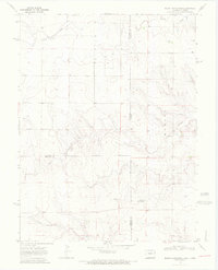 1969 Mount Sunflower1972 Print · USGSThe High Plains border of Colorado and Kansas comes into focus in this late 1960s survey. Genealogists and historians can locate the highest point in Kansas at Mount Sunflower and trace the sparse prairie settlements like Hitchcock and the drainages of Goose Creek.2 unique versions available
 - 1969 Map of Settlement, 1972 Print
 1969 Settlement1972 Print · USGSThe high plains of Kit Carson County are captured in the late sixties, showing a landscape defined by ranching and small community hubs. Genealogists can trace family footprints at Kramer and Stoltz, or locate rural church sites like Hope Ch and Immanuel Ch.
 - 1969 Map of Tuttle, 1972 Print
 1969 Tuttle1972 Print · USGSThe high plains of Kit Carson County in the late sixties are defined here by the confluence of the Republican River and its South Fork. Researchers can trace the drainage of Spring Creek and Dry Gulch near the settlement of Tuttle.4 unique versions available
 - 1969 Map of Bethune, 1972 Print
 1969 Bethune1972 Print · USGSThe high plains of Kit Carson County are captured here in the late sixties, centered on the railroad town of Bethune. Genealogists and historians can trace the infrastructure of the Chicago Rock Island and Pacific rail line and the seasonal flow of Landsman Creek and Sevenmile Creek.4 unique versions available
 - 1969 Map of Kanorado NE, 1972 Print
 1969 Kanorado NE1972 Print · USGSThe high plains along the Colorado and Kansas border are captured here in the late sixties, showcasing a landscape of section-line roads and prairie creek beds. Researchers can find local landmarks like the Bear Valley Cem, Bear Valley Sch, and the isolated Witzel settlement.
 - 1969 Map of Burlington, 1972 Print
 1969 Burlington1972 Print · USGSEastern Colorado during the late sixties shows the agricultural and transit importance of this plains hub. Trace the development of Burlington along the Chicago Rock Island and Pacific railroad, finding landmarks like the Rodeo Ground and Fairview Cem.3 unique versions available
 - 1969 Map of Idalia SE, 1972 Print
 1969 Idalia SE1972 Print · USGSThe High Plains of eastern Colorado appear in detail during the late sixties, showing the vital irrigation network of the South Fork Republican River. Researchers can trace local history through Ritzius Sch, Belto Cem, and Spring Valley Ranch.
 - 1969 Map of Mount Sunflower NW, 1972 Print
 1969 Mount Sunflower NW1972 Print · USGSEastern Colorado ranching and school life come into focus in the late sixties along the winding drainage of Sandy Creek. Genealogists and local historians can trace the footprint of the Smoky Hill Sch and the rural junction of Janssen.2 unique versions available
 - 1969 Map of Mount Sunflower NE, 1972 Print
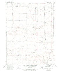 1969 Mount Sunflower NE1972 Print · USGSThe Colorado-Kansas state line at the edge of Kit Carson and Sherman Counties comes into focus in the late 1960s. Genealogists and local historians can trace rural development near the Green Valley Sch or follow the waters of the North Fork Smoky Hill River and Sappa Creek.
 - 1969 Map of Idalia SW, 1972 Print
 1969 Idalia SW1972 Print · USGSThe eastern Colorado high plains are captured in the late sixties as the river forks converge near the county line. Genealogists and historians can locate the Wood Ranch and trace the paths of Sand Creek and the South Fork Republican River.
 - 1969 Map of Peconic, 1972 Print
 1969 Peconic1972 Print · USGSEastern Colorado ranching and rail infrastructure are captured here in the late sixties as the high plains economy hummed along. Researchers can trace the path of the Chicago Rock Island and Pacific and locate the small settlement of Peconic.3 unique versions available
 - 1969 Map of Kanorado NW, 1972 Print
 1969 Kanorado NW1972 Print · USGSThe High Plains borderlands of the late sixties are captured here in meticulous detail along the Kit Carson County line. Researchers can trace the winding paths of Bonny Creek and Little Beaver Creek while locating numerous rural wells and section-line roads.2 unique versions available
 - 1969 Map of Burlington 3 NW, 1972 Print
 1969 Burlington 3 NW1972 Print · USGSThe High Plains of Kit Carson County are captured here in the late sixties, showing a landscape defined by ranching and vital water sources. Genealogists and local historians can locate Beloit Cem and trace the paths of Landsman Creek and Sand Creek.
 - 1969 Map of Kirk, 1972 Print
 1969 Kirk1972 Print · USGSKirk and the eastern Colorado plains are captured here in the late sixties, showing the agricultural heart of the Republican River valley. Researchers can trace local landmarks like the Kirk Cemetery, Idler Landing Strip, and the winding course of Hell Creek.2 unique versions available
 - 1969 Map of Stratton, 1972 Print
 1969 Stratton1972 Print · USGSThe high plains of Kit Carson County come to life in this late 1960s survey as the town of Stratton straddles the rail and highway corridor. Researchers can trace the local infrastructure of the day, from the Clairmont Cemetery to the Chicago Rock Island and Pacific tracks.
 - 1969 Map of Burlington NE, 1972 Print
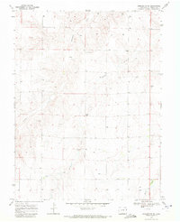 1969 Burlington NE1972 Print · USGSThe high plains of Kit Carson County meet the Kansas State Line in the late sixties, showing a landscape of deep-rooted ranching and agriculture. Researchers can locate rural landmarks like the Emerson School and trace the paths of Landsman Creek and Bonny Creek.
 - 1969 Map of Alpine Ranch, 1972 Print
 1969 Alpine Ranch1972 Print · USGSThe eastern Colorado plains at the boundary of Kit Carson and Cheyenne Counties are captured here just before the 1970s. Researchers can trace rural landmarks like Alpine Ranch, the settlement at Perry, and numerous Well sites along the North Fork Smoky Hill River.
 - 1969 Map of Kanorado, 1972 Print
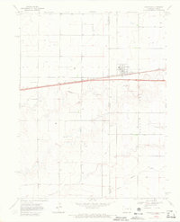 1969 Kanorado1972 Print · USGSThe High Plains border town of Kanorado is captured in the late sixties as it straddled the State Line between Kansas and Colorado. Genealogists and researchers can trace the path of the Chicago Rock Island and Pacific railroad and find local markers like Grain Bins and early Gravel Pits.3 unique versions available
Showing maps 1-25 of 311
Top cities of Kit Carson County
- Burlington historical maps
- Stratton historical maps
- Flagler historical maps
- Bethune historical maps
- Seibert historical maps
- Vona historical maps
Frequently asked questions
- What are the different types of historical maps available for Kit Carson County?
- What is the oldest map of Kit Carson County?
- Where can I purchase historical maps of Kit Carson County for my home or office?
- Where can I download high-res historical maps of Kit Carson County?
- Are there historical topographic maps available for Kit Carson County?
- Is there historical aerial imagery available for Kit Carson County?
- Where are historical maps of Kit Carson County sourced from?