1960s Maps of Otero County, Colorado
Explore 10 historic maps of Otero County from the 1960s. These maps offer a rare glimpse into what life looked like during the 1960s — showing old roads, neighborhoods, homes, and landmarks that have changed or disappeared over time.
Whether you're researching your family's past, planning a metal detecting trip, or studying how Otero County's landscape evolved across the 1960s, these high-resolution maps are a powerful tool for exploring the history of this region.
- Focus on a specific era: All maps on this page are from the 1960s, giving you a focused view of this time period.
- See what’s changed: Compare century-old streets, trails, and buildings to today's modern landscape using overlays and satellite layers.
- Research with precision: Use these maps for genealogy, historical research, land use analysis, or educational projects.
- View, download, or print: Maps are fully viewable online in high resolution, and can be downloaded or printed for your own records.
Start exploring Otero County's history through authentic maps from the 1960s. This is your window into the past.
Otero County, CO maps
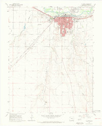
(10)- 1960 Map of Fowler, 1961 Print
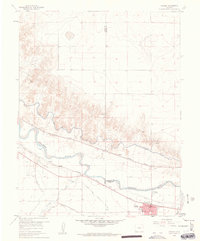 1960 Fowler1961 Print · USGSIn the Arkansas River valley during the early sixties, the local economy relied heavily on a sophisticated network of canals and competing rail lines. Researchers can trace the layout of Fowler and the settlement at Hamlet, or locate industrial sites like the Gravel Pits and the Rocky Ford Highline Canal.3 unique versions available
 - 1962 Map of Pueblo
 1962 Pueblo1962 Print · USGSThe Front Range and high plains meet in the early sixties as military installations and industrial mining shape the corridor from Colorado Springs to Pueblo. Genealogists can trace family names through rural landmarks like the Columbine School, Hanover Church, and Fairview Cem.
 - 1965 Map of La Junta SW, 1969 Print
 1965 La Junta SW1969 Print · USGSOtero County southwest of La Junta is shown in the mid-1960s as a landscape defined by its arroyo systems and the Atchison Topeka and Santa Fe rail line. Researchers can trace the path of an old Trail near a Historical Monument and the meandering course of Crooked Arroyo.2 unique versions available
 - 1966 Map of Pueblo
 1966 Pueblo1966 Print · USGSThe Front Range and Arkansas River Valley are captured here in the mid-1960s, showing a landscape shaped by mining, military expansion, and rail. Researchers can locate numerous country schools and mines, such as the Lytle School, Pioneer Cem, and Empire Zinc Mine.
 - 1966 Map of La Junta SE, 1969 Print
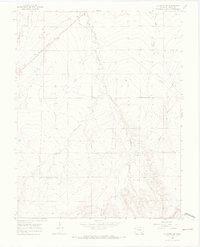
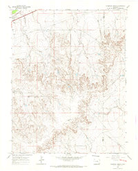
 1966 La Junta SE1969 Print · USGSSoutheast of La Junta during the mid-sixties, this landscape reveals a rugged ranching and utility corridor defined by deep arroyos and canyons. Genealogists and historians can trace the course of David Canyon Road, find the location of Vogel Springs, and locate early infrastructure like the cross-country Pipeline.4 unique versions available
 - 1966 Map of Hawley, 1969 Print
 1966 Hawley1969 Print · USGSOtero County's high plains irrigation and transit corridor are captured here during the mid-sixties. Researchers can trace the legacy of the Santa Fe Trail and the local rail-side communities of Hawley and Benton along the Otero Canal.4 unique versions available
 - 1966 Map of La Junta, 1970 Print
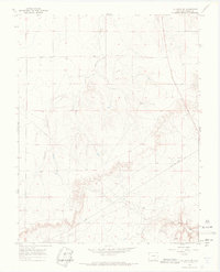
 1966 La Junta1970 Print · USGSLa Junta during the mid-1960s was a bustling railroad and education hub on the Arkansas River. Historians can trace the development of neighborhood schools like Columbian Sch and Jr High Sch, or locate family sites near Fairview Cem and the Otero Jr College campus.4 unique versions available
 - 1966 Map of Thompson Arroyo, 1970 Print
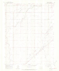
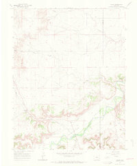
 1966 Thompson Arroyo1970 Print · USGSRanching lands and arid arroyos define this Otero County landscape in the mid-1960s. Genealogists and historians can trace family-named features like Miller Mesa or locate the Drive-in Theater and Circle I Waters Spring across the plains.2 unique versions available
 - 1966 Map of Higbee, 1970 Print
 1966 Higbee1970 Print · USGSSoutheast Colorado ranching country is captured here in the mid-sixties as it follows the winding course of the Purgatoire River. Genealogists and local historians can trace the foundations of the Higbee community through the Higbee Cem and Higbee Valley Sch.2 unique versions available
 - 1968 Map of La Junta
 1968 La Junta1968 Print · USGSSoutheastern Colorado and the high plains appear in remarkable detail during the late 1960s, showing the intersection of irrigation, ranching, and rail. Genealogists can trace family footprints at the Lycan Post Office, Konantz Cem, and across numerous named cattle ranches.
End of results
Showing maps 1-10 of 10
Top cities of Otero County
- La Junta historical maps
- Rocky Ford historical maps
- Fowler historical maps
- Swink historical maps
- Manzanola historical maps
- Cheraw historical maps
Frequently asked questions
- What are the different types of historical maps available for Otero County?
- What is the oldest map of Otero County?
- Where can I purchase historical maps of Otero County for my home or office?
- Where can I download high-res historical maps of Otero County?
- Are there historical topographic maps available for Otero County?
- Is there historical aerial imagery available for Otero County?
- Where are historical maps of Otero County sourced from?