1990s Maps of Otero County, Colorado
Explore 21 historic maps of Otero County from the 1990s. These maps offer a rare glimpse into what life looked like during the 1990s — showing old roads, neighborhoods, homes, and landmarks that have changed or disappeared over time.
Whether you're researching your family's past, planning a metal detecting trip, or studying how Otero County's landscape evolved across the 1990s, these high-resolution maps are a powerful tool for exploring the history of this region.
- Focus on a specific era: All maps on this page are from the 1990s, giving you a focused view of this time period.
- See what’s changed: Compare century-old streets, trails, and buildings to today's modern landscape using overlays and satellite layers.
- Research with precision: Use these maps for genealogy, historical research, land use analysis, or educational projects.
- View, download, or print: Maps are fully viewable online in high resolution, and can be downloaded or printed for your own records.
Start exploring Otero County's history through authentic maps from the 1990s. This is your window into the past.
Otero County, CO maps
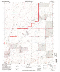
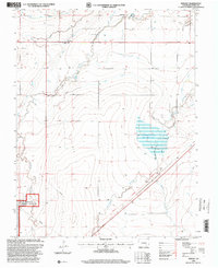
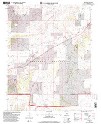
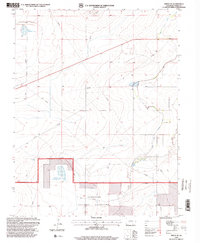
(21)- 1993 Map of Delhi
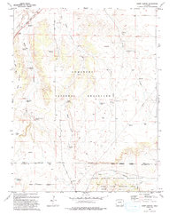
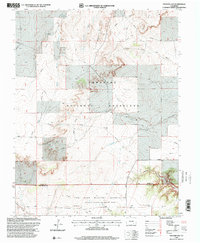
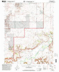
 1993 Delhi1993 Print · USGSThe high plains of the Colorado borderlands are captured here in the early 1990s, where the Santa Fe railroad meets the Comanche National Grassland. Researchers can trace old ranching infrastructure through local landmarks like Barbee Windmill, Hixon Spring, and the small settlement of Delhi.
 - 1993 Map of Sheep Canyon
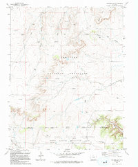
 1993 Sheep Canyon1993 Print · USGSSoutheast Colorado ranching lands and military training grounds converge in the 1990s near the Santa Fe National Historic Trail. Researchers can trace old family ranching legacies through remote landmarks like Mills Well, the Hoffman Windmill, and Kennedy Ponds.
 - 1993 Map of Bloom
 1993 Bloom1993 Print · USGSSoutheast Colorado's high plains reveal a landscape of transit and ranching in the early nineties, where the Historic Santa Fe Trail follows the same path as the railroad. Researchers can trace the small settlement at Bloom or locate family-named landmarks like Cochran Reservoir and Fultz Reservoir.
 - 1993 Map of Riley Canyon, 1994 Print
 1993 Riley Canyon1994 Print · USGSSoutheastern Colorado canyon country is captured in the 1990s as ranching heritage meets military maneuver grounds. Trace local family history at Martinez Cem and find remote water sources like Antone Spring and River Windmill.
 - 1993 Map of Packers Gap, 1994 Print
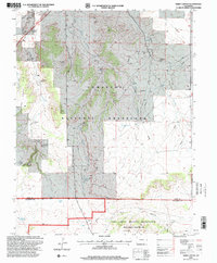
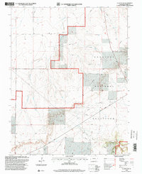
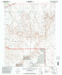
 1993 Packers Gap1994 Print · USGSSoutheast Colorado in the early nineties is revealed as a landscape of federal land management and deep canyon systems. Researchers can trace the varied terrain from Packers Gap to the military training grounds of the Fort Carson Military Reservation.
 - 1996 Map of Timpas, 2000 Print
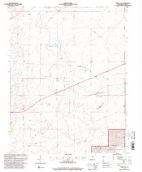
 1996 Timpas2000 Print · USGSOtero County is shown here in the mid-1990s as a landscape of historic transit and high plains ranching. Researchers can trace the path of the Santa Fe National Historic Trail alongside the rail line near Timpas and the local Cem.
 - 1996 Map of Packers Gap, 2000 Print
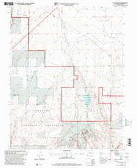
 1996 Packers Gap2000 Print · USGSThe high plains of Otero County are captured in the mid-1990s, where public grazing lands meet military training grounds. Researchers can trace the rugged geography of Packers Gap and the deep cuts of Minnie Canyon or Bent Canyon.
 - 1996 Map of Timpas SW, 2000 Print
 1996 Timpas SW2000 Print · USGSThe Otero County high plains during the mid-nineties reveal a landscape of managed grazing and water reclamation. Genealogists and researchers can trace local ranching landmarks like Dry Creek Camp, the Reed Windmill, and Larson Reservoir.
 - 1996 Map of Hawley, 2000 Print
 1996 Hawley2000 Print · USGSOtero County agriculture and historical frontier paths intersect here during the late twentieth century. Genealogists and historians can trace the Santa Fe National Historic Trail near Hawley and the Grand Valley Sch alongside complex canal systems.
 - 1996 Map of Higbee, 2000 Print
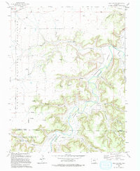
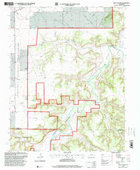
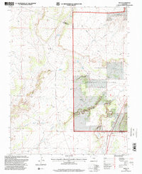
 1996 Higbee2000 Print · USGSOtero County ranching and river life are documented here in the mid-1990s as the high plains meet the canyonlands. Researchers can trace local genealogy and land use through the Higbee Cem, Higbee Valley Sch, and the winding Purgatoire River.
 - 1996 Map of Bloom, 2000 Print
 1996 Bloom2000 Print · USGSThe Colorado high plains near the Otero and Las Animas county line appear here in the mid-1990s, dominated by the wide reaches of the Comanche National Grassland. Genealogists and historians can trace the Santa Fe National Historic Trail past Bloom and locate isolated Graves and ranch landmarks like Corral Well.
 - 1996 Map of Riley Canyon, 2000 Print
 1996 Riley Canyon2000 Print · USGSSoutheastern Colorado’s high plains and deep canyons are captured in the mid-1990s as ranching heritage meets military expansion. Genealogists and historians can trace local landmarks like Martinez Cem, the remote Penitenta Ch, and the settlement of Withers.
 - 1996 Map of Sheep Canyon, 2000 Print
 1996 Sheep Canyon2000 Print · USGSSoutheast Colorado's high plains are mapped in the mid-nineties as the region balanced conservation with military training. Trace the path of the Santa Fe National Historic Trail past landmarks like Mills Well and Timpas Creek.
 - 1996 Map of La Junta SW, 2000 Print
 1996 La Junta SW2000 Print · USGSOtero County's high plains are captured here in the mid-nineties, showing a landscape defined by the Comanche National Grassland. Researchers can trace the Santa Fe National Historic Trail as it passes near Rene and the Historical Monument.
 - 1996 Map of Snowden Lake, 2000 Print
 1996 Snowden Lake2000 Print · USGSPueblo and Otero counties meet in the mid-1990s within the sprawling ranchlands of the Comanche National Grassland. Researchers can trace vital water infrastructure across this landscape, from the Snowden Lake reservoir to family-named landmarks like North Hixon Well and Kitch Spring.
 - 1996 Map of Timpas NE, 2000 Print
 1996 Timpas NE2000 Print · USGSOtero County is captured here in the mid-1990s, showcasing the intersection of federal conservation and regional water management. Researchers can trace land use patterns across the Comanche National Grassland and locate specific sites like Swink Reservoir No 1 and the Flowing Well.
 - 1996 Map of La Junta, 2000 Print
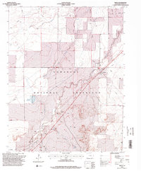
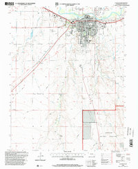 1996 La Junta2000 Print · USGSLa Junta at the close of the twentieth century shows a robust rail-and-river hub anchored by the Arkansas River. Genealogists and local historians can locate neighborhood landmarks like Fairview Cem, Lincoln Sch, and the Otero Jr College campus.
 - 1996 Map of La Junta SE, 2000 Print
 1996 La Junta SE2000 Print · USGSOtero County is captured in the late nineties as a landscape of conservation and ranching infrastructure within the Comanche National Grassland. Genealogists and researchers can trace the rugged topography of David Canyon and Vogel Canyon alongside local landmarks like Anderson Arroyo.
 - 1996 Map of Delhi, 2000 Print
 1996 Delhi2000 Print · USGSThe high plains of Las Animas County come into focus during the mid-nineties, showing the intersection of ranching infrastructure and historic western routes. Trace the path of the Santa Fe Historic Trail near Delhi and locate family-named landmarks like the Barbee Windmill and Deal Windmill.
 - 1996 Map of Thompson Arroyo, 2000 Print
 1996 Thompson Arroyo2000 Print · USGSSoutheastern Colorado prairie lands appear here in the mid-nineties, showing the intersection of conservation and cattle country. Researchers can trace the water-scarce landscape through Vandiver Canal, Circle T Waters Spring, and the grazing lands of Comanche National Grassland.
 - 1996 Map of Timpas NW, 2000 Print
 1996 Timpas NW2000 Print · USGSOtero County ranch lands and protected plains are captured here in the mid-nineties. Trace the essential water infrastructure of this arid landscape through Harbeck Windmill, Big Well, and the Swink Reservoir No 2 system.
End of results
Showing maps 1-21 of 21
Top cities of Otero County
- La Junta historical maps
- Rocky Ford historical maps
- Fowler historical maps
- Swink historical maps
- Manzanola historical maps
- Cheraw historical maps
Frequently asked questions
- What are the different types of historical maps available for Otero County?
- What is the oldest map of Otero County?
- Where can I purchase historical maps of Otero County for my home or office?
- Where can I download high-res historical maps of Otero County?
- Are there historical topographic maps available for Otero County?
- Is there historical aerial imagery available for Otero County?
- Where are historical maps of Otero County sourced from?