1970s Maps of Otero County, Colorado
Explore 14 historic maps of Otero County from the 1970s. These maps offer a rare glimpse into what life looked like during the 1970s — showing old roads, neighborhoods, homes, and landmarks that have changed or disappeared over time.
Whether you're researching your family's past, planning a metal detecting trip, or studying how Otero County's landscape evolved across the 1970s, these high-resolution maps are a powerful tool for exploring the history of this region.
- Focus on a specific era: All maps on this page are from the 1970s, giving you a focused view of this time period.
- See what’s changed: Compare century-old streets, trails, and buildings to today's modern landscape using overlays and satellite layers.
- Research with precision: Use these maps for genealogy, historical research, land use analysis, or educational projects.
- View, download, or print: Maps are fully viewable online in high resolution, and can be downloaded or printed for your own records.
Start exploring Otero County's history through authentic maps from the 1970s. This is your window into the past.
Otero County, CO maps
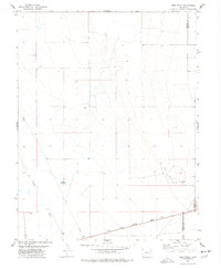
(14)- 1970 Map of Apishapa Bridge, 1973 Print
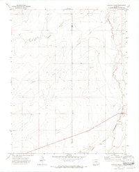 1970 Apishapa Bridge1973 Print · USGSSoutheastern Colorado ranching country is captured here during the 1970s, where the high plains meet the winding Apishapa River. Genealogists and historians can trace the remote settlement of Whiterock and the historic crossing at Apishapa Bridge.3 unique versions available
 - 1970 Map of Snowden Lake, 1974 Print
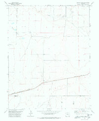
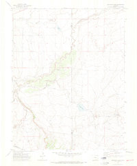 1970 Snowden Lake1974 Print · USGSPueblo and Otero counties meet along the Apishapa River in this early 1970s survey of the Colorado high plains. Genealogists and historians can trace essential water landmarks like Snowden Lake, Kitch Spring, and the Bull Pasture Windmill.4 unique versions available
 - 1970 Map of Delhi, 1974 Print
 1970 Delhi1974 Print · USGSSoutheast Colorado ranching country is captured here just as the modern era reached these high plains. Genealogists and historians can trace family-named sites like Hall Windmills and Barbee Windmill along the path of the Santa Fe Trail.2 unique versions available
 - 1972 Map of Timpas NE, 1975 Print
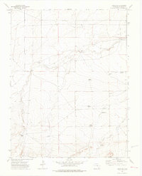
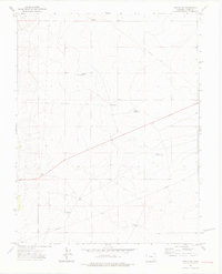
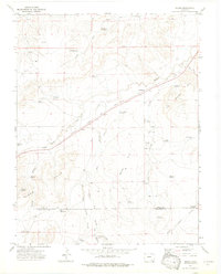
 1972 Timpas NE1975 Print · USGSOtero County in the early seventies reveals a landscape defined by water management and resource transport. Researchers can trace the path of the Rocky Ford High Line Canal and locate industrial markers like a Gravel Pit or Drill Hole.3 unique versions available
 - 1972 Map of Packers Gap, 1976 Print
 1972 Packers Gap1976 Print · USGSSoutheast Colorado ranching country is shown here in the 1970s along the Otero and Las Animas county line. Trace the local geography through family-named landmarks and water sources like Honey Windmill, Packers Gap, and Minnie Canyon.4 unique versions available
 - 1972 Map of Timpas SW, 1976 Print
 1972 Timpas SW1976 Print · USGSSoutheast Colorado ranching country in the early seventies relied on a vital network of windmills and reservoirs to sustain life on the high plains. Researchers can trace land use through family-named sites like Haight Wells, Anderson Reservoir, and Swisher Windmill.3 unique versions available
 - 1972 Map of Riley Canyon, 1976 Print
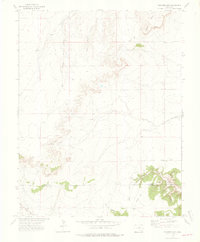
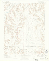
 1972 Riley Canyon1976 Print · USGSThe Otero County high plains meet the canyonlands in the early 1970s, where life centered on the Purgatoire River. Genealogists and historians can trace family landmarks like Martinez Cem, the Penitenta Ch, and Withers.5 unique versions available
 - 1972 Map of Timpas, 1976 Print
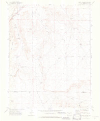
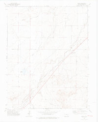 1972 Timpas1976 Print · USGSSoutheast Colorado in the 1970s shows a landscape still defined by its historic transit corridors and prairie ranching roots. Local historians can trace the parallel paths of the Santa Fe Trail and the railroad through Timpas and Ayer, locating local Cemeteries and Historical Markers along the way.3 unique versions available
 - 1972 Map of Timpas NW, 1976 Print
 1972 Timpas NW1976 Print · USGSOtero County's high plains are captured in the early 1970s, revealing a landscape transformed by water management and ranching. Researchers can trace the infrastructure of the prairie through Swink Reservoir No 2, the Harbeck Windmill, and Big Well.3 unique versions available
 - 1972 Map of Corbin Canyon, 1976 Print
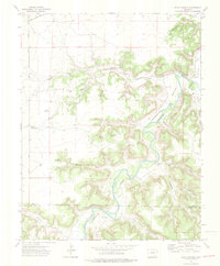
 1972 Corbin Canyon1976 Print · USGSSoutheastern Colorado ranching country is mapped here in the early 1970s at the intersection of Otero, Bent, and Las Animas counties. Researchers can trace remote water sources and family landmarks such as Anstine Windmill, Harbordale Pond, and the Purgatoire River.2 unique versions available
 - 1972 Map of Bloom, 1976 Print
 1972 Bloom1976 Print · USGSThe high plains of Otero County are captured here in the early seventies, centered on the railroad settlements of Bloom and Mindeman. Researchers can trace the ranching history of the Bloom Hills through family landmarks like Baski Windmill and Cochran Reservoir.3 unique versions available
 - 1972 Map of Sheep Canyon, 1976 Print
 1972 Sheep Canyon1976 Print · USGSThe high plains and rugged canyons of southern Colorado appear in the early 1970s as a landscape defined by ranching and historic transit. Trace the Santa Fe Trail near the Atchison Topeka and Santa Fe rail line or locate isolated landmarks like Jack Point and Rourke Reservoir.4 unique versions available
 - 1977 Map of Todd Point, 1978 Print
 1977 Todd Point1978 Print · USGSCrowley County in the mid-1970s reveals a landscape of high plains ranching and vital water management. Genealogists and historians can trace the Missouri Pacific railroad corridor and the layout of local landmarks like Lolita Reservoir and Todd Point Spring.
 - 1978 Map of Houston Lakes
 1978 Houston Lakes1978 Print · USGSSoutheastern Colorado's high plains are mapped during the 1970s, showing a landscape defined by ranching and rail. Genealogists can trace the settlement at Heath and the Missouri Pacific railroad as it crosses the Kiowa and Otero county lines.2 unique versions available
End of results
Showing maps 1-14 of 14
Top cities of Otero County
- La Junta historical maps
- Rocky Ford historical maps
- Fowler historical maps
- Swink historical maps
- Manzanola historical maps
- Cheraw historical maps
Frequently asked questions
- What are the different types of historical maps available for Otero County?
- What is the oldest map of Otero County?
- Where can I purchase historical maps of Otero County for my home or office?
- Where can I download high-res historical maps of Otero County?
- Are there historical topographic maps available for Otero County?
- Is there historical aerial imagery available for Otero County?
- Where are historical maps of Otero County sourced from?