Old Maps of Garo, Colorado for Metal Detecting
Plan your next treasure hunt with 12 historic maps of Garo. Find old homesites, ghost towns, trails, and gathering spots that may be lost to time — perfect for identifying promising metal detecting locations.
- Locate forgotten sites: Uncover places like long-lost settlements, abandoned rail lines, or gathering spots.
- Plan better hunts: Use map overlays combined with LiDAR or satellite views to narrow in on historically rich areas.
- Made for detectorists: Thousands of hobbyists use these maps to discover relics, coins, and hidden history.
Use these historic maps to boost your research and find new opportunities beneath the surface of Garo.
Garo, CO maps
(12)- 1953 Map of Denver, 1964 Print
 1953 Denver1964 Print · USGSDenver and the Colorado Front Range are captured here during a decade of post-war growth and military expansion. Researchers can trace the sprawling rail lines of the Union Pacific, locate the State Capitol, and explore historic mountain mining hubs like Central City.6 unique versions available
 - 1956 Map of Garo, 1957 Print
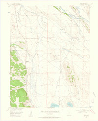 1956 Garo1957 Print · USGSPark County ranching and water management are captured here in the mid-1950s, centered on the settlement of Garo. Researchers can trace old property lines at Cargill Ranch, follow the Old Railroad Grade, and locate the Buffalo Springs site.3 unique versions available
 - 1957 Map of Denver
 1957 Denver1957 Print · USGSDenver and the Colorado Front Range are seen here during a mid-century period of intense military and urban expansion. Trace the footprints of the Rocky Mountain Arsenal, the early United States Air Force Academy, and the Lowry AF Base.
 - 1958 Map of Denver
 1958 Denver1958 Print · USGSDenver and the Colorado Front Range are captured here during the mid-century suburban boom. Trace the footprints of military installations like Buckley Air Force Base alongside the established rail networks of the Colorado & Southern Ry.
 - 1960 Map of Denver
 1960 Denver1960 Print · USGSDenver and the Colorado Front Range are seen here at a pivotal moment of postwar expansion into the plains and foothills. Researchers can trace the mid-century rail network of the Denver & Rio Grande Western RR and locate historic institutional landmarks like Buckley Field and the Colorado School of Mines.
 - 1983 Map of Bailey
 1983 Bailey1983 Print · USGSPark County and the high Front Range are captured here during the early 1980s as traditional mountain settlements met new development patterns. Genealogists and researchers can trace the Denver and Rio Grande Western Railroad and old mountain hamlets like Bailey, Webster, and Garo.2 unique versions available
 - 1994 Map of Garo, 1998 Print
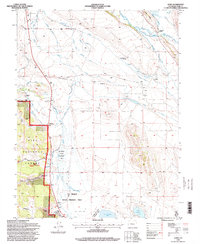 1994 Garo1998 Print · USGSRanching and water rights dominate this Park County landscape in the 1990s, where the high plains meet the forest edge. Trace family-owned history through the McDowell Ranch, the Weston site, and the extensive Miller Ditch irrigation system.
 - 2011 Map of Garo, 2011 Print
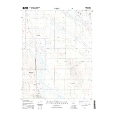
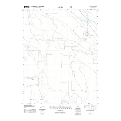 2011 Garo2011 Print · USGSCovers Garo, including Park County, United States, and other nearby areas
 - 2013 Map of Garo, 2013 Print
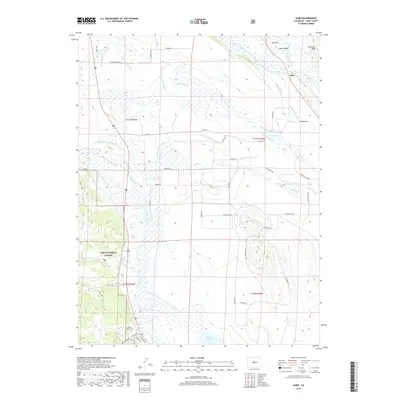
 2013 Garo2013 Print · USGSCovers Garo, including Park County, United States, and other nearby areas
 - 2016 Map of Garo, 2016 Print
 2016 Garo2016 Print · USGSCovers Garo, including Park County, United States, and other nearby areas
 - 2019 Map of Garo, 2019 Print
 2019 Garo2019 Print · USGSCovers Garo, including Park County, United States, and other nearby areas
 - 2022 Map of Garo, 2022 Print
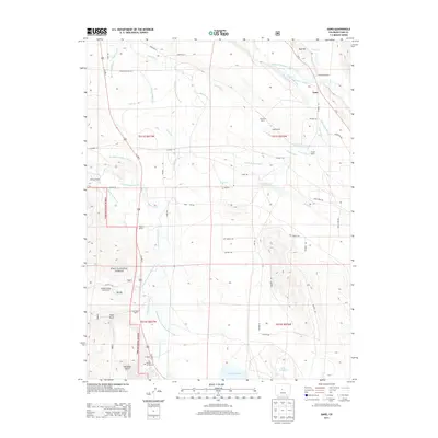
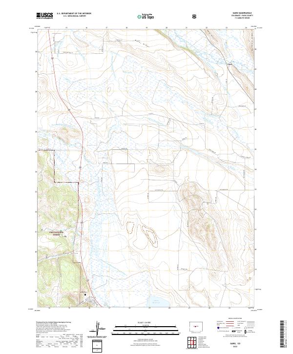 2022 Garo2022 Print · USGSPark County ranching country is documented here in the early twenty-first century, centered on the historic crossroads at Garo. Researchers can trace intricate irrigation networks like the Antero-Feeder Ditch or locate the Buffalo Springs Cem near the banks of the South Fork Platte River.
End of results
Showing maps 1-12 of 12
Top cities near Garo
Frequently asked questions
- What are the different types of historical maps available for Garo?
- What is the oldest map of Garo?
- Where can I purchase historical maps of Garo for my home or office?
- Where can I download high-res historical maps of Garo?
- Are there historical topographic maps available for Garo?
- Is there historical aerial imagery available for Garo?
- Where are historical maps of Garo sourced from?