Old Maps of Sawpit, Colorado for Hiking & Exploration
Hike through history with 28 historic maps of Sawpit. Explore old trails, ghost towns, and forgotten backroads — perfect for outdoor adventurers and local explorers.
- Rediscover forgotten places: Map out old mining camps, roads, and footpaths that no longer exist on modern maps.
- Layer with modern tools: Combine with LiDAR or satellite views to plan hikes through historical terrain.
- Made for exploration: Popular among hikers, overlanders, and local history lovers.
Use these maps to find adventure and explore the hidden past of Sawpit.
Sawpit, CO maps
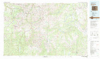
(28)- 1897 Map of Telluride
 1897 Telluride1897 Print · USGSMining and railroading define the San Miguel Mountains during the 1890s silver boom. Genealogists and historians can trace the foundations of Telluride and its surrounding camps, including Pandora, Ames (P.O.), and the Nellie Mine.
 - 1904 Map of Telluride
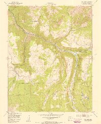
 1904 Telluride1904 Print · USGSThe San Juan Mountains were at the height of their mining boom when this survey was conducted at the turn of the century. Genealogists and historians can trace the intricate rail network of the Rio Grande Southern R.R. and locate storied operations like the Smuggler Mine and the community at Ophir.2 unique versions available
 - 1945 Map of Durango
 1945 Durango1945 Print · USGSSouthwest Colorado and Northern New Mexico at mid-century are defined by the high peaks of the San Juan Range and the tribal lands of the Southern Ute. Genealogists and historians can trace the paths of the D & R G W RR and locate local landmarks like Animas City and the Blanco Basin School.3 unique versions available
 - 1953 Map of Gray Head, 1954 Print
 1953 Gray Head1954 Print · USGSThe San Miguel River valley in the early fifties shows a landscape of inactive mines and remote mountain settlements. Trace the Old Railroad Grade and find historic sites like Vanadium, the Belle Champion Mine, and Skyline Ranch.6 unique versions available
 - 1953 Map of Little Cone, 1955 Print
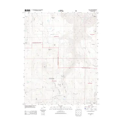
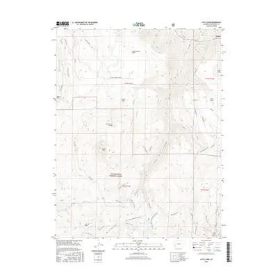
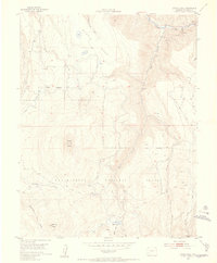 1953 Little Cone1955 Print · USGSSan Miguel County in the early 1950s reveals a high-altitude landscape of mesas and mining infrastructure. Researchers can trace the Aerial Tramway near Saw Pit or explore the rugged trails leading to Woods Lake and Silver Pick Basin.6 unique versions available
 - 1953 Map of Durango, 1963 Print
 1953 Durango1963 Print · USGSThe high peaks of the San Juan Mountains and the Colorado mining country are shown here as they appeared in the early fifties. Genealogists and local historians can trace the rail lines of the D & R G W RR and locate historic mining camps like Silverton, Ouray, and Old Ophir.
 - 1954 Map of Durango
 1954 Durango1954 Print · USGSSouthern Colorado in the mid-1950s was defined by high-altitude mining towns and the expansion of water storage in the San Luis Valley. Trace the narrow-gauge Denver & Rio Grande Western RR as it connects Durango to mountain outposts like Silverton and Creede.2 unique versions available
 - 1955 Map of Telluride, 1959 Print
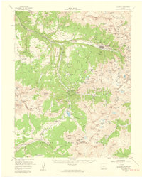 1955 Telluride1959 Print · USGSHigh in the San Miguel Mountains during the 1950s, this area shows the peak of Colorado's mining infrastructure. Genealogists and historians can trace the Rio Grande Southern Railroad past Tomboy and the Ophir Loop Sch.5 unique versions available
 - 1956 Map of Cortez, 1972 Print
 1956 Cortez1972 Print · USGSThe Four Corners region comes alive in this mid-century study of the high plateaus and deep canyons surrounding Cortez. Trace the development of desert outposts like Towaoc or follow the historic Laramie Trail across a landscape dotted with ancient sites at Mesa Verde National Park.2 unique versions available
 - 1958 Map of Cortez
 1958 Cortez1958 Print · USGSThe Four Corners region comes alive in the late fifties, showing the interplay between expanding mountain settlements and ancient archeological sites. Trace the layout of Cortez, Monticello, and Blanding alongside landmarks like Mesa Verde National Park and Fort Lewis A&M College.
 - 1959 Map of Cortez
 1959 Cortez1959 Print · USGSThe Four Corners region in the late fifties was a landscape of ancestral sites and isolated ranching outposts. Genealogists and historians can trace the early footprints of Cortez, Towaoc, and Mexican Hat alongside the canyons of the San Juan River.2 unique versions available
 - 1961 Map of Durango
 1961 Durango1961 Print · USGSThe high San Juan country in the early sixties is shown here as a network of historic mining towns and early reservoir projects. Genealogists and researchers can trace the Denver & Rio Grande Western RR as it connects Durango, Silverton, and Arboles.
 - 1962 Map of Cortez
 1962 Cortez1962 Print · USGSThe Four Corners region comes alive in the early sixties, showing a landscape defined by reservation lands and federal forests. Trace the route of the Rio Grande Southern RR or locate the Uranium and vanadium mines near Monticello.
 - 1963 Map of Durango
 1963 Durango1963 Print · USGSThe San Juan Mountains and San Luis Valley are captured here in the early 1950s as mining, rail, and tribal lands shaped the region. Researchers can trace the Denver & Rio Grande Western RR through high-country towns like Telluride and Silverton, or locate landmarks such as the Asiatic Mine.
 - 1966 Map of Cortez
 1966 Cortez1966 Print · USGSThe Four Corners region in the mid-sixties reveals a landscape of high mesas, tribal lands, and archaeological preserves. Researchers can trace the ancient sites at Hovenweep National Monument, follow the Denver & Rio Grande Western Railroad, or locate old settlements like Ginger Hill and Yellow Jacket.
 - 1966 Map of Durango
 1966 Durango1966 Print · USGSSouthwestern Colorado and the New Mexico borderlands are shown here in the mid-1960s, a time when the narrow-gauge rail network still tied the high peaks to the valley floor. Researchers can trace the Denver & Rio Grande Western Railroad between settlements like Silverton, Antonito, and Pagosa Springs.2 unique versions available
 - 1982 Map of Dove Creek
 1982 Dove Creek1982 Print · USGSThe high plateaus and deep canyons of Southwest Colorado are captured in the early 1980s as the McPhee Dam takes shape. Genealogists and researchers can locate remote settlements like Egnar and Cahone or trace family mining claims at the Effie B Mine.
 - 1982 Map of Silverton, 1983 Print
 1982 Silverton1983 Print · USGSThe San Juan Mountains were entering a new era in the early eighties as mining heritage met growing wilderness preservation. Researchers can trace historic claims and mountain rail routes through Silverton, Telluride, and the high-altitude Sunnyside Mine.3 unique versions available
 - 2011 Map of Gray Head, 2011 Print
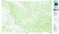
 2011 Gray Head2011 Print · USGSCovers Sawpit, including Mountain Village, Lime, and other nearby areas
 - 2011 Map of Little Cone, 2011 Print
 2011 Little Cone2011 Print · USGSCovers Sawpit, including San Miguel County, United States, and other nearby areas
 - 2013 Map of Gray Head, 2013 Print
 2013 Gray Head2013 Print · USGSCovers Sawpit, including Mountain Village, Lime, and other nearby areas
 - 2013 Map of Little Cone, 2013 Print
 2013 Little Cone2013 Print · USGSCovers Sawpit, including San Miguel County, United States, and other nearby areas
 - 2016 Map of Gray Head, 2016 Print
 2016 Gray Head2016 Print · USGSCovers Sawpit, including Mountain Village, Lime, and other nearby areas
 - 2016 Map of Little Cone, 2016 Print
 2016 Little Cone2016 Print · USGSCovers Sawpit, including San Miguel County, United States, and other nearby areas
 - 2019 Map of Little Cone, 2019 Print
 2019 Little Cone2019 Print · USGSCovers Sawpit, including San Miguel County, United States, and other nearby areas
Showing maps 1-25 of 28
Top cities near Sawpit
Frequently asked questions
- What are the different types of historical maps available for Sawpit?
- What is the oldest map of Sawpit?
- Where can I purchase historical maps of Sawpit for my home or office?
- Where can I download high-res historical maps of Sawpit?
- Are there historical topographic maps available for Sawpit?
- Is there historical aerial imagery available for Sawpit?
- Where are historical maps of Sawpit sourced from?