2020s Maps of Breckenridge, Colorado
Explore 2 historic maps of Breckenridge from the 2020s. These maps offer a rare glimpse into what life looked like during the 2020s — showing old roads, neighborhoods, homes, and landmarks that have changed or disappeared over time.
Whether you're researching your family's past, planning a metal detecting trip, or studying how Breckenridge's landscape evolved across the 2020s, these high-resolution maps are a powerful tool for exploring the history of this region.
- Focus on a specific era: All maps on this page are from the 2020s, giving you a focused view of this time period.
- See what’s changed: Compare century-old streets, trails, and buildings to today's modern landscape using overlays and satellite layers.
- Research with precision: Use these maps for genealogy, historical research, land use analysis, or educational projects.
- View, download, or print: Maps are fully viewable online in high resolution, and can be downloaded or printed for your own records.
Start exploring Breckenridge's history through authentic maps from the 2020s. This is your window into the past.
Breckenridge, CO maps
(2)- 2022 Map of Breckenridge, 2022 Print
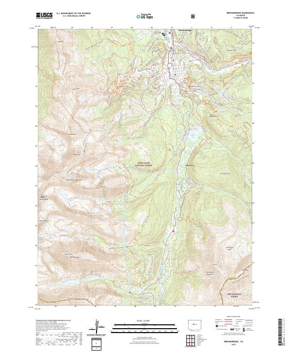 2022 Breckenridge2022 Print · USGSBreckenridge and the surrounding high alpine peaks of the Tenmile Range are captured here in the early twenty-first century. Researchers can trace historic mining-era names like Gibson Hill and Prospect Hill or locate the Breckenridge Masonic Cem near the Blue River.
 - 2022 Map of Frisco, 2022 Print
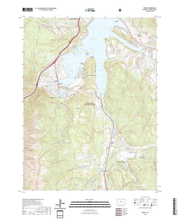 2022 Frisco2022 Print · USGSThe Summit County high country is shown here in the early 2020s as a thriving hub of mountain recreation and water management. Genealogists and hikers can trace old pathways near Masontown, locate Frisco Cem, and explore the banks of Dillon Reservoir.
End of results
Showing maps 1-2 of 2
Top cities near Breckenridge
- Silverthorne historical maps
- Frisco historical maps
- Dillon historical maps
- Blue River historical maps
- Alma historical maps
- Montezuma historical maps
See more
Frequently asked questions
- What are the different types of historical maps available for Breckenridge?
- What is the oldest map of Breckenridge?
- Where can I purchase historical maps of Breckenridge for my home or office?
- Where can I download high-res historical maps of Breckenridge?
- Are there historical topographic maps available for Breckenridge?
- Is there historical aerial imagery available for Breckenridge?
- Where are historical maps of Breckenridge sourced from?