1960s Maps of Washington County, Colorado
Explore 2 historic maps of Washington County from the 1960s. These maps offer a rare glimpse into what life looked like during the 1960s — showing old roads, neighborhoods, homes, and landmarks that have changed or disappeared over time.
Whether you're researching your family's past, planning a metal detecting trip, or studying how Washington County's landscape evolved across the 1960s, these high-resolution maps are a powerful tool for exploring the history of this region.
- Focus on a specific era: All maps on this page are from the 1960s, giving you a focused view of this time period.
- See what’s changed: Compare century-old streets, trails, and buildings to today's modern landscape using overlays and satellite layers.
- Research with precision: Use these maps for genealogy, historical research, land use analysis, or educational projects.
- View, download, or print: Maps are fully viewable online in high resolution, and can be downloaded or printed for your own records.
Start exploring Washington County's history through authentic maps from the 1960s. This is your window into the past.
Washington County, CO maps
(2)- 1965 Map of Gary, 1967 Print
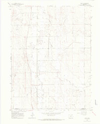 1965 Gary1967 Print · USGSMorgan County and Washington County meet on the high plains during the mid-sixties, an era of expanding water and oil infrastructure. Genealogists and historians can trace the small settlements of Gary and Stivers alongside the winding Beaver Creek.2 unique versions available
 - 1965 Map of Huey Ranch, 1967 Print
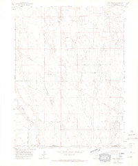 1965 Huey Ranch1967 Print · USGSEastern Colorado ranching and oil extraction meet on the high plains in the mid-1960s. Researchers can trace family-named landmarks like Huey Ranch and Rediess Ranch or the industrial footprint of the Sand River Oil Field.3 unique versions available
End of results
Showing maps 1-2 of 2
Top cities of Washington County
Frequently asked questions
- What are the different types of historical maps available for Washington County?
- What is the oldest map of Washington County?
- Where can I purchase historical maps of Washington County for my home or office?
- Where can I download high-res historical maps of Washington County?
- Are there historical topographic maps available for Washington County?
- Is there historical aerial imagery available for Washington County?
- Where are historical maps of Washington County sourced from?