Old Maps of Washington County, Colorado for Metal Detecting
Plan your next treasure hunt with 359 historic maps of Washington County. Find old homesites, ghost towns, trails, and gathering spots that may be lost to time — perfect for identifying promising metal detecting locations.
- Locate forgotten sites: Uncover places like long-lost settlements, abandoned rail lines, or gathering spots.
- Plan better hunts: Use map overlays combined with LiDAR or satellite views to narrow in on historically rich areas.
- Made for detectorists: Thousands of hobbyists use these maps to discover relics, coins, and hidden history.
Use these historic maps to boost your research and find new opportunities beneath the surface of Washington County.
Washington County, CO maps
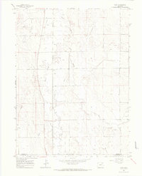
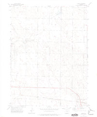
(359)- 1951 Map of Messex, 1952 Print
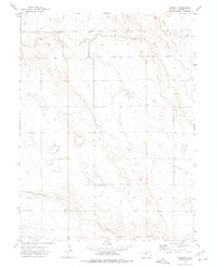
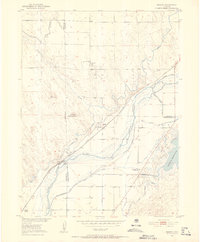 1951 Messex1952 Print · USGSEastern Colorado plains life in the early fifties revolves around the river and the rails. Trace family roots at the Roosevelt School or Merino Cemetery, and explore the vital irrigation systems including the Sterling Canal and Prewitt Reservoir.4 unique versions available
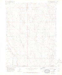
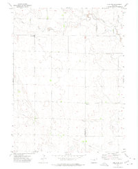
 - 1951 Map of Merino SW, 1952 Print
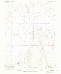
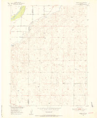 1951 Merino SW1952 Print · USGSNortheastern Colorado’s plains are captured here in the early fifties, documenting the remote ranching lands between Washington and Morgan counties. Researchers can trace rural life through the Highland School, the waters of Emerson Lake, and the winding South Platte River.5 unique versions available
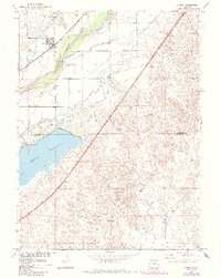
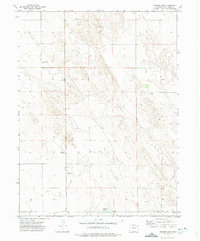
 - 1951 Map of Merino SE, 1953 Print
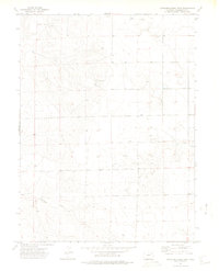
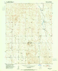 1951 Merino SE1953 Print · USGSThe Colorado high plains of Washington County appear here in the early fifties, a landscape defined by ranching and rural education. Genealogists and historians can locate family landmarks like the Flying YJ Ranch or trace the districts of the North Buena Vista School and South Buena Vista School.3 unique versions available
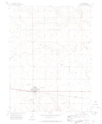
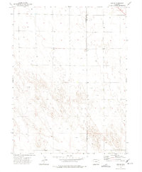
 - 1951 Map of Merino, 1953 Print
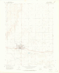
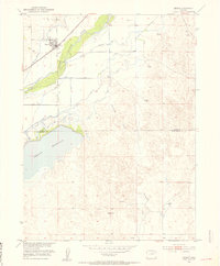 1951 Merino1953 Print · USGSMerino and the surrounding plains are captured in the early fifties, showcasing a landscape shaped by irrigation and the railroad. Genealogists and researchers can trace the Union Pacific line, the South Platte River corridor, and the waters of Prewitt Reservoir.3 unique versions available
 - 1954 Map of Limon
 1954 Limon1954 Print · USGSThe Eastern Colorado plains and the Kansas borderlands come alive in the mid-fifties, showing the vital rail-and-road corridor through Limon. Genealogists and historians can trace the Chicago Rock Island & Pacific line through Burlington and find remote outposts like Arickaree and Anton.4 unique versions available
 - 1954 Map of Sterling
 1954 Sterling1954 Print · USGSNortheastern Colorado and the Nebraska borderlands are defined by the river-and-rail corridors of the mid-twentieth century. Researchers can trace the development of agricultural hubs from Sterling and Fort Morgan to smaller rail stops along the Union Pacific and Burlington Northern lines.3 unique versions available
 - 1957 Map of Limon
 1957 Limon1957 Print · USGSThe High Plains of Eastern Colorado and Western Kansas come alive in the mid-1950s, showing the vital rail-and-road connections of the era. You can trace the path of the Chicago Rock Island and Pacific through towns like Limon, Stratton, and Burlington or find the early footprint of Bonny Reservoir.
 - 1958 Map of Limon
 1958 Limon1958 Print · USGSEastern Colorado and the Kansas border meet in this late-fifties study of High Plains rail and river systems. Researchers can trace the path of the Chicago Rock Island and Pacific through Limon and Burlington, or locate the Bonny Dam and Bonny Reservoir.
 - 1958 Map of Sterling
 1958 Sterling1958 Print · USGSNortheastern Colorado thrived along the river and rail corridors during the late fifties. Genealogists and historians can trace family-named irrigation works like Davis Brothers Ditch and agricultural hubs from Peetz to Fort Morgan.
 - 1965 Map of Gary, 1967 Print
 1965 Gary1967 Print · USGSMorgan County and Washington County meet on the high plains during the mid-sixties, an era of expanding water and oil infrastructure. Genealogists and historians can trace the small settlements of Gary and Stivers alongside the winding Beaver Creek.2 unique versions available
 - 1965 Map of Huey Ranch, 1967 Print
 1965 Huey Ranch1967 Print · USGSEastern Colorado ranching and oil extraction meet on the high plains in the mid-1960s. Researchers can trace family-named landmarks like Huey Ranch and Rediess Ranch or the industrial footprint of the Sand River Oil Field.3 unique versions available
 - 1971 Map of Messex, 1984 Print
 1971 Messex1984 Print · USGSThe South Platte River valley in the early seventies shows a complex irrigation landscape at the borders of Logan and Morgan Counties. Researchers can trace the Union Pacific rail line through small settlements like Messex and locate landmarks such as the Roosevelt School and Merino Cemetery.
 - 1971 Map of Merino, 1984 Print
 1971 Merino1984 Print · USGSNortheastern Colorado’s agricultural heartland is captured here in the early 1970s, where the river and rail meet at the town of Merino. Researchers can trace the extensive irrigation network including the Pawnee Ditch and the shoreline of the massive Prewitt Reservoir.
 - 1972 Map of New Haven, 1975 Print
 1972 New Haven1975 Print · USGSThe high plains of Northeast Colorado are captured here in the early seventies, showing a quiet rural landscape at the meeting point of three counties. Genealogists and local historians can trace the early layout of New Haven and the paths of Coyote Creek and Red Willow Creek.
 - 1972 Map of Glacken Hill, 1975 Print
 1972 Glacken Hill1975 Print · USGSThe High Plains of Colorado meet at the border of Logan and Washington Counties in the early seventies. Genealogists and local historians can trace the sparse settlement of Fitzjohn or locate specific landmarks like Glacken Hill and the Radio Tower.
 - 1972 Map of Otis, 1975 Print
 1972 Otis1975 Print · USGSThe town of Otis is captured in the early 1970s, showing a prairie landscape shaped by the rail line and dryland infrastructure. Genealogists and researchers can trace the town layout including the High Sch, Cem, and the nearby Calhoun siding.3 unique versions available
 - 1972 Map of Hyde, 1975 Print
 1972 Hyde1975 Print · USGSEastern Colorado's High Plains are captured here in the early seventies, showing a landscape defined by rail transport and energy extraction. Genealogists and historians can locate the Hyde Cem and trace the Burlington Northern line through Suiter and Yuma Siding.
 - 1972 Map of Lone Star, 1975 Print
 1972 Lone Star1975 Print · USGSThe high plains of the Colorado panhandle are captured in the early seventies, centered on the rural settlement of Lone Star. Genealogists and local historians can trace the paths of Rock Creek and Red Willow Creek or locate landmarks like the Meridian and isolated Well sites.
 - 1972 Map of Snyder Lake, 1975 Print
 1972 Snyder Lake1975 Print · USGSEastern Colorado's High Plains are captured here in the early seventies, showing a landscape shaped by intermittent watercourses and land surveying. Researchers can locate specific sites of local industry and infrastructure, such as a Drill Hole, Gravel Pit, and the namesake Snyder Lake.
 - 1972 Map of Otis SE, 1975 Print
 1972 Otis SE1975 Print · USGSEastern Colorado high-plains terrain is documented in the early seventies along the Washington Co and Yuma Co line. Local historians and researchers can trace a landscape defined by industrial water access via numerous Well sites and a central Gravel Pit.
 - 1972 Map of Burdett, 1975 Print
 1972 Burdett1975 Print · USGSBurdett and the rural expanses of Washington County are captured here in the early seventies, showing a quiet landscape of High Plains ranching and farming. Researchers can trace local landmarks like Hope Cem, the waters of Rock Creek, and the small settlement at Hansen.
 - 1973 Map of Woodrow, 1975 Print
 1973 Woodrow1975 Print · USGSWashington County, Colorado, is captured during a period of active energy development in the early 1970s. Researchers can trace the layout of the Kejr Oil Field and find specific landmarks like the settlement of Woodrow and the banks of Beaver Creek.
 - 1973 Map of Antelope Creek East, 1976 Print
 1973 Antelope Creek East1976 Print · USGSNortheastern Colorado’s plains are documented here in the early 1970s, showing a landscape defined by cattle country and oil exploration. Genealogists and local historians can locate the Elba Cem and trace the paths of Buck Creek and Antelope Creek.2 unique versions available
 - 1973 Map of Akron, 1976 Print
 1973 Akron1976 Print · USGSAkron flourished as a railroad and oil hub on the High Plains during the early seventies. Genealogists and local historians can trace the town's development through the County Fairground, local Cemetery, and the sprawling East Akron Oil Field.2 unique versions available
 - 1973 Map of Buffalo Springs Ranch NW, 1976 Print
 1973 Buffalo Springs Ranch NW1976 Print · USGSThe High Plains along the Logan and Washington County line are captured in the early 1970s, showing a landscape of institutional research and frontier history. Genealogists and historians can locate the Historical Marker (Summit Springs Battlefield) and the Colo State University Research Station.
Showing maps 1-25 of 359
Top cities of Washington County
Frequently asked questions
- What are the different types of historical maps available for Washington County?
- What is the oldest map of Washington County?
- Where can I purchase historical maps of Washington County for my home or office?
- Where can I download high-res historical maps of Washington County?
- Are there historical topographic maps available for Washington County?
- Is there historical aerial imagery available for Washington County?
- Where are historical maps of Washington County sourced from?