1970s Maps of Washington County, Colorado
Explore 54 historic maps of Washington County from the 1970s. These maps offer a rare glimpse into what life looked like during the 1970s — showing old roads, neighborhoods, homes, and landmarks that have changed or disappeared over time.
Whether you're researching your family's past, planning a metal detecting trip, or studying how Washington County's landscape evolved across the 1970s, these high-resolution maps are a powerful tool for exploring the history of this region.
- Focus on a specific era: All maps on this page are from the 1970s, giving you a focused view of this time period.
- See what’s changed: Compare century-old streets, trails, and buildings to today's modern landscape using overlays and satellite layers.
- Research with precision: Use these maps for genealogy, historical research, land use analysis, or educational projects.
- View, download, or print: Maps are fully viewable online in high resolution, and can be downloaded or printed for your own records.
Start exploring Washington County's history through authentic maps from the 1970s. This is your window into the past.
Washington County, CO maps
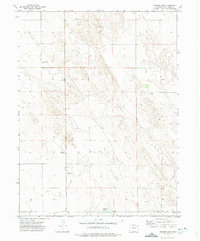
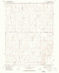
(54)- 1971 Map of Messex, 1984 Print
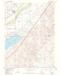
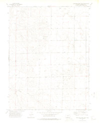
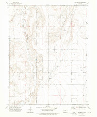
 1971 Messex1984 Print · USGSThe South Platte River valley in the early seventies shows a complex irrigation landscape at the borders of Logan and Morgan Counties. Researchers can trace the Union Pacific rail line through small settlements like Messex and locate landmarks such as the Roosevelt School and Merino Cemetery.
 - 1971 Map of Merino, 1984 Print
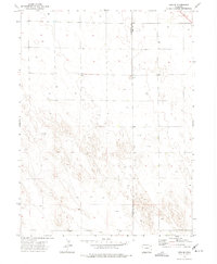
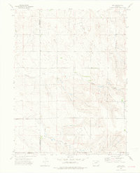
 1971 Merino1984 Print · USGSNortheastern Colorado’s agricultural heartland is captured here in the early 1970s, where the river and rail meet at the town of Merino. Researchers can trace the extensive irrigation network including the Pawnee Ditch and the shoreline of the massive Prewitt Reservoir.
 - 1972 Map of New Haven, 1975 Print
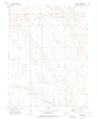
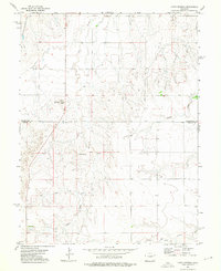
 1972 New Haven1975 Print · USGSThe high plains of Northeast Colorado are captured here in the early seventies, showing a quiet rural landscape at the meeting point of three counties. Genealogists and local historians can trace the early layout of New Haven and the paths of Coyote Creek and Red Willow Creek.
 - 1972 Map of Glacken Hill, 1975 Print
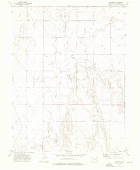
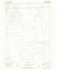
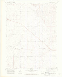
 1972 Glacken Hill1975 Print · USGSThe High Plains of Colorado meet at the border of Logan and Washington Counties in the early seventies. Genealogists and local historians can trace the sparse settlement of Fitzjohn or locate specific landmarks like Glacken Hill and the Radio Tower.
 - 1972 Map of Otis, 1975 Print
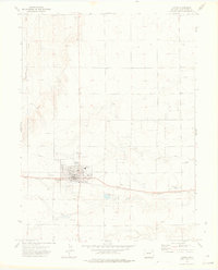
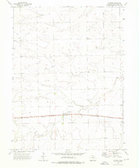
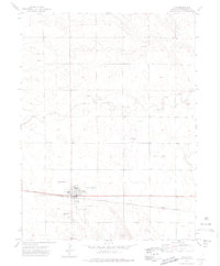 1972 Otis1975 Print · USGSThe town of Otis is captured in the early 1970s, showing a prairie landscape shaped by the rail line and dryland infrastructure. Genealogists and researchers can trace the town layout including the High Sch, Cem, and the nearby Calhoun siding.3 unique versions available
 - 1972 Map of Hyde, 1975 Print
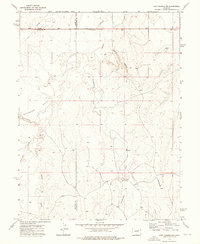
 1972 Hyde1975 Print · USGSEastern Colorado's High Plains are captured here in the early seventies, showing a landscape defined by rail transport and energy extraction. Genealogists and historians can locate the Hyde Cem and trace the Burlington Northern line through Suiter and Yuma Siding.
 - 1972 Map of Lone Star, 1975 Print
 1972 Lone Star1975 Print · USGSThe high plains of the Colorado panhandle are captured in the early seventies, centered on the rural settlement of Lone Star. Genealogists and local historians can trace the paths of Rock Creek and Red Willow Creek or locate landmarks like the Meridian and isolated Well sites.
 - 1972 Map of Snyder Lake, 1975 Print
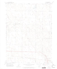
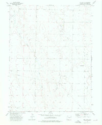
 1972 Snyder Lake1975 Print · USGSEastern Colorado's High Plains are captured here in the early seventies, showing a landscape shaped by intermittent watercourses and land surveying. Researchers can locate specific sites of local industry and infrastructure, such as a Drill Hole, Gravel Pit, and the namesake Snyder Lake.
 - 1972 Map of Otis SE, 1975 Print
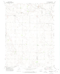
 1972 Otis SE1975 Print · USGSEastern Colorado high-plains terrain is documented in the early seventies along the Washington Co and Yuma Co line. Local historians and researchers can trace a landscape defined by industrial water access via numerous Well sites and a central Gravel Pit.
 - 1972 Map of Burdett, 1975 Print
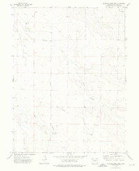
 1972 Burdett1975 Print · USGSBurdett and the rural expanses of Washington County are captured here in the early seventies, showing a quiet landscape of High Plains ranching and farming. Researchers can trace local landmarks like Hope Cem, the waters of Rock Creek, and the small settlement at Hansen.
 - 1973 Map of Woodrow, 1975 Print
 1973 Woodrow1975 Print · USGSWashington County, Colorado, is captured during a period of active energy development in the early 1970s. Researchers can trace the layout of the Kejr Oil Field and find specific landmarks like the settlement of Woodrow and the banks of Beaver Creek.
 - 1973 Map of Antelope Creek East, 1976 Print
 1973 Antelope Creek East1976 Print · USGSNortheastern Colorado’s plains are documented here in the early 1970s, showing a landscape defined by cattle country and oil exploration. Genealogists and local historians can locate the Elba Cem and trace the paths of Buck Creek and Antelope Creek.2 unique versions available
 - 1973 Map of Akron, 1976 Print
 1973 Akron1976 Print · USGSAkron flourished as a railroad and oil hub on the High Plains during the early seventies. Genealogists and local historians can trace the town's development through the County Fairground, local Cemetery, and the sprawling East Akron Oil Field.2 unique versions available
 - 1973 Map of Buffalo Springs Ranch NW, 1976 Print
 1973 Buffalo Springs Ranch NW1976 Print · USGSThe High Plains along the Logan and Washington County line are captured in the early 1970s, showing a landscape of institutional research and frontier history. Genealogists and historians can locate the Historical Marker (Summit Springs Battlefield) and the Colo State University Research Station.
 - 1973 Map of Antelope Creek West, 1976 Print
 1973 Antelope Creek West1976 Print · USGSThe high plains of Washington County are captured in the early 1970s, showing a landscape defined by ranching and oil extraction. Researchers can trace the isolated Ward Ranch, the settlement at Parslow, and the drainage patterns of Antelope Creek.
 - 1973 Map of Dry Gulch, 1976 Print
 1973 Dry Gulch1976 Print · USGSThe high plains of Washington County in the 1970s reveal a landscape of emerging energy infrastructure and isolated rural life. Researchers can trace the development of the Roderick Oil Field and locate landmarks like Abbott Ch and several remote Landing Strips.
 - 1973 Map of Last Chance SW, 1976 Print
 1973 Last Chance SW1976 Print · USGSThe eastern Colorado plains during the early 1970s are revealed here at the four-county junction of Arapahoe, Washington, Elbert, and Lincoln. Researchers can trace rural landmarks like Brooks Ranch and the winding course of Middlemist Creek across this high-country landscape.
 - 1973 Map of Lindon NE, 1976 Print
 1973 Lindon NE1976 Print · USGSEastern Colorado in the early 1970s reveals a landscape shaped by energy exploration and ranching. Genealogists and historians can trace the infrastructure of the Lindon Oil Field, individual Oil Well locations, and the path of Gordon Creek.
 - 1973 Map of Platner, 1976 Print
 1973 Platner1976 Print · USGSWashington County, Colorado, is captured in the early 1970s as a landscape defined by the railroad and emerging energy exploration. Local historians can trace the townsite of Platner along the Burlington Northern rail line and locate early resource markers like Oil Well and Surveyor Creek.
 - 1973 Map of Last Chance NW, 1976 Print
 1973 Last Chance NW1976 Print · USGSThe High Plains of Eastern Colorado are captured here in the early 1970s as agricultural life centered on the tri-county border. Genealogists and researchers can trace local landmarks like Prairie Farms, the Landing Strip, and the winding Beaver Creek.
 - 1973 Map of Woodrow NW, 1976 Print
 1973 Woodrow NW1976 Print · USGSThe rural border of Washington and Adams Counties is shown here in the 1970s as an active center of energy production. Researchers can trace the layout of the local Oil Field, identifying Oil Wells and the Arapahoe Pumping Sta along Badger Creek.
 - 1973 Map of Rago, 1976 Print
 1973 Rago1976 Print · USGSThe High Plains of Washington County appear here in the early 1970s, during a period of active petroleum development. Genealogists and historians can trace the intersection of the Morgan and Washington County line near Rago and the Rago Oil Field.3 unique versions available
 - 1973 Map of Lusto Springs, 1976 Print
 1973 Lusto Springs1976 Print · USGSThe High Plains of Eastern Colorado come into focus during the early seventies, spanning the border of Washington and Lincoln counties. Researchers can trace the ranching landscape near Lusto Springs and locate early settlements like Falch and Sutton.
 - 1973 Map of Buffalo Springs Ranch NE, 1976 Print
 1973 Buffalo Springs Ranch NE1976 Print · USGSThe Colorado plains at the Logan and Washington county line appear here during the early seventies. Genealogists and researchers can locate rural gathering spots like the Kelly Community Center and trace landmarks like Rock Creek and the Pipeline.3 unique versions available
 - 1973 Map of Fremont Butte, 1976 Print
 1973 Fremont Butte1976 Print · USGSWashington County, Colorado, is seen here during the early 1970s as a landscape of rail-line settlements and active energy exploration. Genealogists and local historians can locate the community of Xenia, trace the Burlington Northern tracks, and identify numerous Oil Wells across the plain.3 unique versions available
Showing maps 1-25 of 54
Top cities of Washington County
Frequently asked questions
- What are the different types of historical maps available for Washington County?
- What is the oldest map of Washington County?
- Where can I purchase historical maps of Washington County for my home or office?
- Where can I download high-res historical maps of Washington County?
- Are there historical topographic maps available for Washington County?
- Is there historical aerial imagery available for Washington County?
- Where are historical maps of Washington County sourced from?