
1951 Map of Messex
USGS Topo · Published 1952About this map
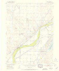
The South Platte River and its intricate network of irrigation channels define this 1951 landscape at the junction of Morgan, Logan, and Washington counties. Settled areas like Messex and Beta appear alongside the Union Pacific Railroad, which follows the river's path through the valley. The map documents an intensive agricultural and industrial transformation of the plains, evident in the numerous water features such as the Sterling Canal, Pawnee Ditch, and Riverside Canal. Genealogists and local historians can locate the Roosevelt School and Merino Cemetery, while the presence of the Merino Oil Field and various Gravel Pits reflects the area's mid-century resource extraction. The southern portion is dominated by the Prewitt Reservoir and its Inlet Canal, illustrating the vital role of water management in sustaining these High Plains communities during the post-war era.
Find a feature on this map
26 named features on this map. Tap any name to fly to it.
Don’t see what you’re looking for? This feature index may not catch every label — zoom into the map to look around manually.
Map Details
Editions of this 1951 Messex Map
4 editions found
Other maps of this area

1951 · Willard
USGS Topo · 1:24,000

1951 · Antelope Springs
USGS Topo · 1:24,000

1951 · Merino SW
USGS Topo · 1:24,000

1951 · Brush East
USGS Topo · 1:24,000

1951 · Merino SE
USGS Topo · 1:24,000

1951 · Merino
USGS Topo · 1:24,000

1951 · Atwood
USGS Topo · 1:24,000

1954 · Sterling
USGS Topo · 1:250,000

1958 · Sterling
USGS Topo · 1:250,000

1971 · Brush East
USGS Topo · 1:24,000