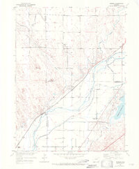
1951 Map of Messex
USGS Topo · Published 1972About this map
The South Platte River carves a diagonal path through this corner of northeast Colorado, anchoring a complex network of irrigation infrastructure and rural settlements. This 1951 survey reveals the critical role of water management in the High Plains, documented through the Sterling Pacific Canal, North Sterling Canal, and the Prewitt Reservoir. These waterways supported the farming communities of Messex, Beta, and Balzac, which are positioned along the corridor of the Union Pacific Railroad.
Find a feature on this map
28 named features on this map. Tap any name to fly to it.
Don’t see what you’re looking for? This feature index may not catch every label — zoom into the map to look around manually.
Map Details
Editions of this 1951 Messex Map
4 editions found
Other maps of this area

1951 · Willard
USGS Topo · 1:24,000

1951 · Messex
USGS Topo · 1:24,000

1951 · Antelope Springs
USGS Topo · 1:24,000

1951 · Merino SW
USGS Topo · 1:24,000

1951 · Brush East
USGS Topo · 1:24,000

1951 · Merino SE
USGS Topo · 1:24,000

1951 · Merino
USGS Topo · 1:24,000

1951 · Atwood
USGS Topo · 1:24,000

1954 · Sterling
USGS Topo · 1:250,000

1958 · Sterling
USGS Topo · 1:250,000