1950s Maps of Evans, Colorado
Explore 10 historic maps of Evans from the 1950s. These maps offer a rare glimpse into what life looked like during the 1950s — showing old roads, neighborhoods, homes, and landmarks that have changed or disappeared over time.
Whether you're researching your family's past, planning a metal detecting trip, or studying how Evans's landscape evolved across the 1950s, these high-resolution maps are a powerful tool for exploring the history of this region.
- Focus on a specific era: All maps on this page are from the 1950s, giving you a focused view of this time period.
- See what’s changed: Compare century-old streets, trails, and buildings to today's modern landscape using overlays and satellite layers.
- Research with precision: Use these maps for genealogy, historical research, land use analysis, or educational projects.
- View, download, or print: Maps are fully viewable online in high resolution, and can be downloaded or printed for your own records.
Start exploring Evans's history through authentic maps from the 1950s. This is your window into the past.
Evans, CO maps
(10)- 1950 Map of Greeley
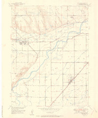
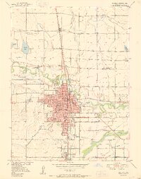 1950 Greeley1950 Print · USGSGreeley and Evans thrive at the mid-century confluence of the Cache La Poudre and South Platte Rivers. Researchers can trace historic neighborhoods and landmarks like the Spanish Colony, Linn Grove Cemetery, and the Union Pacific rail network.8 unique versions available
 - 1950 Map of Bracewell, 1960 Print
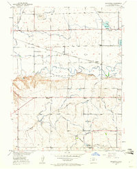 1950 Bracewell1960 Print · USGSWeld County’s agricultural heartland is captured here at mid-century, defined by the irrigation canals of the Cache La Poudre valley. Genealogists can trace family landmarks and school sites like Hazelton School, Bracewell, and the Lucas School (Aban'd).7 unique versions available
 - 1950 Map of Milliken, 1964 Print
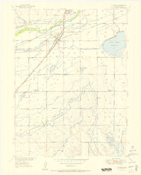
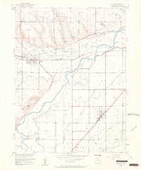 1950 Milliken1964 Print · USGSWeld County’s agricultural and rail heartland is captured here at mid-century, defined by the irrigation network surrounding the South Platte River. Researchers can trace the Union Pacific lines, locate the Fort St Vrain Ruins, and find vanished school sites like Fairview School.6 unique versions available
 - 1950 Map of La Salle, 1991 Print
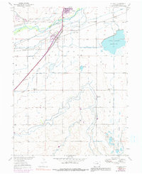 1950 La Salle1991 Print · USGSWeld County agriculture and rail transit thrived mid-century as the Union Pacific spurred growth in La Salle and Evans. Genealogists and researchers can trace rural life through the locations of the Big Bend and Beebe Draw Schools and the Lower Latham Reservoir.
 - 1951 Map of Milliken
 1951 Milliken1951 Print · USGSWeld County’s agricultural heartland is captured here in the early fifties as the rail-and-river economy flourished. Genealogists and historians can trace the Great Western rail lines and locate landmarks like Fairview School and the Fort St Vrain ruins.
 - 1951 Map of La Salle
 1951 La Salle1951 Print · USGSMid-century Weld County is captured here at a peak of rail and irrigation development near the South Platte. Researchers can trace rural school districts like Big Bend School and Beebe Draw School or the complex water network of the Lower Latham Reservoir.4 unique versions available
 - 1951 Map of Bracewell
 1951 Bracewell1951 Print · USGSNorthern Colorado's agricultural heartland is documented here in the early fifties, showing the complex irrigation networks of the Poudre Valley. Researchers can trace rural school districts like Hazelton School and old rail stops such as Bracewell and Farmers.2 unique versions available
 - 1954 Map of Greeley, 1966 Print
 1954 Greeley1966 Print · USGSNorthern Colorado transitions from high-alpine peaks to the irrigated South Platte valley during this mid-century period of growth. Genealogists and historians can trace rail-connected hubs like Greeley and Longmont alongside landmarks like Horsetooth Reservoir and Estes Park.3 unique versions available
 - 1957 Map of Greeley
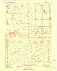
 1957 Greeley1957 Print · USGSNorthern Colorado in the mid-fifties is captured here as the agricultural plains of Weld County meet the high peaks of the Front Range. Genealogists and historians can trace rail-linked towns like Keenesburg and Roggen or locate early water features such as Boyd Lake and Fossil Creek Reservoir.
 - 1958 Map of Greeley
 1958 Greeley1958 Print · USGSNorthern Colorado and the high peaks of the Front Range appear here in the mid-fifties as the region's agricultural and rail networks were fully established. Genealogists can locate family homes near Virginia Dale, Waverly, or Kuner, and trace the path of the Union Pacific Railroad through Greeley.
End of results
Showing maps 1-10 of 10
Top cities near Evans
- Greeley historical maps
- Windsor historical maps
- Johnstown historical maps
- Firestone historical maps
- Frederick historical maps
- Severance historical maps
See more
Top neighborhoods of Evans
Frequently asked questions
- What are the different types of historical maps available for Evans?
- What is the oldest map of Evans?
- Where can I purchase historical maps of Evans for my home or office?
- Where can I download high-res historical maps of Evans?
- Are there historical topographic maps available for Evans?
- Is there historical aerial imagery available for Evans?
- Where are historical maps of Evans sourced from?