1950s Maps of Westminster, Colorado
Explore 10 historic maps of Westminster from the 1950s. These maps offer a rare glimpse into what life looked like during the 1950s — showing old roads, neighborhoods, homes, and landmarks that have changed or disappeared over time.
Whether you're researching your family's past, planning a metal detecting trip, or studying how Westminster's landscape evolved across the 1950s, these high-resolution maps are a powerful tool for exploring the history of this region.
- Focus on a specific era: All maps on this page are from the 1950s, giving you a focused view of this time period.
- See what’s changed: Compare century-old streets, trails, and buildings to today's modern landscape using overlays and satellite layers.
- Research with precision: Use these maps for genealogy, historical research, land use analysis, or educational projects.
- View, download, or print: Maps are fully viewable online in high resolution, and can be downloaded or printed for your own records.
Start exploring Westminster's history through authentic maps from the 1950s. This is your window into the past.
Westminster, CO maps
(10)- 1950 Map of Arvada
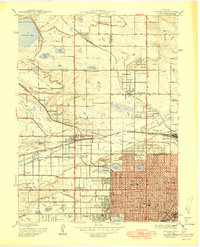 1950 Arvada1950 Print · USGSMid-century Jefferson County comes to life as Denver’s western edge begins its suburban transformation from a landscape of irrigation ditches and small farms. Researchers can trace the original footprints of Arvada, Wheatridge, and local landmarks like the Crown Hill Cemetery and Regis College.
 - 1950 Map of Louisville, 1955 Print
 1950 Louisville1955 Print · USGSThe Boulder Valley coal fields and irrigation networks are on full display in the mid-twentieth century. Researchers can trace dozens of mining sites like the Eldorado Mine, find the Superior Cemetery, and locate rural schools including Marshall Sch.
 - 1953 Map of Denver, 1964 Print
 1953 Denver1964 Print · USGSDenver and the Colorado Front Range are captured here during a decade of post-war growth and military expansion. Researchers can trace the sprawling rail lines of the Union Pacific, locate the State Capitol, and explore historic mountain mining hubs like Central City.6 unique versions available
 - 1956 Map of Lafayette, 1958 Print
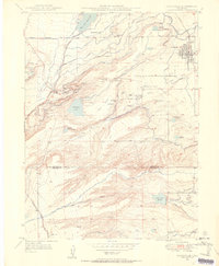
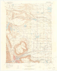
 1956 Lafayette1958 Print · USGSBoulder County experiences a post-war transition in the mid-fifties as the new turnpike and traditional mining industries coexist. Researchers can trace early suburban expansion in Broomfield Heights while locating the Centennial Mine and local landmarks like Ruston Heights Airport.
 - 1957 Map of Denver
 1957 Denver1957 Print · USGSDenver and the Colorado Front Range are seen here during a mid-century period of intense military and urban expansion. Trace the footprints of the Rocky Mountain Arsenal, the early United States Air Force Academy, and the Lowry AF Base.
 - 1957 Map of Louisville, 1958 Print
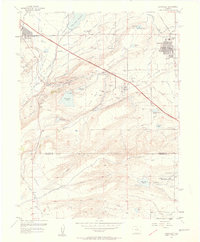 1957 Louisville1958 Print · USGSThe northern Colorado coalfields and rural landscapes are captured here during a period of industrial transition. Researchers can trace numerous historic coal operations like the Cracker Jack Mine and Industrial Mine, alongside the early Denver Boulder Turnpike.2 unique versions available
 - 1957 Map of Eastlake, 1958 Print
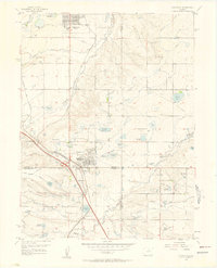
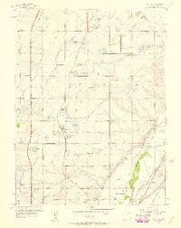 1957 Eastlake1958 Print · USGSAdams County’s farming and irrigation heartland is frozen in time in the late fifties, just as the metropolitan area began its northward shift. Researchers can trace historic water rights and small-town roots through landmarks like Eastlake, the Wesley Cem, and the Union Pacific rail siding at Hazeltine.2 unique versions available
 - 1957 Map of Arvada, 1958 Print
 1957 Arvada1958 Print · USGSThe northwest Denver suburbs are caught in a moment of post-war transformation, balancing old canal-fed agriculture with new residential growth. Local historians can trace established landmarks like Elitch Gardens, Regis College, and the sprawling Crown Hill Cemetery.3 unique versions available
 - 1957 Map of Golden, 1958 Print
 1957 Golden1958 Print · USGSGolden and its surrounding mesas are shown in the late fifties as the area balanced mining, academia, and military training. Researchers can trace local institutions like the Colorado School of Mines, the extensive Mount Olivet Cemetery, and Camp George West.3 unique versions available
 - 1958 Map of Denver
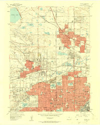
 1958 Denver1958 Print · USGSDenver and the Colorado Front Range are captured here during the mid-century suburban boom. Trace the footprints of military installations like Buckley Air Force Base alongside the established rail networks of the Colorado & Southern Ry.
End of results
Showing maps 1-10 of 10
Top cities near Westminster
- Denver historical maps
- Aurora historical maps
- Lakewood historical maps
- Thornton historical maps
- Arvada historical maps
- Boulder historical maps
See more
Top neighborhoods of Westminster
- Wallace Village historical maps
- Northridge Manor historical maps
- Bradburn historical maps
- Cedar Bridge historical maps
- Hillcrest historical maps
- The Meadows at Timber Lake historical maps
See more
Frequently asked questions
- What are the different types of historical maps available for Westminster?
- What is the oldest map of Westminster?
- Where can I purchase historical maps of Westminster for my home or office?
- Where can I download high-res historical maps of Westminster?
- Are there historical topographic maps available for Westminster?
- Is there historical aerial imagery available for Westminster?
- Where are historical maps of Westminster sourced from?