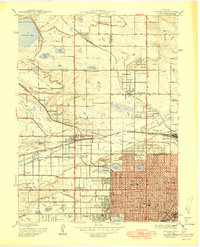
1950 Map of Arvada
USGS Topo · Published 1950About this map
The agricultural landscape of the Denver periphery is documented here just as suburban expansion began to reshape Jefferson and Adams counties. Built around the flow of Clear Creek and an intricate network of irrigation such as the Farmers Highline Canal and Farmers Highline Ditch, the region shows a transition from rural homesteading to organized towns. Small settlements like Fruitdale and Wheatridge appear alongside established education and charitable landmarks including Regis College, Bellevue College, and the St Vincents Home.
Find a feature on this map
58 named features on this map. Tap any name to fly to it.
Don’t see what you’re looking for? This feature index may not catch every label — zoom into the map to look around manually.
Map Details
Editions of this 1950 Arvada Map
This is the sole edition of this map. No revisions or reprints were ever made.
Other maps of this area

1890 · East Denver
USGS Topo · 1:125,000

1899 · West Denver
USGS Topo · 1:125,000

1935 · East Denver Nos. 3 and 4
USGS Topo · 1:48,000

1938 · Morrison
USGS Topo · 1:24,000

1938 · Derby
USGS Topo · 1:24,000

1939 · Golden
USGS Topo · 1:24,000

1940 · Englewood
USGS Topo · 1:31,680

1940 · Eastlake
USGS Topo · 1:31,680

1940 · Lafayette
USGS Topo · 1:31,680

1940 · Derby
USGS Topo · 1:31,680