Old Maps of Eckley, Colorado for Genealogy
Trace your family roots with 9 historic maps of Eckley. These high-res maps reveal old neighborhoods, homesites, landmarks, and streets — helping you uncover where your ancestors lived and how the area evolved over time.
- Explore historic neighborhoods: Identify where your relatives may have lived in the 1800s or 1900s.
- Compare maps over time: Trace the changes in streets, buildings, and landmarks for multi-generational research.
- Perfect for genealogy & ancestry research: Used by family historians and researchers to map out lineage and migration.
These maps are an incredible resource for exploring your personal connection to Eckley's past.
Eckley, CO maps
(9)- 1954 Map of Sterling
 1954 Sterling1954 Print · USGSNortheastern Colorado and the Nebraska borderlands are defined by the river-and-rail corridors of the mid-twentieth century. Researchers can trace the development of agricultural hubs from Sterling and Fort Morgan to smaller rail stops along the Union Pacific and Burlington Northern lines.3 unique versions available
 - 1958 Map of Sterling
 1958 Sterling1958 Print · USGSNortheastern Colorado thrived along the river and rail corridors during the late fifties. Genealogists and historians can trace family-named irrigation works like Davis Brothers Ditch and agricultural hubs from Peetz to Fort Morgan.
 - 1961 Map of Eckley, 1963 Print
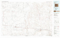
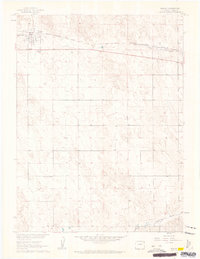 1961 Eckley1963 Print · USGSEckley and the surrounding high plains of Yuma County are documented here in the early sixties, as the region's agricultural layout was firmly established. Researchers can trace land boundaries through detailed fence lines and locate sites like the Eckley Cems, Bethel Community Hall, and the Chicago Burlington and Quincy rail line.3 unique versions available
 - 1981 Map of Wray, 1982 Print
 1981 Wray1982 Print · USGSThe high plains at the meeting of Colorado, Nebraska, and Kansas are documented here in the early 1980s. Local researchers can trace the Burlington Northern rail corridor and locate rural landmarks like Lone Star, Glocken Hill, and Dearing Lake.
 - 2010 Map of Eckley, 2010 Print
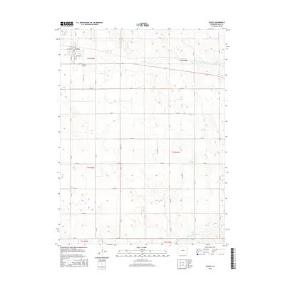
 2010 Eckley2010 Print · USGSCovers Eckley, including Yuma County, United States, and other nearby areas
 - 2013 Map of Eckley, 2013 Print
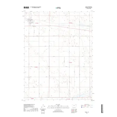
 2013 Eckley2013 Print · USGSCovers Eckley, including Yuma County, United States, and other nearby areas
 - 2016 Map of Eckley, 2016 Print
 2016 Eckley2016 Print · USGSCovers Eckley, including Yuma County, United States, and other nearby areas
 - 2019 Map of Eckley, 2019 Print
 2019 Eckley2019 Print · USGSCovers Eckley, including Yuma County, United States, and other nearby areas
 - 2022 Map of Eckley, 2022 Print
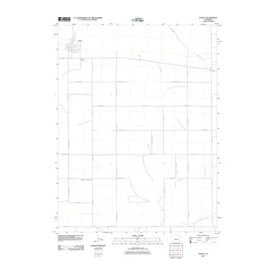
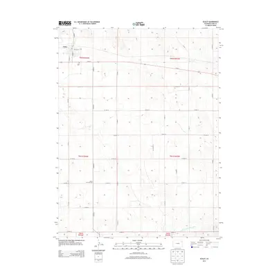
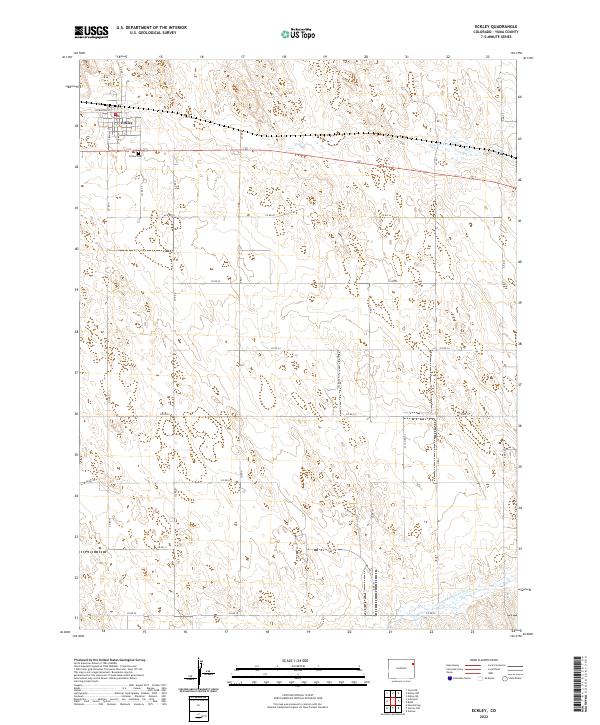 2022 Eckley2022 Print · USGSThe town of Eckley and the surrounding high plains of Yuma County are documented here in the early twenty-first century. Researchers can trace the layout of the settlement and find local landmarks like Eckley Cemetery and the course of Chief Creek.
End of results
Showing maps 1-9 of 9
Top cities near Eckley
Frequently asked questions
- What are the different types of historical maps available for Eckley?
- What is the oldest map of Eckley?
- Where can I purchase historical maps of Eckley for my home or office?
- Where can I download high-res historical maps of Eckley?
- Are there historical topographic maps available for Eckley?
- Is there historical aerial imagery available for Eckley?
- Where are historical maps of Eckley sourced from?