1950s Maps of Capitol Planning Region, Connecticut
Explore 40 historic maps of Capitol Planning Region from the 1950s. These maps offer a rare glimpse into what life looked like during the 1950s — showing old roads, neighborhoods, homes, and landmarks that have changed or disappeared over time.
Whether you're researching your family's past, planning a metal detecting trip, or studying how Capitol Planning Region's landscape evolved across the 1950s, these high-resolution maps are a powerful tool for exploring the history of this region.
- Focus on a specific era: All maps on this page are from the 1950s, giving you a focused view of this time period.
- See what’s changed: Compare century-old streets, trails, and buildings to today's modern landscape using overlays and satellite layers.
- Research with precision: Use these maps for genealogy, historical research, land use analysis, or educational projects.
- View, download, or print: Maps are fully viewable online in high resolution, and can be downloaded or printed for your own records.
Start exploring Capitol Planning Region's history through authentic maps from the 1950s. This is your window into the past.
Capitol Planning Region, CT maps
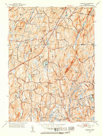
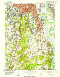
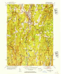
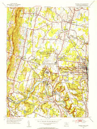
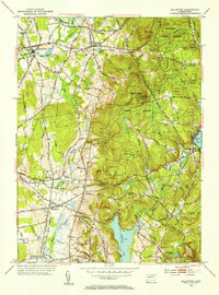
(40)- 1951 Map of Tariffville
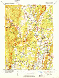 1951 Tariffville1951 Print · USGSNorth-central Connecticut thrives at the intersection of rail and river just after the war. You can trace family roots at Copper Hill Ch or locate the old Granby Station and Simsbury Landing Field.2 unique versions available
 - 1951 Map of New Hartford
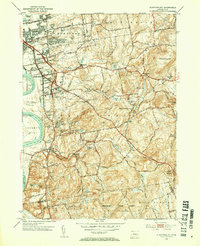
 1951 New Hartford1951 Print · USGSLitchfield and Hartford Counties appear here in the early fifties, centered on the massive Barkhamsted Reservoir and Saville Dam. Researchers can locate historic sites like the Washington Hill Ch, the Riverside Cem, and the Indian Council Cave.2 unique versions available
 - 1951 Map of Collinsville
 1951 Collinsville1951 Print · USGSThe Farmington River valley in the early fifties shows a landscape of growing reservoirs and busy rail lines. Trace family roots at Collinsville, find the State Fish Hatchery, or locate old schools like Lovely Street Sch.2 unique versions available
 - 1951 Map of Avon
 1951 Avon1951 Print · USGSMid-century Hartford County reveals a landscape of ridge-top landmarks and valley settlements along the Farmington River. Trace the grounds of the Avon Old Farms School, locate the Heublein Tower, and find family history at Cider Brook Cemetery.2 unique versions available
 - 1952 Map of Moodus, 1953 Print
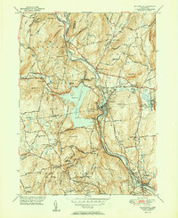
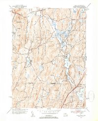
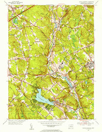
 1952 Moodus1953 Print · USGSThe Moodus area in the early fifties shows a landscape defined by industrial river power and maturing state forests. Genealogists and hikers can trace historic connections between Moodus, Leesville, and the Old Comstock Bridge while locating family plots at Bashan Lake Cem.3 unique versions available
 - 1952 Map of Westford, 1953 Print
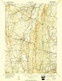
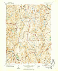
 1952 Westford1953 Print · USGSIn the hills of Tolland and Windham counties in the early fifties, rural life centered on crossroads like Union and Westford. Genealogists can trace family footprints at Swamp Burying Ground, Moose Meadow Sch, and Westford Village.5 unique versions available
 - 1952 Map of Middletown, 1954 Print
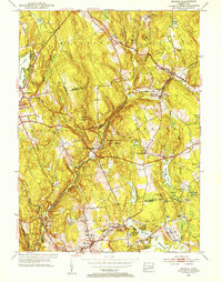
 1952 Middletown1954 Print · USGSThe Connecticut River valley thrives in the early fifties as Middletown and Portland expand around their industrial and academic roots. Genealogists and historians can locate Indian Hill Cemetery, the Swedish Orphanage, and the old Brazos Quarry.3 unique versions available
 - 1952 Map of Hartford North, 1954 Print
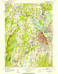
 1952 Hartford North1954 Print · USGSGreater Hartford is depicted in the early fifties as the city expanded across the river into the surrounding suburbs. Genealogists can trace family footprints through numerous urban cemeteries like Mt St Benedict Cemetery and historic institutions including Trinity College and St Thomas Seminary.3 unique versions available
 - 1952 Map of Manchester, 1954 Print
 1952 Manchester1954 Print · USGSManchester and the surrounding river valleys are captured here during the post-war growth of the early fifties. Genealogists and local historians can locate several family landmarks including Rye Street Cem, Talcottville, and the Nathan Hale Sch.3 unique versions available
 - 1952 Map of Hartford South, 1954 Print
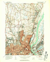
 1952 Hartford South1954 Print · USGSGreater Hartford and the Connecticut River valley are shown during a period of rapid suburban growth in the early fifties. Genealogists and historians can locate family landmarks like the Cedar Hill Cemetery, Trinity College, and the State Veterans Home.4 unique versions available
 - 1952 Map of Wales, 1954 Print
 1952 Wales1954 Print · USGSThe rural borders of Massachusetts and Connecticut are captured here in the early fifties, showcasing a landscape of dense state forests and quiet reservoirs. Trace family sites near St Anns Cem or explore the mid-century layouts of Wales, Holland, and Mashapaug.4 unique versions available
 - 1952 Map of Stafford Springs, 1955 Print
 1952 Stafford Springs1955 Print · USGSStafford and Willington are captured in the early fifties, showing a landscape defined by mill hamlets and the Central Vermont railroad. Genealogists can trace family names through the Stafford St Cem, Ellithorpe Cem, and the historic homes of Stafford Springs.5 unique versions available
 - 1953 Map of Colchester, 1954 Print
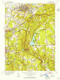
 1953 Colchester1954 Print · USGSColchester and its surrounding hamlets are captured in the early 1950s, revealing a landscape of historic crossroads and family-named corners. Genealogists can trace ancestral locations at St Johns Cem, Exeter Ch, and rural intersections like Avery Corner.7 unique versions available
 - 1953 Map of Monson, 1954 Print
 1953 Monson1954 Print · USGSMonson and the Massachusetts-Connecticut borderlands are detailed here in the early fifties, following the Central Vermont rail corridor. Genealogists can trace burial sites like Butler Cem and old family roads including Munn Road and Hollow Road.3 unique versions available
 - 1953 Map of Willimantic, 1954 Print
 1953 Willimantic1954 Print · USGSWillimantic and its surrounding hill country are captured here in the early fifties, showing a bustling rail junction at the height of its mid-century character. Trace the routes of the Central Vermont Railway, find the historic Trumbull Cem, or locate the old Willimantic State Teachers College.5 unique versions available
 - 1953 Map of Marlborough, 1954 Print
 1953 Marlborough1954 Print · USGSThis eastern Connecticut landscape near the Tolland and Hartford county line shows the region’s rural character in the early fifties. You can locate family history at Townsend Cem, trace the old New York New Haven and Hartford line, and see the early layout of Marlborough.4 unique versions available
 - 1953 Map of Bristol, 1954 Print
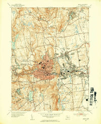 1953 Bristol1954 Print · USGSPost-war Bristol and its surrounding hills are captured here in transition from an industrial hub to a suburban landscape. Genealogists can trace family plots at St Josephs Cem or locate old neighborhood landmarks like Stafford Sch and Lake Compounce.3 unique versions available
 - 1953 Map of Windsor Locks, 1954 Print
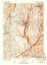
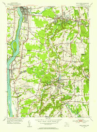
 1953 Windsor Locks1954 Print · USGSThe Connecticut River valley comes alive in the early fifties, centered on the growing aviation hub at Bradley Field. Genealogists can trace family roots through West Suffield Cem, Suffield Academy, and the historic grounds of Newgate Prison.3 unique versions available
 - 1953 Map of Broad Brook, 1954 Print
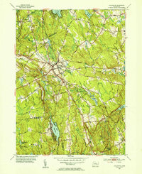
 1953 Broad Brook1954 Print · USGSHartford County's agricultural and industrial character is preserved here just after the war, showing the village centers of Broad Brook and Hazardville. Researchers can locate old family plots at St Patricks Cem, trace the local water power at Sadds Mill, or find the former site of the Wallop Sch.4 unique versions available
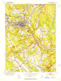
 - 1953 Map of New Britain, 1954 Print
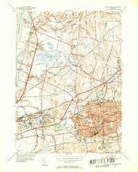
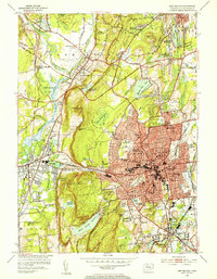 1953 New Britain1954 Print · USGSNew Britain and Plainville are shown at a peak of post-war expansion, where dense urban blocks meet the trap rock ridges of central Connecticut. Researchers can trace historic institutions like the State Teachers College, local industry near Farmington Sta, and the old Copper Mine.4 unique versions available
 - 1953 Map of Glastonbury, 1954 Print
 1953 Glastonbury1954 Print · USGSGlastonbury and East Hartford are shown during a period of post-war residential growth, as new villages expanded toward the eastern ridges. Researchers can trace the layout of early housing at Welles Village, locate historic burials at Still Hill Cem, or follow the path of the New London Turnpike.3 unique versions available
 - 1953 Map of Ellington, 1955 Print
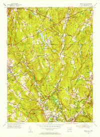
 1953 Ellington1955 Print · USGSThe Tolland County hills and Scantic River valley are captured here in the early fifties, showing a rural landscape defined by forestry and small-town crossroads. You can locate old landmarks like the Swiss Apostolic Ch, Jobs Hill Sch, and the winding Hartford and New Haven Turnpike.3 unique versions available
 - 1953 Map of South Coventry, 1955 Print
 1953 South Coventry1955 Print · USGSTolland County in the early fifties shows a landscape of developing university grounds and historic rural villages. Genealogists can trace family landmarks like the Nathan Hale Birthplace or follow the Central Vermont Railway past Mansfield Depot and Eagleville Lake.5 unique versions available
 - 1953 Map of Rockville, 1955 Print
 1953 Rockville1955 Print · USGSTolland and Hartford Counties show a blend of industrial centers and rural farmsteads in the early fifties as the highway system begins to expand. Researchers can locate family landmarks like the Old Vernon Cem, the County Home, and the Grant Hill Sch among the rolling ridges.3 unique versions available
 - 1953 Map of Spring Hill, 1955 Print
 1953 Spring Hill1955 Print · USGSTolland and Windham counties are shown in the early fifties as the University of Connecticut expanded within a landscape of traditional hill towns. Trace ancestral roots through rural landmarks like Wormwood Hill Cem, the crossroads at Bedlam Corner, and the old rail line at North Windham.4 unique versions available
Showing maps 1-25 of 40
Top cities of Capitol Planning Region
- Hartford historical maps
- New Britain historical maps
- West Hartford historical maps
- Manchester historical maps
- East Hartford historical maps
- Enfield historical maps
See more
Frequently asked questions
- What are the different types of historical maps available for Capitol Planning Region?
- What is the oldest map of Capitol Planning Region?
- Where can I purchase historical maps of Capitol Planning Region for my home or office?
- Where can I download high-res historical maps of Capitol Planning Region?
- Are there historical topographic maps available for Capitol Planning Region?
- Is there historical aerial imagery available for Capitol Planning Region?
- Where are historical maps of Capitol Planning Region sourced from?