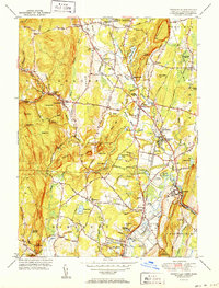
1951 Map of Tariffville
USGS Topo · Published 1951About this map
The Farmington River winds through the village of Tariffville, serving as a focal point for the settlement patterns in north-central Connecticut at the end of the 1940s. The landscape is characterized by the sudden rise of the Barn Door Hills and Bushy Hill, which separate the agricultural valleys from the more secluded terrain of the Mc Lean Game Refuge. Small hamlets such as Goodrichville, Pegville, and Floydville are clearly defined, showing the distribution of local commerce and community life prior to late-century suburbanization.
Find a feature on this map
102 named features on this map. Tap any name to fly to it.
Don’t see what you’re looking for? This feature index may not catch every label — zoom into the map to look around manually.
Map Details
Editions of this 1951 Tariffville Map
2 editions found
Other maps of this area

1886 · Springfield
USGS Topo · 1:62,500

1887 · Granville
USGS Topo · 1:62,500

1889 · Springfield
USGS Topo · 1:62,500

1889 · Granville
USGS Topo · 1:62,500

1892 · Hartford
USGS Topo · 1:62,500

1892 · Granby
USGS Topo · 1:62,500

1893 · Springfield
USGS Topo · 1:62,500

1893 · Granville
USGS Topo · 1:62,500

1895 · Springfield
USGS Topo · 1:62,500

1895 · Granville
USGS Topo · 1:62,500