1960s Maps of Northeastern Connecticut Planning Region, Connecticut
Explore 11 historic maps of Northeastern Connecticut Planning Region from the 1960s. These maps offer a rare glimpse into what life looked like during the 1960s — showing old roads, neighborhoods, homes, and landmarks that have changed or disappeared over time.
Whether you're researching your family's past, planning a metal detecting trip, or studying how Northeastern Connecticut Planning Region's landscape evolved across the 1960s, these high-resolution maps are a powerful tool for exploring the history of this region.
- Focus on a specific era: All maps on this page are from the 1960s, giving you a focused view of this time period.
- See what’s changed: Compare century-old streets, trails, and buildings to today's modern landscape using overlays and satellite layers.
- Research with precision: Use these maps for genealogy, historical research, land use analysis, or educational projects.
- View, download, or print: Maps are fully viewable online in high resolution, and can be downloaded or printed for your own records.
Start exploring Northeastern Connecticut Planning Region's history through authentic maps from the 1960s. This is your window into the past.
Northeastern Connecticut Planning Region, CT maps
(11)- 1961 Map of Hartford
 1961 Hartford1961 Print · USGSSouthern New England and the Hudson Valley are shown here in the mid-fifties, capturing a landscape of booming coastal cities and interior hill towns. Researchers can trace the legacy of the New York New Haven and Hartford rail corridor and find strategic sites like Camp Shanks and Fort Michie.
 - 1961 Map of Boston
 1961 Boston1961 Print · USGSThe Massachusetts coastline and its industrial interior are detailed here in the mid-twentieth century, from the Monadnock highlands to Cape Cod. Researchers can trace the rail routes of the Boston and Maine or locate landmarks like Fort Devens and the Wachusett Reservoir.2 unique versions available
 - 1962 Map of Albany
 1962 Albany1962 Print · USGSThe Hudson and Connecticut River valleys meet the Green Mountains and Berkshires in this mid-century overview of the Northeast. Genealogists and historians can trace the industrial hearts of Albany and Springfield or locate features like Quabbin Reservoir and Westover Air Force Base.
 - 1962 Map of Hartford, 1971 Print
 1962 Hartford1971 Print · USGSSouthern New England and the Hudson Valley are shown in the early sixties, as suburban growth reached into the foothills. Trace the path of the New York New Haven & Hartford RR and find landmarks like Camp Nathan Hale and Gillette Castle State Park.3 unique versions available
 - 1963 Map of Providence
 1963 Providence1963 Print · USGSSouthern New England's coastal and industrial heartland is captured here in the early sixties, from the Rhode Island mainland to the far reaches of the Cape. Researchers can trace mid-century growth in Providence or locate landmarks on Marthas Vineyard and Nantucket Island.
 - 1964 Map of Oxford
 1964 Oxford1964 Print · USGSThe tri-state border region of Massachusetts, Connecticut, and Rhode Island comes alive in this mid-century survey. Genealogists and researchers can map family plots at St Joseph Cem or trace the winding shores of Lake Chaubunagungamaug.
 - 1965 Map of Hartford
 1965 Hartford1965 Print · USGSSouthern New England and the Hudson Valley are shown here during the mid-sixties expansion of the Interstate era. Trace the path of the New York New Haven & Hartford RR or locate historic landmarks like West Point Military Reservation and the Merritt Parkway.2 unique versions available
 - 1967 Map of Southbridge
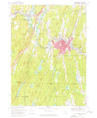 1967 Southbridge1967 Print · USGSMassachusetts and Connecticut meet in this late 1960s survey as the Quinebaug River valley transitions from industrial centers to quiet forest. Researchers can locate family sites and landmarks like Old Sturbridge Village, St Annes Shrine, and the old crossroads at Sherman Corner.6 unique versions available
 - 1967 Map of Wales, 1970 Print
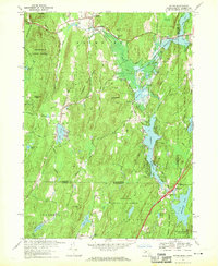 1967 Wales1970 Print · USGSThe Massachusetts-Connecticut borderlands are captured here in the late sixties, showing the sprawling state forests and new reservoirs of the era. Genealogists can trace family names across Haynes Hill and Blake Hill or locate landmarks like the Springfield Boys Camp.5 unique versions available
 - 1969 Map of Oxford, 1971 Print
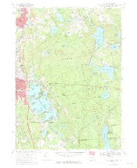 1969 Oxford1971 Print · USGSThe tri-state border region of Massachusetts, Connecticut, and Rhode Island is captured here in the late sixties, showcasing its industrial villages and extensive pond systems. Researchers can locate St Josephs Cemetery, trace the Penn Central line, or explore the shores of Lake Chaubunagungamaug.4 unique versions available
 - 1969 Map of Webster, 1972 Print
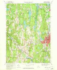 1969 Webster1972 Print · USGSThe industrial river valleys of the Massachusetts borderlands are captured here during the late sixties. Genealogists can trace old family burial grounds like Blackmer Cem and Dresser Cem or the mill-town heritage of Perryville and Quinebaug.4 unique versions available
End of results
Showing maps 1-11 of 11
Top cities of Northeastern Connecticut Planning Region
- Killingly historical maps
- Plainfield historical maps
- Thompson historical maps
- Brooklyn historical maps
- Woodstock historical maps
- Putnam historical maps
See more
Frequently asked questions
- What are the different types of historical maps available for Northeastern Connecticut Planning Region?
- What is the oldest map of Northeastern Connecticut Planning Region?
- Where can I purchase historical maps of Northeastern Connecticut Planning Region for my home or office?
- Where can I download high-res historical maps of Northeastern Connecticut Planning Region?
- Are there historical topographic maps available for Northeastern Connecticut Planning Region?
- Is there historical aerial imagery available for Northeastern Connecticut Planning Region?
- Where are historical maps of Northeastern Connecticut Planning Region sourced from?