Old Maps of Canaan, Connecticut for Genealogy
Trace your family roots with 52 historic maps of Canaan. These high-res maps reveal old neighborhoods, homesites, landmarks, and streets — helping you uncover where your ancestors lived and how the area evolved over time.
- Explore historic neighborhoods: Identify where your relatives may have lived in the 1800s or 1900s.
- Compare maps over time: Trace the changes in streets, buildings, and landmarks for multi-generational research.
- Perfect for genealogy & ancestry research: Used by family historians and researchers to map out lineage and migration.
These maps are an incredible resource for exploring your personal connection to Canaan's past.
Canaan, CT maps
(52)- 1885 Map of Sheffield
 1885 Sheffield1885 Print · USGSThe Berkshires meet the Connecticut and New York borders during a period of heavy rail expansion and riverside industry. Genealogists can trace family roots through settlements like Gomorrah, Sodom, and North Egremont, or locate landmarks such as Union Church and Ashley Falls.
 - 1888 Map of Sheffield
 1888 Sheffield1888 Print · USGSThe Housatonic Valley in the 1880s is captured here at the height of its rail-and-mill era, spanning the borderlands of Massachusetts and Connecticut. Researchers can trace the original routes of the Housatonic Railroad and locate community landmarks like Union Church and Twin Lakes Station.
 - 1891 Map of Sheffield
 1891 Sheffield1891 Print · USGSThe Housatonic Valley in the 1890s reveals a bustling corridor of rail-and-river commerce at the foot of the Berkshire mountains. Genealogists and historians can trace Victorian-era settlements from Great Barrington to Sheffield, locating old landmarks like Union Church and Chapinville Station.
 - 1892 Map of Winsted
 1892 Winsted1892 Print · USGSLitchfield County's industrial valleys and upland villages are captured here in the late nineteenth century, during the peak of the region's railroad era. Researchers can trace historic property locations and rail spurs in Winsted, Torrington, and along the shores of Highland Lake.10 unique versions available
 - 1892 Map of Cornwall
 1892 Cornwall1892 Print · USGSLitchfield County in the 1890s reveals a landscape of river-powered industry and rail-connected villages. Researchers can trace ancestral roots and old transport routes through Ore Hill, Lime Rock, and the stops along the Housatonic Railroad.
 - 1893 Map of Sheffield
 1893 Sheffield1893 Print · USGSThe Housatonic River valley flourished at the end of the century as a hub for rail and water-powered industry. Researchers can trace the path of the Housatonic Railroad through Great Barrington and locate landmarks like Union Church and Bashbish Falls.
 - 1893 Map of Cornwall
 1893 Cornwall1893 Print · USGSLitchfield County's iron-mining and rail-corridor history comes into focus in the 1890s as the Housatonic Railroad follows the river valley. Genealogists and historians can trace old property lines and rural centers like Ore Hill, Lime Rock, and Amenia Union.3 unique versions available
 - 1897 Map of Sheffield
 1897 Sheffield1897 Print · USGSThe Housatonic valley and the Berkshire foothills are captured here in the late 1800s, showing a landscape defined by river-driven industry and early rail lines. Trace family roots and old homesteads in Great Barrington, South Egremont, and the high mountain village of Mt Washington.10 unique versions available
 - 1899 Map of Housatonic
 1899 Housatonic1899 Print · USGSThe Berkshire hills at the close of the nineteenth century reveal a landscape of industrial hamlets and Shaker settlements. Trace the rail-and-river economy through Lenox Furnace, locate the historic Shaker Village, and find landmarks like Laura Tower.
 - 1900 Map of Housatonic
 1900 Housatonic1900 Print · USGSThe Berkshires and the Housatonic Valley are captured here at a moment of industrial and social transition during the late Victorian era. Genealogists and historians can trace the early rail networks of the Boston and Albany R.R. through old settlements like Shaker Village and Lenox Furnace.5 unique versions available
 - 1903 Map of Cornwall
 1903 Cornwall1903 Print · USGSNorthwestern Connecticut at the dawn of the twentieth century shows a landscape of iron-mining hamlets and river-valley rail lines. Genealogists and historians can trace the foundations of Ore Hill, the streets of Salisbury, and the path of the Central New England RR.9 unique versions available
 - 1904 Map of Litchfield
 1904 Litchfield1904 Print · USGSThe Litchfield Hills at the turn of the century are shown here as a landscape of iron heritage and river-powered industry. Genealogists and historians can locate old industrial sites like Kent Furnace, ancestral homes near Sharon Valley, and early rail stops at Limerock Sta..3 unique versions available
 - 1943 Map of Housatonic
 1943 Housatonic1943 Print · USGSThe Berkshires and the Housatonic Valley are captured during the war years, showing a landscape of traditional Shaker settlements and growing industrial centers. Trace the routes of the NY NH & H RR and explore sites like Shaker Village, Richmond Furnace, and Rockdale Mills.
 - 1947 Map of Hartford, 1955 Print
 1947 Hartford1955 Print · USGSSouthern New England and the Hudson Valley are shown in detail during the post-war expansion era. Genealogists and researchers can trace local landmarks from the State Capitol and Yale University to the Stratford Lighthouse and Woodlawn Cem.2 unique versions available
 - 1948 Map of Hartford
 1948 Hartford1948 Print · USGSSouthern New England is captured here in the late 1940s, showcasing a landscape of thriving industrial cities and developing parkways. Genealogists and historians can trace the rail networks of the New York New Haven and Hartford RR or locate coastal defense sites like Fort Terry and Camp Shanks.2 unique versions available
 - 1948 Map of Ashley Falls
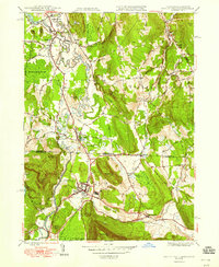 1948 Ashley Falls1948 Print · USGSThe Berkshires and Litchfield Hills meet at the state line in the late 1940s, where the river and rail define local life. Researchers can trace ancestral sites and defunct rail lines through Ashley Falls, Hewins Cem, and the village of Sodom.
 - 1948 Map of Albany, 1951 Print
 1948 Albany1951 Print · USGSThe Hudson and Connecticut River valleys are captured here in the late 1940s, showing the vital rail and water corridors of the Northeast. You can trace the Boston and Maine tracks past Mt Greylock or locate early settlements like Great Barrington and Bennington.
 - 1949 Map of Ashley Falls
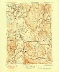 1949 Ashley Falls1949 Print · USGSThe Berkshires and Litchfield Hills meet in the late 1940s along this detailed corridor of the Housatonic River. Genealogists and researchers can trace family lands near Ashley Falls, locate the Canaan Landing Field, or find old burial sites like Carroll Cem.2 unique versions available
 - 1950 Map of South Canaan
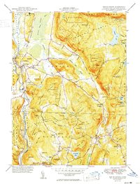 1950 South Canaan1950 Print · USGSLitchfield County highland life in the late 1940s is centered here on the rugged ridges of the Housatonic State Forest and the Housatonic River valley. Genealogists and hikers can trace the Appalachian Trail past family landmarks like Under Mountain Cem and Cornwall Hollow.3 unique versions available
 - 1951 Map of Norfolk
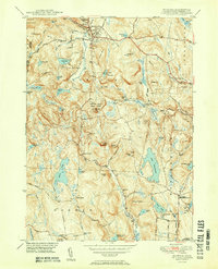 1951 Norfolk1951 Print · USGSThe Litchfield County foothills in the early fifties show a quiet landscape of mountain parks and scattered farmsteads. Researchers can trace old family burial grounds like Grantville Cem and find vanished rural nodes like the Winchester Center PO.2 unique versions available
 - 1956 Map of Norfolk, 1958 Print
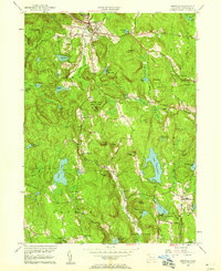 1956 Norfolk1958 Print · USGSLitchfield County's upland terrain is captured here in the mid-fifties, showing the rural character of Norfolk and Winchester. Genealogists can trace family names through sites like Winchester Center PO, Grantville Cem, and South Norfolk.4 unique versions available
 - 1956 Map of South Canaan, 1958 Print
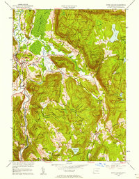 1956 South Canaan1958 Print · USGSLitchfield County's upland forests and river valleys are captured here in the mid-1950s, showing a landscape defined by timber and transit. Researchers can trace the Appalachian Trail, locate the Yale University Forestry School, and find rural burials at Root Cem.6 unique versions available
 - 1956 Map of Albany, 1968 Print
 1956 Albany1968 Print · USGSThe industrial heart of the Northeast is revealed in the mid-1950s, from the Hudson Valley to the Connecticut River. Researchers can trace the legacy of the Quabbin Reservoir, locate Westover Air Force Base, or follow the Rutland RR through the Green Mountains.2 unique versions available
 - 1957 Map of Albany
 1957 Albany1957 Print · USGSThe Tri-State region and Connecticut River Valley are captured here during a period of significant postwar growth and infrastructure expansion. Genealogists and historians can trace the rail-and-river economy through landmarks like the Boston and Maine railroad, Quabbin Reservoir, and Westover Air Force Base.
 - 1958 Map of Ashley Falls, 1959 Print
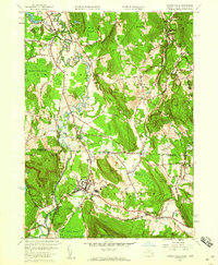 1958 Ashley Falls1959 Print · USGSThe Housatonic Valley in the late fifties shows a landscape shaped by its winding river and the New York New Haven and Hartford railroad. Local researchers can trace family lands near Ashley Falls, identify old burial sites like Mountain View Cem, or locate mid-century landmarks like the Drive-in Theater.7 unique versions available
Showing maps 1-25 of 52
Top cities near Canaan
- Torrington historical maps
- Dover historical maps
- Litchfield historical maps
- Litchfield historical maps
- Winsted historical maps
- Great Barrington historical maps
See more
Top neighborhoods of Canaan
- Huntsville historical maps
- Pine Grove historical maps
- South Canaan historical maps
- Falls Village Historic District historical maps
Frequently asked questions
- What are the different types of historical maps available for Canaan?
- What is the oldest map of Canaan?
- Where can I purchase historical maps of Canaan for my home or office?
- Where can I download high-res historical maps of Canaan?
- Are there historical topographic maps available for Canaan?
- Is there historical aerial imagery available for Canaan?
- Where are historical maps of Canaan sourced from?