1940s Maps of Colebrook, Connecticut
Explore 8 historic maps of Colebrook from the 1940s. These maps offer a rare glimpse into what life looked like during the 1940s — showing old roads, neighborhoods, homes, and landmarks that have changed or disappeared over time.
Whether you're researching your family's past, planning a metal detecting trip, or studying how Colebrook's landscape evolved across the 1940s, these high-resolution maps are a powerful tool for exploring the history of this region.
- Focus on a specific era: All maps on this page are from the 1940s, giving you a focused view of this time period.
- See what’s changed: Compare century-old streets, trails, and buildings to today's modern landscape using overlays and satellite layers.
- Research with precision: Use these maps for genealogy, historical research, land use analysis, or educational projects.
- View, download, or print: Maps are fully viewable online in high resolution, and can be downloaded or printed for your own records.
Start exploring Colebrook's history through authentic maps from the 1940s. This is your window into the past.
Colebrook, CT maps
(8)- 1943 Map of Housatonic
 1943 Housatonic1943 Print · USGSThe Berkshires and the Housatonic Valley are captured during the war years, showing a landscape of traditional Shaker settlements and growing industrial centers. Trace the routes of the NY NH & H RR and explore sites like Shaker Village, Richmond Furnace, and Rockdale Mills.
 - 1946 Map of South Sandisfield, 1958 Print
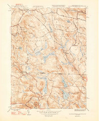
 1946 South Sandisfield1958 Print · USGSThe Massachusetts-Connecticut borderlands during the mid-forties show a landscape of high forests and scattered upland villages. Researchers can trace family sites at Montville Cem or St Marys Cem and locate local centers like Southfield and North Norfolk.
 - 1947 Map of Hartford, 1955 Print
 1947 Hartford1955 Print · USGSSouthern New England and the Hudson Valley are shown in detail during the post-war expansion era. Genealogists and researchers can trace local landmarks from the State Capitol and Yale University to the Stratford Lighthouse and Woodlawn Cem.2 unique versions available
 - 1948 Map of Tolland
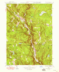 1948 Tolland1948 Print · USGSThe hill country of the Massachusetts and Connecticut border is captured here in the late 1940s, highlighting the river-valley settlements of the Berkshires. Genealogists and historians can trace the roads and residents of West New Boston, North Colebrook, and the crossroads at Tolland Center.3 unique versions available
 - 1948 Map of Hartford
 1948 Hartford1948 Print · USGSSouthern New England is captured here in the late 1940s, showcasing a landscape of thriving industrial cities and developing parkways. Genealogists and historians can trace the rail networks of the New York New Haven and Hartford RR or locate coastal defense sites like Fort Terry and Camp Shanks.2 unique versions available
 - 1948 Map of South Sandisfield
 1948 South Sandisfield1948 Print · USGSThe Massachusetts-Connecticut border highlands are captured here just after the war, showing a rural landscape of timbered hills and small village centers. Genealogists and hikers can trace old family sites at Montville Cem, the falls at Campbells Falls, and the quiet reaches of Doolittle Lake.2 unique versions available
 - 1948 Map of Albany, 1951 Print
 1948 Albany1951 Print · USGSThe Hudson and Connecticut River valleys are captured here in the late 1940s, showing the vital rail and water corridors of the Northeast. You can trace the Boston and Maine tracks past Mt Greylock or locate early settlements like Great Barrington and Bennington.
 - 1948 Map of Winsted, 1956 Print
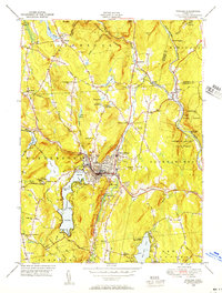 1948 Winsted1956 Print · USGSMid-century Winsted and the surrounding hill towns are captured here at a peak of rail and river-based industry. Genealogists can locate family sites at St Joseph Cem, trace the grounds of The Little Red Schoolhouse, or explore the many summer camps like Camp Wahanda.
End of results
Showing maps 1-8 of 8
Top cities near Colebrook
- Torrington historical maps
- Farmington historical maps
- Simsbury historical maps
- Avon historical maps
- Granby historical maps
- Canton historical maps
See more
Top neighborhoods of Colebrook
- Mill Brook historical maps
- Robertsville historical maps
- McClaveville historical maps
- North Colebrook historical maps
Frequently asked questions
- What are the different types of historical maps available for Colebrook?
- What is the oldest map of Colebrook?
- Where can I purchase historical maps of Colebrook for my home or office?
- Where can I download high-res historical maps of Colebrook?
- Are there historical topographic maps available for Colebrook?
- Is there historical aerial imagery available for Colebrook?
- Where are historical maps of Colebrook sourced from?