Old Maps of Colebrook, Connecticut for Academic Research
Study the evolution of Colebrook with 58 high-resolution historic maps. Whether you're teaching, researching, or modeling changes in land use, these maps provide essential visual documentation of urban, environmental, and geographic change.
- Analyze long-term change: Track patterns in development, transportation, and natural features.
- Ideal for environmental or urban studies: Support academic projects with primary historical map data.
- Use in the classroom or lab: Educators and researchers rely on these maps to bring historical context to life.
These maps are a powerful tool for teaching, research, and visualizing how Colebrook has changed over the decades.
Colebrook, CT maps
(58)- 1888 Map of Sandisfield
 1888 Sandisfield1888 Print · USGSThe Berkshires at the end of the nineteenth century reveal a landscape of mountain villages and river-powered industry. Genealogists can trace family roots through the early roads of Sandisfield, New Marlborough, and the banks of the Farmington River.
 - 1892 Map of Winsted
 1892 Winsted1892 Print · USGSLitchfield County's industrial valleys and upland villages are captured here in the late nineteenth century, during the peak of the region's railroad era. Researchers can trace historic property locations and rail spurs in Winsted, Torrington, and along the shores of Highland Lake.10 unique versions available
 - 1893 Map of Sandisfield
 1893 Sandisfield1893 Print · USGSThe Berkshires and northern Litchfield County are captured here in the late nineteenth century during a period of established river-valley industry. Genealogists and historians can trace the early layout of Sandisfield, New Boston, and Colebrook River along the Farmington River corridor.
 - 1897 Map of Sandisfield
 1897 Sandisfield1897 Print · USGSThe Berkshires and Litchfield Hills are captured here in the late nineteenth century before modern development reshaped the highlands. Genealogists can trace early homesteads and hamlets along the Farmington River, including New Boston, Montville, and South Sandisfield.7 unique versions available
 - 1899 Map of Housatonic
 1899 Housatonic1899 Print · USGSThe Berkshire hills at the close of the nineteenth century reveal a landscape of industrial hamlets and Shaker settlements. Trace the rail-and-river economy through Lenox Furnace, locate the historic Shaker Village, and find landmarks like Laura Tower.
 - 1900 Map of Housatonic
 1900 Housatonic1900 Print · USGSThe Berkshires and the Housatonic Valley are captured here at a moment of industrial and social transition during the late Victorian era. Genealogists and historians can trace the early rail networks of the Boston and Albany R.R. through old settlements like Shaker Village and Lenox Furnace.5 unique versions available
 - 1904 Map of Litchfield
 1904 Litchfield1904 Print · USGSThe Litchfield Hills at the turn of the century are shown here as a landscape of iron heritage and river-powered industry. Genealogists and historians can locate old industrial sites like Kent Furnace, ancestral homes near Sharon Valley, and early rail stops at Limerock Sta..3 unique versions available
 - 1907 Map of Sandisfield, 1910 Print
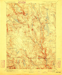 1907 Sandisfield1910 Print · USGSThe Massachusetts-Connecticut borderlands appear here at the turn of the century, showing a network of river-valley hamlets and upland farms. Genealogists can trace family roots through old settlements like Sandisfield, New Boston, and Montville along the Clam River.3 unique versions available
 - 1943 Map of Housatonic
 1943 Housatonic1943 Print · USGSThe Berkshires and the Housatonic Valley are captured during the war years, showing a landscape of traditional Shaker settlements and growing industrial centers. Trace the routes of the NY NH & H RR and explore sites like Shaker Village, Richmond Furnace, and Rockdale Mills.
 - 1946 Map of South Sandisfield, 1958 Print
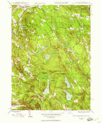 1946 South Sandisfield1958 Print · USGSThe Massachusetts-Connecticut borderlands during the mid-forties show a landscape of high forests and scattered upland villages. Researchers can trace family sites at Montville Cem or St Marys Cem and locate local centers like Southfield and North Norfolk.
 - 1947 Map of Hartford, 1955 Print
 1947 Hartford1955 Print · USGSSouthern New England and the Hudson Valley are shown in detail during the post-war expansion era. Genealogists and researchers can trace local landmarks from the State Capitol and Yale University to the Stratford Lighthouse and Woodlawn Cem.2 unique versions available
 - 1948 Map of Tolland
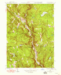 1948 Tolland1948 Print · USGSThe hill country of the Massachusetts and Connecticut border is captured here in the late 1940s, highlighting the river-valley settlements of the Berkshires. Genealogists and historians can trace the roads and residents of West New Boston, North Colebrook, and the crossroads at Tolland Center.3 unique versions available
 - 1948 Map of Hartford
 1948 Hartford1948 Print · USGSSouthern New England is captured here in the late 1940s, showcasing a landscape of thriving industrial cities and developing parkways. Genealogists and historians can trace the rail networks of the New York New Haven and Hartford RR or locate coastal defense sites like Fort Terry and Camp Shanks.2 unique versions available
 - 1948 Map of South Sandisfield
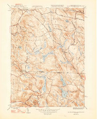 1948 South Sandisfield1948 Print · USGSThe Massachusetts-Connecticut border highlands are captured here just after the war, showing a rural landscape of timbered hills and small village centers. Genealogists and hikers can trace old family sites at Montville Cem, the falls at Campbells Falls, and the quiet reaches of Doolittle Lake.2 unique versions available
 - 1948 Map of Albany, 1951 Print
 1948 Albany1951 Print · USGSThe Hudson and Connecticut River valleys are captured here in the late 1940s, showing the vital rail and water corridors of the Northeast. You can trace the Boston and Maine tracks past Mt Greylock or locate early settlements like Great Barrington and Bennington.
 - 1948 Map of Winsted, 1956 Print
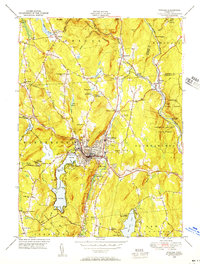 1948 Winsted1956 Print · USGSMid-century Winsted and the surrounding hill towns are captured here at a peak of rail and river-based industry. Genealogists can locate family sites at St Joseph Cem, trace the grounds of The Little Red Schoolhouse, or explore the many summer camps like Camp Wahanda.
 - 1951 Map of Winsted
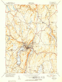 1951 Winsted1951 Print · USGSLitchfield County's industrial valleys and summer camps are captured here in the early fifties. Genealogists and historians can trace the New York New Haven and Hartford rail corridor or locate The Little Red Schoolhouse and Barkhamsted Lighthouse.2 unique versions available
 - 1951 Map of Norfolk
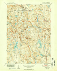 1951 Norfolk1951 Print · USGSThe Litchfield County foothills in the early fifties show a quiet landscape of mountain parks and scattered farmsteads. Researchers can trace old family burial grounds like Grantville Cem and find vanished rural nodes like the Winchester Center PO.2 unique versions available
 - 1954 Map of Tolland
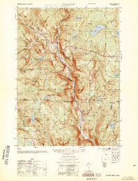 1954 Tolland1954 Print · USGSThe Massachusetts-Connecticut borderlands appear here in the early fifties, defined by the winding Farmington River West Branch and high forest reserves. Researchers can trace historic road networks like Blandford Road and locate rural settlements such as Roosterville, McClayville, and Montville.
 - 1956 Map of Norfolk, 1958 Print
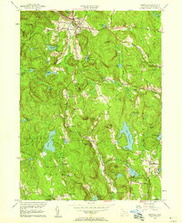 1956 Norfolk1958 Print · USGSLitchfield County's upland terrain is captured here in the mid-fifties, showing the rural character of Norfolk and Winchester. Genealogists can trace family names through sites like Winchester Center PO, Grantville Cem, and South Norfolk.4 unique versions available
 - 1956 Map of Winsted, 1958 Print
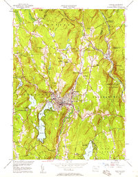 1956 Winsted1958 Print · USGSMid-century Litchfield County is centered here on the industrial hub of Winsted and the recreation-rich Highland Lake. Genealogists and historians can locate The Little Red Schoolhouse, the Old North Road Burying Ground, and the nascent Hogsback Dam.7 unique versions available
 - 1956 Map of Albany, 1968 Print
 1956 Albany1968 Print · USGSThe industrial heart of the Northeast is revealed in the mid-1950s, from the Hudson Valley to the Connecticut River. Researchers can trace the legacy of the Quabbin Reservoir, locate Westover Air Force Base, or follow the Rutland RR through the Green Mountains.2 unique versions available
 - 1957 Map of Albany
 1957 Albany1957 Print · USGSThe Tri-State region and Connecticut River Valley are captured here during a period of significant postwar growth and infrastructure expansion. Genealogists and historians can trace the rail-and-river economy through landmarks like the Boston and Maine railroad, Quabbin Reservoir, and Westover Air Force Base.
 - 1958 Map of Tolland Center, 1959 Print
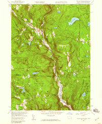 1958 Tolland Center1959 Print · USGSThe borderlands of Massachusetts and Connecticut appear here in the late fifties, showcasing a landscape of state forests and river-cut valleys. Genealogists and hikers can trace old roads to Tolland Center, Roberts Cem, and the waters of Doolittle Lake.5 unique versions available
 - 1958 Map of South Sandisfield, 1959 Print
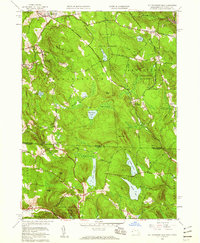 1958 South Sandisfield1959 Print · USGSThe Berkshire highlands and Litchfield hills meet in this 1950s survey of the Massachusetts-Connecticut border. Researchers can trace historic family burial sites at St Marys Cem and Montville Cem or locate old homesteads near Southfield and West Norfolk.5 unique versions available
Showing maps 1-25 of 58
Top cities near Colebrook
- Torrington historical maps
- Farmington historical maps
- Simsbury historical maps
- Avon historical maps
- Granby historical maps
- Canton historical maps
See more
Top neighborhoods of Colebrook
- Mill Brook historical maps
- Robertsville historical maps
- McClaveville historical maps
- North Colebrook historical maps
Frequently asked questions
- What are the different types of historical maps available for Colebrook?
- What is the oldest map of Colebrook?
- Where can I purchase historical maps of Colebrook for my home or office?
- Where can I download high-res historical maps of Colebrook?
- Are there historical topographic maps available for Colebrook?
- Is there historical aerial imagery available for Colebrook?
- Where are historical maps of Colebrook sourced from?