2000s (21st Century) Maps of Torrington, Connecticut
Explore 20 historic maps of Torrington from the 2000s (21st Century). These maps offer a rare glimpse into what life looked like during the 2000s — showing old roads, neighborhoods, homes, and landmarks that have changed or disappeared over time.
Whether you're researching your family's past, planning a metal detecting trip, or studying how Torrington's landscape evolved across the 2000s, these high-resolution maps are a powerful tool for exploring the history of this region.
- Focus on a specific era: All maps on this page are from the 2000s, giving you a focused view of this time period.
- See what’s changed: Compare century-old streets, trails, and buildings to today's modern landscape using overlays and satellite layers.
- Research with precision: Use these maps for genealogy, historical research, land use analysis, or educational projects.
- View, download, or print: Maps are fully viewable online in high resolution, and can be downloaded or printed for your own records.
Start exploring Torrington's history through authentic maps from the 2000s. This is your window into the past.
Torrington, CT maps
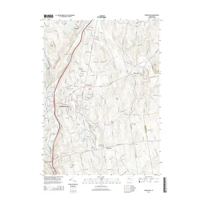
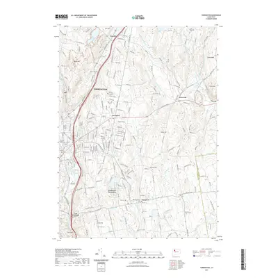
(20)- 2012 Map of Torrington, 2012 Print
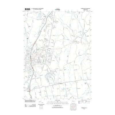 2012 Torrington2012 Print · USGSCovers Torrington, including Burlington, Litchfield, and other nearby areas
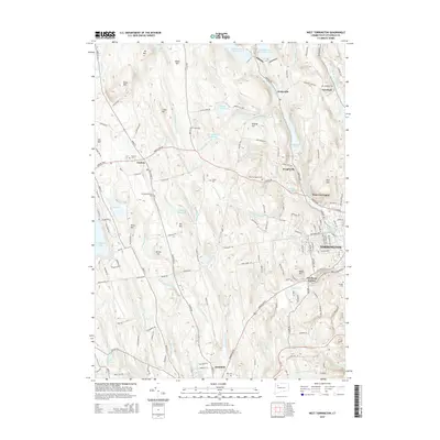
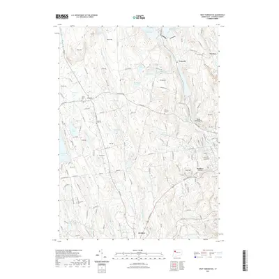
 - 2012 Map of West Torrington, 2012 Print
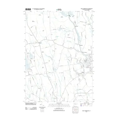 2012 West Torrington2012 Print · USGSCovers Torrington, including Litchfield, Litchfield, and other nearby areas
 - 2012 Map of Winsted, 2012 Print
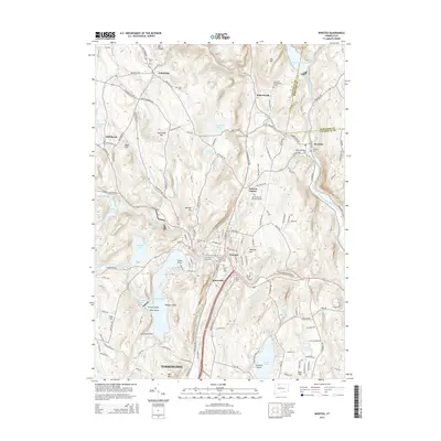
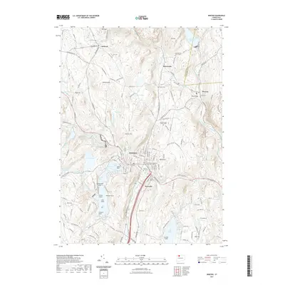
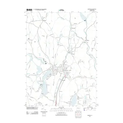 2012 Winsted2012 Print · USGSCovers Torrington, including Winsted, New Hartford, and other nearby areas
 - 2012 Map of Norfolk, 2012 Print
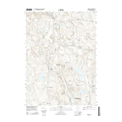
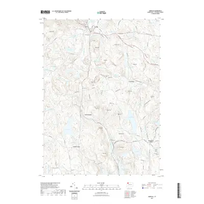
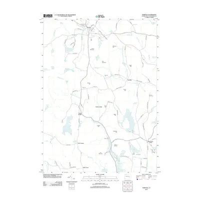 2012 Norfolk2012 Print · USGSCovers Torrington, including North Canaan, Goshen, and other nearby areas
 - 2015 Map of Winsted, 2015 Print
 2015 Winsted2015 Print · USGSCovers Torrington, including Winsted, New Hartford, and other nearby areas
 - 2015 Map of West Torrington, 2015 Print
 2015 West Torrington2015 Print · USGSCovers Torrington, including Litchfield, Litchfield, and other nearby areas
 - 2015 Map of Norfolk, 2015 Print
 2015 Norfolk2015 Print · USGSCovers Torrington, including North Canaan, Goshen, and other nearby areas
 - 2015 Map of Torrington, 2015 Print
 2015 Torrington2015 Print · USGSCovers Torrington, including Burlington, Litchfield, and other nearby areas
 - 2018 Map of Torrington, 2018 Print
 2018 Torrington2018 Print · USGSCovers Torrington, including Burlington, Litchfield, and other nearby areas
 - 2018 Map of Winsted, 2018 Print
 2018 Winsted2018 Print · USGSCovers Torrington, including Winsted, New Hartford, and other nearby areas
 - 2018 Map of Norfolk, 2018 Print
 2018 Norfolk2018 Print · USGSCovers Torrington, including North Canaan, Goshen, and other nearby areas
 - 2018 Map of West Torrington, 2018 Print
 2018 West Torrington2018 Print · USGSCovers Torrington, including Litchfield, Litchfield, and other nearby areas
 - 2021 Map of Torrington, 2021 Print
 2021 Torrington2021 Print · USGSCovers Torrington, including Burlington, Litchfield, and other nearby areas
 - 2021 Map of West Torrington, 2021 Print
 2021 West Torrington2021 Print · USGSCovers Torrington, including Litchfield, Litchfield, and other nearby areas
 - 2021 Map of Norfolk, 2021 Print
 2021 Norfolk2021 Print · USGSCovers Torrington, including North Canaan, Goshen, and other nearby areas
 - 2021 Map of Winsted, 2021 Print
 2021 Winsted2021 Print · USGSCovers Torrington, including Winsted, New Hartford, and other nearby areas
 - 2024 Map of Norfolk, 2024 Print
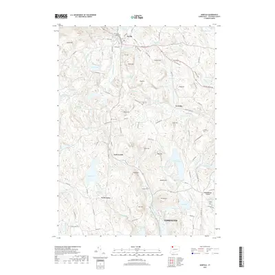
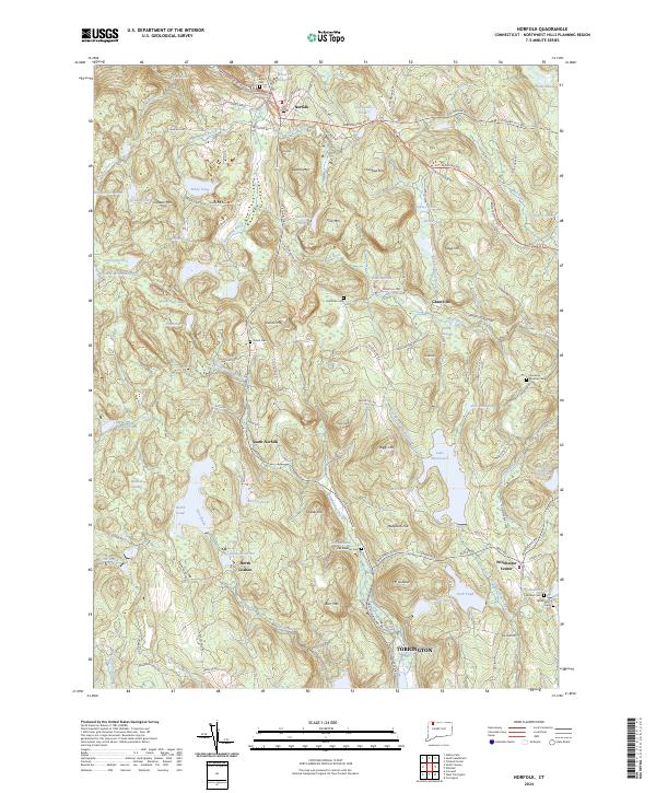 2024 Norfolk2024 Print · USGSThe Northwest Hills of Litchfield County are shown in great detail here, centering on the upland village of Norfolk and its surrounding peaks. Researchers can locate numerous historic burial sites like Center Cem and trace old routes through Grantville and Winchester Center.
 - 2024 Map of Winsted, 2024 Print
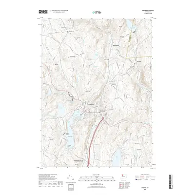
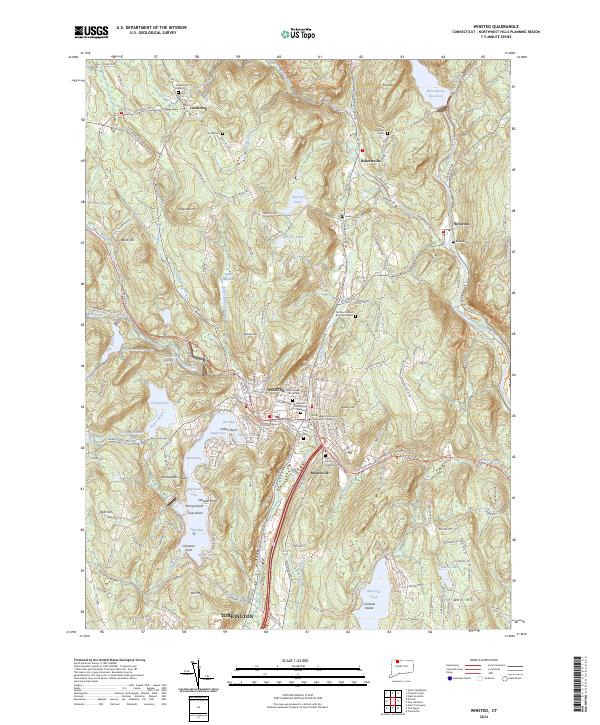 2024 Winsted2024 Print · USGSLitchfield County's industrial and lakeside heritage is on display in this contemporary look at the Winsted and Colebrook area. Genealogists and local historians can locate legacy sites like Saint Josephs Old Catholic Cem, the Old North Road Burying Ground, and landmarks around Highland Lake.
 - 2024 Map of Torrington, 2024 Print
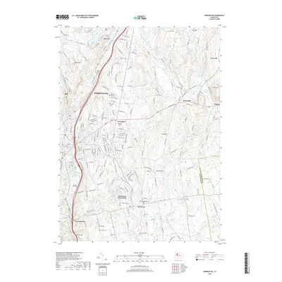
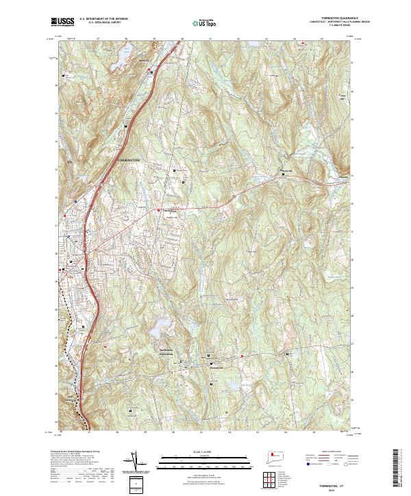 2024 Torrington2024 Print · USGSThe Litchfield hills in the early twenty-first century reveal a landscape where industrial centers like Torrington meet quiet rural outposts. Researchers can trace family history through numerous burial sites like Saint Peter Cem, Fyler Cem, and Scoville Cem.
 - 2024 Map of West Torrington, 2024 Print
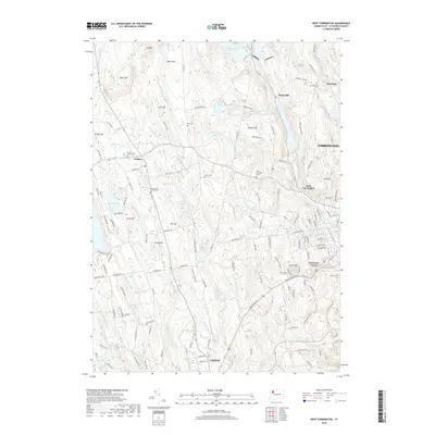
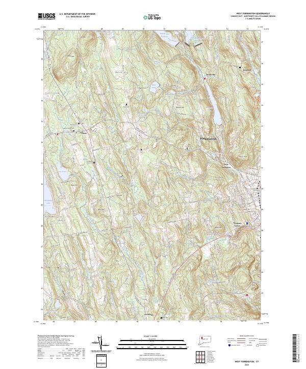 2024 West Torrington2024 Print · USGSThe Northwest Hills of Connecticut are captured here in the early twenty-first century as they balance woodland terrain with residential growth. Genealogists and local researchers can locate established sites like Saint Thomas Cem and the Litchfield County Court House.
End of results
Showing maps 1-20 of 20
Top cities near Torrington
- Waterbury historical maps
- Bristol historical maps
- Southington historical maps
- Farmington historical maps
- Watertown historical maps
- Avon historical maps
See more
Top neighborhoods of Torrington
- Burrville historical maps
- Torringford historical maps
- Drakeville historical maps
- West Torrington historical maps
- Wrightville historical maps
- Newberry Corner historical maps
See more
Frequently asked questions
- What are the different types of historical maps available for Torrington?
- What is the oldest map of Torrington?
- Where can I purchase historical maps of Torrington for my home or office?
- Where can I download high-res historical maps of Torrington?
- Are there historical topographic maps available for Torrington?
- Is there historical aerial imagery available for Torrington?
- Where are historical maps of Torrington sourced from?