1900s (20th Century) Maps of Wallingford, Connecticut
Explore 20 historic maps of Wallingford from the 1900s (20th Century). These maps offer a rare glimpse into what life looked like during the 1900s — showing old roads, neighborhoods, homes, and landmarks that have changed or disappeared over time.
Whether you're researching your family's past, planning a metal detecting trip, or studying how Wallingford's landscape evolved across the 1900s, these high-resolution maps are a powerful tool for exploring the history of this region.
- Focus on a specific era: All maps on this page are from the 1900s, giving you a focused view of this time period.
- See what’s changed: Compare century-old streets, trails, and buildings to today's modern landscape using overlays and satellite layers.
- Research with precision: Use these maps for genealogy, historical research, land use analysis, or educational projects.
- View, download, or print: Maps are fully viewable online in high resolution, and can be downloaded or printed for your own records.
Start exploring Wallingford's history through authentic maps from the 1900s. This is your window into the past.
Wallingford, CT maps
(20)- 1906 Map of Farmington
 1906 Farmington1906 Print · USGSCentral Connecticut at the turn of the century is a landscape of river-powered industry and rail-connected towns. Researchers can trace historic river crossings like Bissell Ferry and explore early village centers including Collinsville, Satans Kingdom, and Pine Meadow.2 unique versions available
 - 1921 Map of New Haven
 1921 New Haven1921 Print · USGSNew Haven and its harbor appear in the early twenties as a thriving industrial and maritime hub. Genealogists and historians can trace rail-era neighborhoods and shoreline landmarks like Savin Rock, Fair Haven, and the Mt. Carmel Sta. depot.
 - 1943 Map of Durham
 1943 Durham1943 Print · USGSMiddlesex and New Haven counties are mapped during the early years of the war, showing the rural landscapes around Durham Center. Genealogists and historians can trace family-named sites like Linmar Dairy Farm and explore the rail corridor of the New York New Haven and Hartford.
 - 1946 Map of Meriden
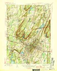 1946 Meriden1946 Print · USGSThe industrial corridor of Central Connecticut comes alive in the mid-1940s, showing the dense development of Meriden and its surrounding ridge lines. Genealogists can locate family sites near St Thomas Cem and Stillmans Corner or trace the early footprint of Meriden Airport.2 unique versions available
 - 1947 Map of Hartford, 1955 Print
 1947 Hartford1955 Print · USGSSouthern New England and the Hudson Valley are shown in detail during the post-war expansion era. Genealogists and researchers can trace local landmarks from the State Capitol and Yale University to the Stratford Lighthouse and Woodlawn Cem.2 unique versions available
 - 1948 Map of Hartford
 1948 Hartford1948 Print · USGSSouthern New England is captured here in the late 1940s, showcasing a landscape of thriving industrial cities and developing parkways. Genealogists and historians can trace the rail networks of the New York New Haven and Hartford RR or locate coastal defense sites like Fort Terry and Camp Shanks.2 unique versions available
 - 1953 Map of Durham, 1954 Print
 1953 Durham1954 Print · USGSThe rural heart of Middlesex County is captured in the early fifties, showing a landscape of small crossroads villages and steep ridges. Genealogists and hikers can trace old routes like Stagecoach Road, locate the Bluff Head Cemetery, and explore the rail corridor through Reed Gap.4 unique versions available
 - 1954 Map of Mount Carmel, 1956 Print
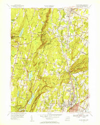 1954 Mount Carmel1956 Print · USGSHamden and Cheshire are shown here in the mid-fifties, just as the Wilbur Cross Parkway was shaping modern travel through these valleys. Trace family roots at Hillside Cemetery or explore the rail era along the New York New Haven and Hartford Railroad.3 unique versions available
 - 1954 Map of Wallingford, 1956 Print
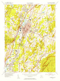 1954 Wallingford1956 Print · USGSThe Quinnipiac River valley in the mid-1950s shows the bustling center of Wallingford alongside its growing suburban neighborhoods. Trace local family roots at St Johns Cem or locate historic landmarks like the Gaylord Farms Sanatorium and Lyman Hall High Sch.3 unique versions available
 - 1955 Map of Meriden, 1956 Print
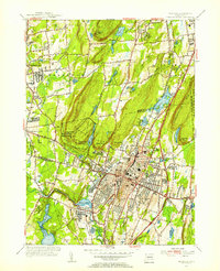 1955 Meriden1956 Print · USGSMid-century Meriden and Southington are shown here during a period of significant post-war development and infrastructure growth. Genealogists can trace family landmarks at Bishops Corner and Stillmans Corner, or locate ancestors at Walnut Grove Cem.3 unique versions available
 - 1961 Map of Hartford
 1961 Hartford1961 Print · USGSSouthern New England and the Hudson Valley are shown here in the mid-fifties, capturing a landscape of booming coastal cities and interior hill towns. Researchers can trace the legacy of the New York New Haven and Hartford rail corridor and find strategic sites like Camp Shanks and Fort Michie.
 - 1962 Map of Hartford, 1971 Print
 1962 Hartford1971 Print · USGSSouthern New England and the Hudson Valley are shown in the early sixties, as suburban growth reached into the foothills. Trace the path of the New York New Haven & Hartford RR and find landmarks like Camp Nathan Hale and Gillette Castle State Park.3 unique versions available
 - 1964 Map of Durham, 1965 Print
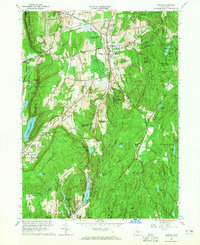 1964 Durham1965 Print · USGSMid-century Middlesex County is captured here during a period of steady growth across the Durham uplands and the Cockaponset State Forest. Genealogists and local historians can trace family-named sites like Beaver Head Corner, Bluff Head Cem, and old district landmarks like Korn Sch.4 unique versions available
 - 1965 Map of Hartford
 1965 Hartford1965 Print · USGSSouthern New England and the Hudson Valley are shown here during the mid-sixties expansion of the Interstate era. Trace the path of the New York New Haven & Hartford RR or locate historic landmarks like West Point Military Reservation and the Merritt Parkway.2 unique versions available
 - 1967 Map of Meriden, 1970 Print
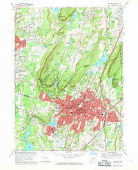 1967 Meriden1970 Print · USGSMeriden and Southington are shown in detail during the late sixties, a time of suburban expansion and industrial transition. Genealogists and historians can trace family roots through sites like Walnut Grove Cemetery and the Undercliff Sanatorium.6 unique versions available
 - 1967 Map of Mount Carmel, 1970 Print
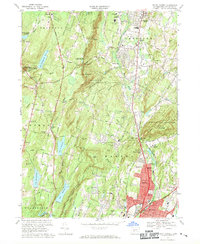 1967 Mount Carmel1970 Print · USGSHamden and Cheshire are captured during a period of mid-century suburban expansion in New Haven County. Researchers can trace historic family plots at Old Bethany Cem, locate Quinnipiac College, and see the early layout of Sleeping Giant State Park.5 unique versions available
 - 1967 Map of Wallingford, 1971 Print
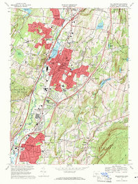 1967 Wallingford1971 Print · USGSWallingford and the Quinnipiac River valley are shown here in the mid-sixties as post-war suburban growth met established industrial and medical institutions. Researchers can trace historic properties like Choate Sch, the Masonic Cem, and the Gaylord Farms Sanatorium.3 unique versions available
 - 1983 Map of New Haven, 1985 Print
 1983 New Haven1985 Print · USGSThe Connecticut shoreline and eastern Long Island are documented here in the early eighties, from the streets of New Haven to the piers of New London. Genealogists and historians can trace the geography of maritime heritage and academia at Yale University and the U.S. Coast Guard Academy.2 unique versions available
 - 1986 Map of Hartford
 1986 Hartford1986 Print · USGSCentral Connecticut and the surrounding highlands were undergoing significant suburban growth and industrial transition during the mid-eighties. Researchers can trace the layout of regional landmarks including Bradley International Airport, the University of Connecticut, and the historic State Capitol.
 - 1994 Map of Hartford, 1995 Print
 1994 Hartford1995 Print · USGSGreater Hartford and the Connecticut River Valley are captured here in the mid-nineties, showing the dense intersection of industry and academia. Trace the urban footprint of the State Capitol and Trinity College or locate the sprawling grounds of the University of Connecticut.2 unique versions available
End of results
Showing maps 1-20 of 20
Top cities near Wallingford
- New Haven historical maps
- Waterbury historical maps
- New Britain historical maps
- Meriden historical maps
- Bristol historical maps
- Hamden historical maps
See more
Top neighborhoods of Wallingford
- Yalesville historical maps
- Tracy historical maps
- Quinnipiac historical maps
- East Wallingford historical maps
- Turnberry Estates historical maps
Frequently asked questions
- What are the different types of historical maps available for Wallingford?
- What is the oldest map of Wallingford?
- Where can I purchase historical maps of Wallingford for my home or office?
- Where can I download high-res historical maps of Wallingford?
- Are there historical topographic maps available for Wallingford?
- Is there historical aerial imagery available for Wallingford?
- Where are historical maps of Wallingford sourced from?