1950s Maps of Rutledge, Bear
Explore 5 historic maps of Rutledge from the 1950s. These maps offer a rare glimpse into what life looked like during the 1950s — showing old roads, neighborhoods, homes, and landmarks that have changed or disappeared over time.
Whether you're researching your family's past, planning a metal detecting trip, or studying how Rutledge's landscape evolved across the 1950s, these high-resolution maps are a powerful tool for exploring the history of this region.
- Focus on a specific era: All maps on this page are from the 1950s, giving you a focused view of this time period.
- See what’s changed: Compare century-old streets, trails, and buildings to today's modern landscape using overlays and satellite layers.
- Research with precision: Use these maps for genealogy, historical research, land use analysis, or educational projects.
- View, download, or print: Maps are fully viewable online in high resolution, and can be downloaded or printed for your own records.
Start exploring Rutledge's history through authentic maps from the 1950s. This is your window into the past.
Rutledge, Bear maps
(5)- 1953 Map of Saint Georges, 1954 Print
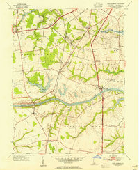 1953 Saint Georges1954 Print · USGSMid-century New Castle County is defined here by the engineering of the Chesapeake and Delaware Canal and the primary transit corridor of the Dupont Parkway. Genealogists and local historians can trace the foundations of Saint Georges, identify family burial sites at Hickory Grove Cem, and locate former institutions like Kings College.5 unique versions available
 - 1953 Map of Newark East, 1955 Print
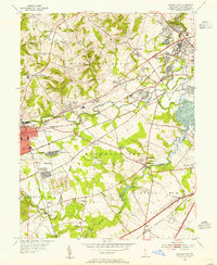 1953 Newark East1955 Print · USGSMid-century New Castle County shows a landscape of burgeoning suburbs and deep-rooted industrial corridors. Researchers can locate family landmarks at Coochs Bridge, St James Ch, and the Delaware Park Race Track.4 unique versions available
 - 1955 Map of Wilmington
 1955 Wilmington1955 Print · USGSThe Delaware Valley and Jersey Shore are seen here during the mid-fifties era of rapid suburban expansion and highway development. You can trace the path of the New Jersey Turnpike, locate the Fort Dix Military Reservation, or explore the rail networks of the Pennsylvania Railroad.
 - 1957 Map of Wilmington
 1957 Wilmington1957 Print · USGSThe mid-Atlantic coastal plain comes alive in the mid-fifties as the New Jersey Turnpike and Garden State Parkway redefine travel. Researchers can trace the rail-to-road transition and find landmarks like Ship John Shoal Light and the Fort Dix Military Reservation.2 unique versions available
 - 1959 Map of Wilmington
 1959 Wilmington1959 Print · USGSThe Delaware Valley and Jersey Shore are seen here in the late fifties, during a period of massive suburban and highway expansion. Researchers can trace mid-century infrastructure like the N J Turnpike or locate coastal landmarks from Barnegat Bay to the Maurice River.3 unique versions available
End of results
Showing maps 1-5 of 5
Frequently asked questions
- What are the different types of historical maps available for Rutledge?
- What is the oldest map of Rutledge?
- Where can I purchase historical maps of Rutledge for my home or office?
- Where can I download high-res historical maps of Rutledge?
- Are there historical topographic maps available for Rutledge?
- Is there historical aerial imagery available for Rutledge?
- Where are historical maps of Rutledge sourced from?